
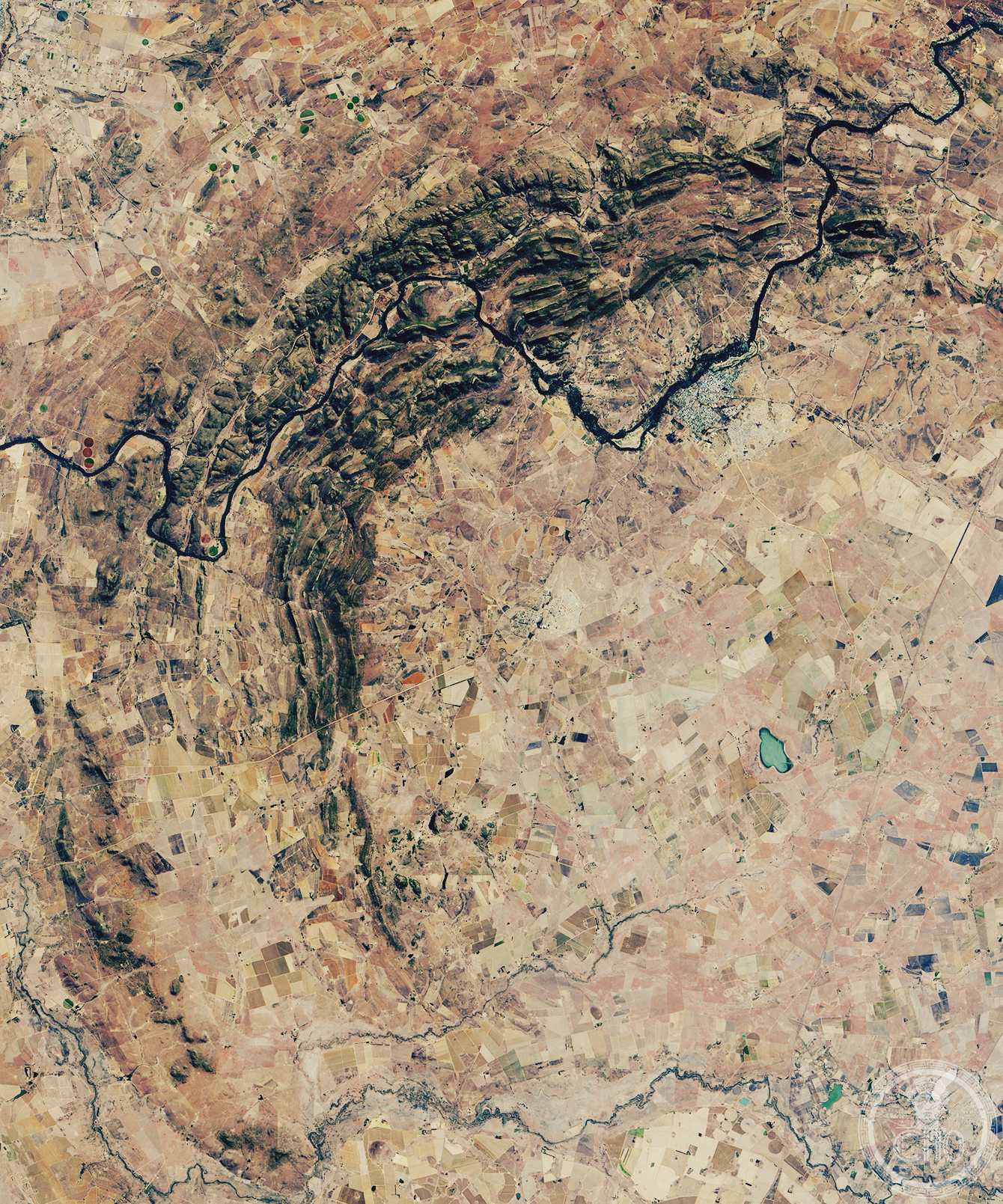
One of Earth’s largest impact craters, formed 2.023 billion years ago, the Vredefort Dome preserves a geological record of cosmic violence etched into the bedrock of South Africa.
At a glance
The Vredefort impact structure spans 170–300 kilometres across, making it among the most massive collision sites ever recorded. Only the deformed bedrock of the ancient crater remains visible today. The structure’s central uplift, the Vredefort Dome, measures approximately 100–120 kilometres in diameter and dominates the landscape near the town of Vredefort.
History
The impact occurred during the Paleoproterozoic Era, 2.023 billion years ago (± 4 million years). Scientists suspected an impact origin for decades before definitive proof arrived in 1961, when American geologists Robert S. Dietz and Robert B. Hargraves identified shatter cones in the rock formations. The discovery confirmed earlier proposals made by Claude C. Albritton and John D. Boon in 1937. Recognition of the structure’s scientific importance led to its designation as a UNESCO World Heritage Site in 2005.
What you see
The original crater has long since eroded away, but the deformed bedrock beneath tells the story of the impact. The Vredefort Dome presents a striking geological cross-section, with rock layers warped and transformed by the violence of collision. Shatter cones—distinctive fractured rock formations—remain the key evidence of impact origin.
Cultural significance
Vredefort ranks among the oldest known impact structures on Earth, surpassed only by Yarrabubba (2.23 billion years old) and possibly Miralga. Some estimates suggest the original crater exceeded the size of Chicxulub, the largest mostly intact impact crater known today. The site provides invaluable geological evidence of Earth’s early history and cosmic bombardment during the Archean and Proterozoic eons.
Key facts
- Country: South Africa
- Location: Free State province, near Vredefort town
- Age: 2.023 billion years (Paleoproterozoic Era)
- Estimated crater diameter: 170–300 km
- Vredefort Dome diameter: 100–120 km
- UNESCO World Heritage Site: 2005
- Coordinates: -27°, 27.5°
Practical information & getting there
The Vredefort Dome lies in Free State province, accessible from the town of Vredefort. The site is managed as a UNESCO World Heritage Site. Consult local tourism information for current visitor facilities, guided tour availability, and accessibility details.
Sources & resources
Find it on the map
See this place and what’s around it →📷 Become a Cultural Heritage Online photographer
Share your photos of places: they stay published under your name as the author. The more they're seen, the more you get noticed — and soon a contest will reward the most appreciated photos.
Log in or sign up free to add a photoIs this page about you?
This page is read by travellers and heritage enthusiasts who find it on Google. Tell us how you are connected to this place and we will take it from there.