

Rio de Janeiro sits at the intersection of two UNESCO World Heritage inscriptions — one celebrating the city’s extraordinary fusion of mountain, forest, and sea, the other protecting one of the planet’s most endangered ecosystems stretching along Brazil’s Atlantic coast. A third inscription, the Baroque gold-rush city of Ouro Preto, lies within a day’s journey by air. From Cultural Heritage Online.
Rio de Janeiro: Carioca Landscapes between the Mountain and the Sea Within the city
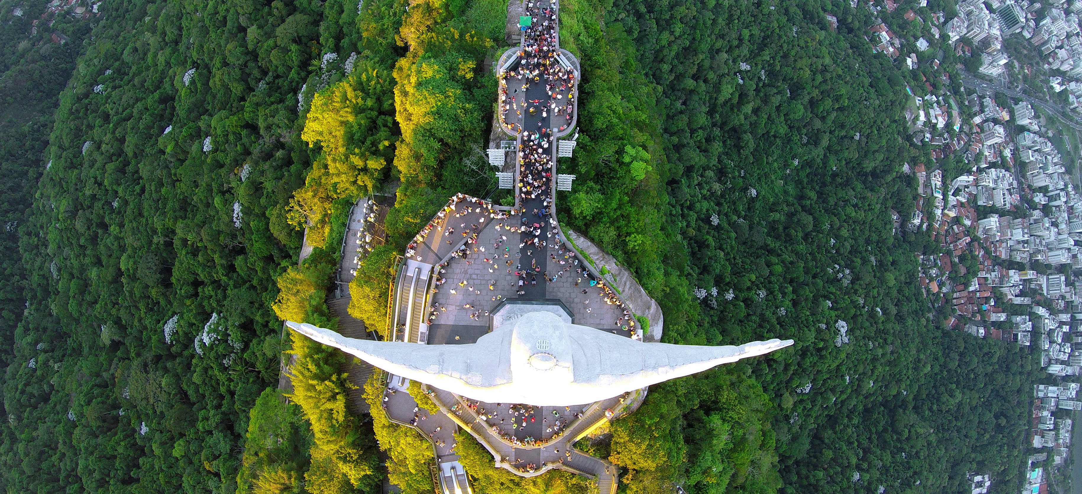
Inscribed by UNESCO in 2012, the Carioca Landscapes inscription does something unusual: it recognises not a single monument but an entire urban-natural system — the way Rio’s inhabitants have woven forests, beaches, and mountain granite into everyday city life over three centuries. The inscription covers Tijuca National Park (the world’s largest urban tropical forest, reforested in the 19th century after coffee plantations stripped the hillsides), the Botanical Garden founded in 1808, the Corcovado peak crowned by the 30-metre Art Deco statue of Christ the Redeemer (inaugurated 1931), Sugarloaf Mountain and Guanabara Bay, the Copacabana and Ipanema beachfronts, and the Praça Mauá waterfront in the historic centre.
Walking through Tijuca on a weekday morning, you hear birdsong before you hear traffic. The forest is thick enough to swallow the city’s sounds within minutes of leaving the trailhead, yet the skyline reappears whenever the canopy breaks. At the summit of Corcovado, the statue’s outstretched arms cast a shadow across Guanabara Bay below — a bay that, at dusk, turns the colour of tarnished copper. UNESCO’s reasoning was precise: Rio is one of very few cities in the world where nature did not simply survive urban growth but was actively integrated into the city’s identity and spatial structure.
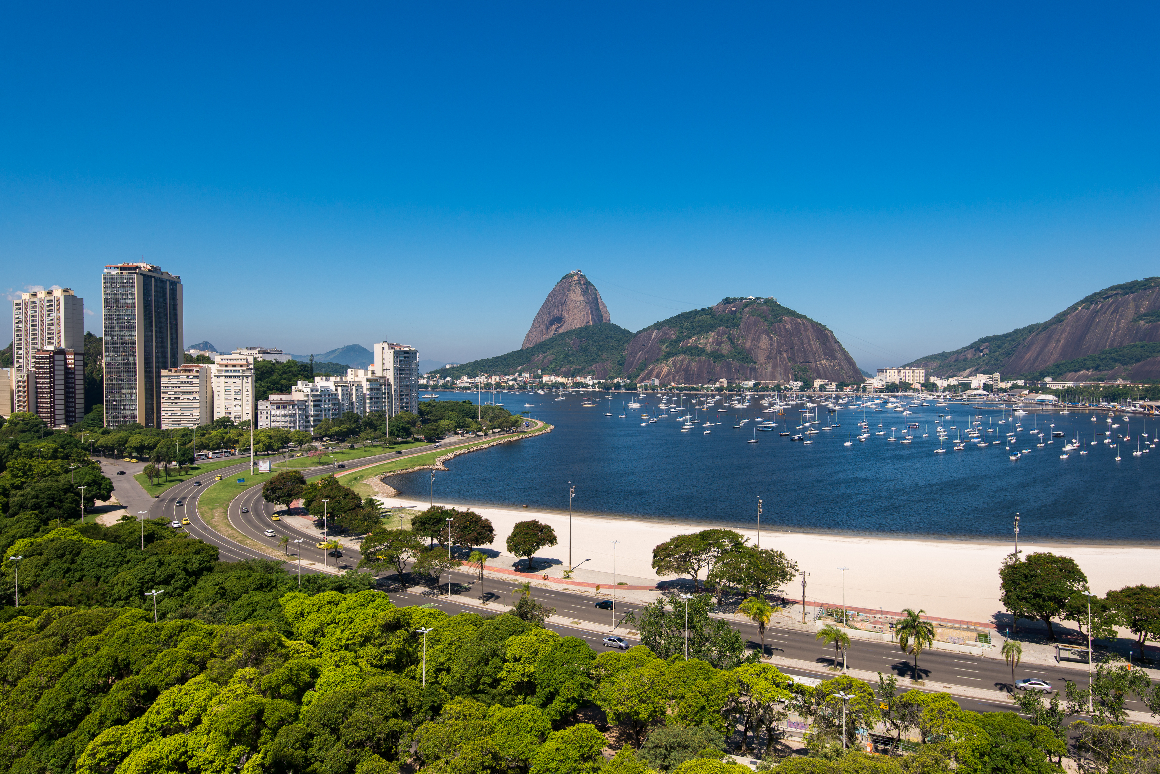
The Botanical Garden alone merits several hours. Founded by Prince Regent João VI as an acclimatisation centre for tropical plants, it houses over 6,500 species, including a double row of imperial palms that have stood since 1842. The garden borders Tijuca directly, so it is possible to move from manicured colonial avenues into Atlantic Forest understorey in a single walk.
Getting there: All inscribed areas are within Rio; the Corcovado rack railway departs from Cosme Velho (15 min from the city centre by taxi or metro + bus). Sugarloaf cable car runs from Praia Vermelha, Urca. Allow: Two full days to cover the core sites: Tijuca + Corcovado on day one, Sugarloaf + Botanical Garden on day two. Best for: Any visitor to Rio; architecture and landscape enthusiasts; birdwatchers (Tijuca harbours over 200 species).
Atlantic Forest South-East Reserves ~200 km south-west — 2.5–3 hr by car
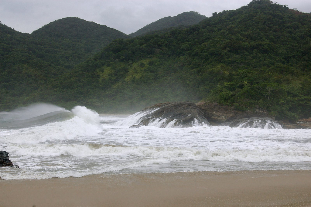
The Atlantic Forest South-East Reserves were inscribed in 1999 as a Natural World Heritage Site. The inscription covers 25 protected areas across the states of Paraná, São Paulo, and Rio Grande do Sul, recognising what remains of a biome that once stretched almost the entire length of Brazil’s eastern seaboard. Today, only 3% of the original Atlantic Forest survives intact. The inscribed areas hold some of the highest levels of endemic species on Earth — jaguars, giant anteaters, muriqui monkeys, and over 400 bird species — in a forest that is structurally distinct from the Amazon and far older in evolutionary terms.
From Rio, the most accessible entry point is the Parque Nacional da Serra da Bocaina, approximately 200 kilometres to the south-west along the Costa Verde. The park occupies a mountainous ridge between the states of Rio de Janeiro and São Paulo, rising to 2,088 metres. Its trails cut through dense Atlantic Forest canopy, past waterfalls and cold-water streams that descend toward the coast at Paraty — itself a historic colonial port town. The road (BR-101 / RJ-165) passes through some of the finest remaining coastal forest in Brazil, and the contrast with the city left behind in Rio is absolute: the air is noticeably cooler above 1,000 metres, and the undergrowth is dense enough to require a guide on less-marked trails.
Getting there: Drive south-west from Rio on BR-101 via Angra dos Reis toward Paraty; Serra da Bocaina park access is signposted from Cunha (São Paulo side) or from Paraty itself. No direct public transport to the park; shared transfers depart from Paraty. Allow: At minimum one overnight in Paraty; two to three nights for serious trekking in the park. Best for: Naturalists, birders, trekkers; travellers combining coastal Colonial heritage at Paraty with inscribed forest.
Historic Town of Ouro Preto ~490 km north-west — 1 hr flight + 2 hr road, or 7–8 hr by road
Ouro Preto — “black gold” — was inscribed in 1980 as UNESCO’s first Brazilian World Heritage Site, a recognition of the city’s near-complete survival as an 18th-century gold-rush capital. The Portuguese colonial administration built Ouro Preto on the ridges of the Espinhaço mountains in Minas Gerais, and between 1698 and the mid-19th century it was one of the wealthiest cities in the Americas, funding extraordinary Baroque architecture in stone, wood, and gold leaf.
The city’s most celebrated creator was Antônio Francisco Lisboa, known as Aleijadinho (“the little cripple”), a sculptor and architect who worked despite a degenerative disease that eventually left him without the use of his hands. His prophets’ statues at the church of Bom Jesus de Matosinhos in nearby Congonhas, and the interiors of the Igreja de São Francisco de Assis in Ouro Preto itself, are considered masterworks of Baroque sculpture in any hemisphere. Twelve historic churches still line the steep cobbled streets, along with the Museu da Inconfidência — housed in the former colonial palace — which documents Brazil’s first independence movement, crushed here in 1789.
Getting there: Fly from Rio Galeão (GIG) to Belo Horizonte Confins (CNF), then take a 2-hour express coach to Ouro Preto (Util bus company; tickets bookable online). Alternatively, drive north-west via BR-040; allow 7–8 hours. Allow: Two days minimum; three days if combining with Congonhas (Aleijadinho’s prophets) and Tiradentes, 90 minutes away. Best for: Architecture and art history travellers; anyone interested in colonial Brazil and the Atlantic slave trade economy.
Frequently Asked Questions
How many UNESCO World Heritage Sites are accessible from Rio de Janeiro?
Two sites are directly accessible from Rio. The Carioca Landscapes between the Mountain and the Sea (inscribed 2012) is embedded within the city itself, encompassing Tijuca National Park, Corcovado and Christ the Redeemer, Sugarloaf Mountain, the Botanical Garden, and the beachfronts. The Atlantic Forest South-East Reserves (inscribed 1999) can be reached in approximately two and a half to three hours by car via the Serra da Bocaina. A third inscription, the Historic Town of Ouro Preto (inscribed 1980), is a 7–8 hour drive or a short flight away in Minas Gerais.
How do I reach Christ the Redeemer and Tijuca National Park?
The Corcovado rack railway (Trem do Corcovado) is the most direct route to the Christ the Redeemer statue; the station is in the Cosme Velho neighbourhood, reachable by metro to Santa Teresa and then bus, or by taxi from anywhere in the South Zone. Advance ticket purchase online is strongly recommended, as queues can be long. Tijuca National Park has several trailheads accessible by ride-share or car; the Paineiras gateway, just below Corcovado, is the most convenient entry point for walkers arriving without a vehicle.
What is the best time of year to visit these sites?
Rio’s dry season runs from May to October, with clear skies, lower humidity, and temperatures between 20°C and 28°C — ideal for Corcovado (fog can obscure the summit during the wet season) and for trekking in Serra da Bocaina. Ouro Preto is best visited outside Carnival and Holy Week, when accommodation is booked months ahead and the cobbled streets become very crowded. For birding in Tijuca or Atlantic Forest, the austral spring (September–November) is the most productive period.
What makes the Carioca Landscapes inscription unusual among UNESCO cultural sites?
Most UNESCO cultural landscape inscriptions recognise a specific designed space — a garden, a terraced field system, a historic town. The Carioca Landscapes inscription is exceptional because it encompasses an entire living city’s relationship with its natural setting: a continuous interplay between urban fabric and tropical wilderness that developed not by deliberate planning but through three centuries of daily practice. The inclusion of Tijuca — a secondary-growth forest replanted by the imperial government in the 1860s after 19th-century coffee farming destroyed the original cover — also makes it a rare inscription of successful ecological restoration rather than pristine wilderness.


.jpg)


