
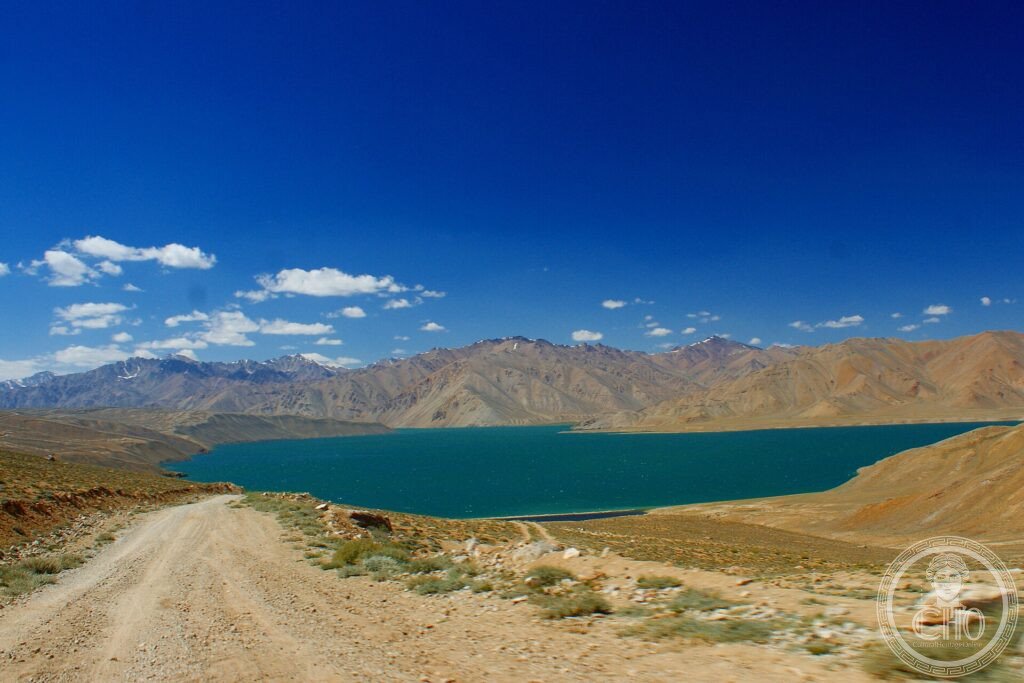
They call it the “roof of the world”: the Pamir plateau, where some of the highest mountain ranges in Asia meet. The Tajik National Park protects an immense portion of its summits, endless glaciers such as the Fedchenko, high-altitude lakes and cold deserts, a harsh and silent nature almost without human presence.
At a glance
Tajik National Park, covering a vast area of the Pamir mountains of eastern Tajikistan, protects part of the high plateau long called the “Roof of the World”, where great ranges of High Asia meet. It is a landscape of towering peaks, immense glaciers — including the Fedchenko, one of the longest outside the polar regions — high-altitude lakes, cold deserts and deep valleys, shaped by earthquakes and ice and almost untouched by people. This remote mountain wilderness was inscribed by UNESCO in 2013.
Key facts
- UNESCO: World Heritage since 2013 (Tajik National Park, Mountains of the Pamirs)
- “Roof of the World”: the high Pamir plateau
- Fedchenko Glacier: one of the longest glaciers outside the poles
- High peaks: summits above 7,000 m
- High lakes: including the great Karakul, in a meteorite crater
- Vast and remote: one of the largest protected areas of High Asia
History
The Pamir plateau, where the Himalaya, Karakoram, Hindu Kush and Tian Shan ranges converge, has been a crossroads and a barrier since antiquity, crossed by branches of the Silk Road and home to small communities of herders in its valleys. Its extreme altitude and harsh climate kept much of it wild.
The region is geologically alive, shaken by frequent earthquakes and carrying enormous glaciers, among them the Fedchenko, studied by scientists as a record of climate. Protected as Tajik National Park, covering more than two and a half million hectares, it was inscribed by UNESCO in 2013 for its outstanding mountain landscapes and geological processes.
What you see
The park is crossed by the high Pamir Highway, one of the world’s great mountain roads, passing turquoise lakes such as Karakul and Yashilkul, bare brown ranges streaked with snow, and remote villages and hot springs. Trekkers and climbers reach the glaciers and high peaks; the silence and scale of the plateau are overwhelming.
The vision of brilliant lakes set among endless high mountains, almost empty of people, is the wonder of the Pamir.
Practical information
- Park: crossed by the Pamir Highway; trekking in the ranges
- Best time: summer (June–September); winters are extreme
- Time needed: several days
- Note: very high altitude and remote; plan permits and logistics
Getting there
Tajik National Park covers much of the Gorno-Badakhshan region of eastern Tajikistan. The Pamir Highway from Khorog or Osh (Kyrgyzstan) crosses it. GPS: 38.50° N, 72.50° E.
Nearby
- Karakul — the great high lake in a meteorite crater
- Pamir Highway — the legendary high-altitude road
- Khorog — the regional town in the Pamir
Sources
- UNESCO World Heritage Centre — “Tajik National Park (Mountains of the Pamirs)” (ref. 1252)
- Government of Tajikistan — official body
- Encyclopaedia Britannica — Pamirs
Find it on the map
See this place and what’s around it →📷 Become a Cultural Heritage Online photographer
Share your photos of places: they stay published under your name as the author. The more they're seen, the more you get noticed — and soon a contest will reward the most appreciated photos.
Log in or sign up free to add a photo