
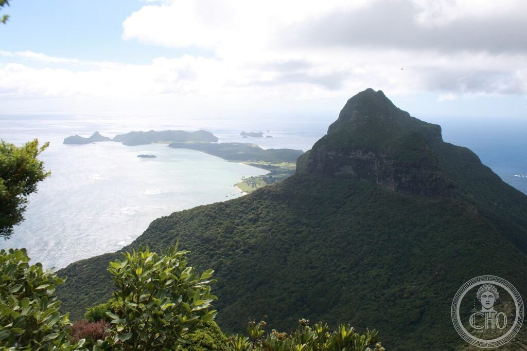
Lost in the Tasman Sea, between Australia and New Zealand, Lord Howe is what remains of a great oceanic volcano: a crescent of intensely green mountains around a coral lagoon, populated by plants and animals that exist nowhere else. A small, fragile paradise, carefully protected.
At a glance
The Lord Howe Island Group, in the Tasman Sea between Australia and New Zealand, is the eroded remnant of a large oceanic volcano: a crescent of steep, forest-clad mountains around a sheltered coral lagoon, with offshore islets and the dramatic spire of Ball’s Pyramid nearby. Isolated for millions of years, it evolved a wealth of plants and animals found nowhere else, and holds the world’s southernmost true coral reef. This rare island world was inscribed by UNESCO in 1982.
Key facts
- UNESCO: World Heritage since 1982 (Lord Howe Island Group)
- Volcanic remnant: the eroded core of an oceanic volcano
- Twin peaks: Mount Gower and Mount Lidgbird dominate the island
- Endemic life: many plants, birds and insects unique to the island
- Coral lagoon: the world’s southernmost true coral reef
- Ball’s Pyramid: a towering sea-stack to the south-east
History
Lord Howe rose from the sea as a volcano some seven million years ago and has been worn down by the ocean to its present form. Never connected to a continent, it was colonised by chance arrivals — seeds, birds, insects — that evolved in isolation into many unique species, including the flightless Lord Howe woodhen and the remarkable “tree lobster” stick insect.
Discovered by Europeans in 1788 and later settled by a small community, the island lost some species to introduced rats and goats but kept much of its natural richness through careful management. Inscribed by UNESCO in 1982, it limits visitor numbers and has undertaken ambitious projects to remove pests and protect its rare wildlife.
What you see
From the small settlement, walking tracks lead to the lagoon and its reef, to forested slopes and to the foot — or, for the fit, the summit — of Mount Gower, with sweeping views over the island and sea. Endemic birds, palms and the clear lagoon are everywhere; Ball’s Pyramid rises offshore.
The intimacy of the small, beautiful island, ringed by its lagoon beneath green peaks, is the charm of Lord Howe.
Practical information
- Island: reached by air; visitor numbers are strictly limited
- Time needed: several days
- Note: bicycles and walking; book accommodation well ahead
- Setting: in the Tasman Sea, about 600 km off New South Wales
Getting there
Lord Howe Island lies in the Tasman Sea about 600 km east of the New South Wales coast, Australia, reached by small aircraft from Sydney, Brisbane and Port Macquarie. GPS: 31.55° S, 159.08° E.
Nearby
- Ball’s Pyramid — the great sea-stack south-east of the island
- The lagoon reef — the southernmost coral reef in the world
- Mount Gower — the island’s high peak and guided climb
Sources
- UNESCO World Heritage Centre — “Lord Howe Island Group” (ref. 186)
- NSW Lord Howe Island Board — official body
- Encyclopaedia Britannica — Lord Howe Island
Find it on the map
See this place and what’s around it →📷 Become a Cultural Heritage Online photographer
Share your photos of places: they stay published under your name as the author. The more they're seen, the more you get noticed — and soon a contest will reward the most appreciated photos.
Log in or sign up free to add a photo