
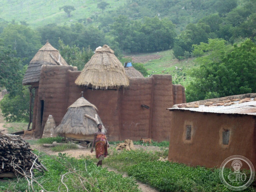
Across a plateau in northeastern Togo, the Batammariba people still build and inhabit two-storey clay tower houses whose construction method is passed only from father to son. Koutammakou is not a ruin but a living landscape, its granaries, shrines and sacred groves still used exactly as intended.
At a glance
Koutammakou, meaning the land of the Batammariba, lies on a hilly plateau in the Kara Region of northeastern Togo and extends across the border into the Atakora region of Benin. It is the homeland of the Batammariba, also known as Tamberma, Somba or Tammari, and the setting for their Takienta tower houses, one of the most distinctive vernacular architectural traditions in Africa.
Each Takienta is a small self-contained compound built of red laterite clay. The ground floor holds the living space, the kitchen and pens for cattle, sheep and goats overnight. Above it rises a cylindrical granary topped with a conical thatched roof, reached by ladder and used to store millet, sorghum and beans. A flat roof links the towers and serves for sleeping in hot weather and for drying crops. Clay sculptures on the facades, representing ancestors and spirits, complete each house: a Takienta without them is considered unfinished.
Key facts
- Location: Kara Region, northeastern Togo, extending into the Atakora region of Benin
- Area: a plateau landscape of approximately 50,000 hectares
- Community: the Batammariba people, also called Tamberma, Somba or Tammari
- UNESCO status: inscribed as a World Heritage Site in 2004, reference 1140
- Coordinates: approximately 10.05° N, 1.30° E
History
The Batammariba are thought to have migrated onto the Koutammakou plateau around the 17th century, though their oral traditions differ on the exact origin of that movement. The plateau’s difficult terrain, with no navigable rivers and dense forest along its escarpments, kept it isolated for centuries.
That isolation shaped its history. The Batammariba avoided the worst of the Atlantic slave trade, since raiders found the plateau hard to reach and the towers themselves, with their narrow defensible entrances, resisted attack and kept livestock secure at night. The community also kept its traditional religion, centred on the sun deity Kuiye, largely untouched by the spread of Islam along regional trade routes. French colonial administration later maintained only a light presence here, and the building tradition continued largely unchanged through that period.
What you see
The main recognised visitor sites within Koutammakou are the villages of Nadoba and Warengo, both reached from the town of Kande and both served by local community guides. Visitors walk among working compounds where towers are still built, granaries still filled and clay ancestor figures, known as botchiou, still added to facades to mark family history and protect against misfortune.
The sacred Kara River, considered a source of spiritual power, and forest groves used for initiation rites are part of the same landscape, though the groves are closed to outsiders without permission. The clearest sense of Koutammakou as a living culture comes during the Evala wrestling festival held each July, when young men who have completed initiation compete in traditional wrestling and the plateau fills with participants from across the Kara Region.
Practical information
- Guides: local community guides are available in Nadoba and Warengo and are strongly recommended
- Transport on site: a four-wheel-drive vehicle is advisable during the rainy season from June to October, when dirt tracks become difficult
- Best time to visit: the dry season from November to April offers easier road access, while July brings the Evala festival
- Health requirements: yellow fever vaccination is required for entry to Togo, and malaria prophylaxis is recommended for all visitors
Getting there
Lomé, served by Lomé-Tokoin Airport, is the usual entry point to Togo, with connections available from several regional and European cities. From Lomé, the town of Kande lies around 400 kilometres to the north along the RN1 road and serves as the practical base for visiting Koutammakou; travellers should check current road conditions and journey times with local operators before setting out, especially in the rainy season.
Nearby
- Atakora region, Benin — the Koutammakou landscape continues across the border, where the same tower-house tradition is known locally as Tata Somba, reached via the town of Natitingou.
- Pendjari National Park, Benin — a wildlife reserve near Natitingou with elephant, hippo, lion and leopard, requiring a four-wheel-drive vehicle and a guide.
- Kara — around 70 kilometres south, the regional capital, with a market and a small ethnographic museum covering Batammariba culture, and the last substantial accommodation before Koutammakou.
Sources
- Wikipedia, Koutammakou
- Wikipedia, Batammariba people
- Wikipedia, Evala
- UNESCO, Koutammakou, the Land of the Batammariba, World Heritage reference 1140
Find it on the map
See this place and what’s around it →📷 Become a Cultural Heritage Online photographer
Share your photos of places: they stay published under your name as the author. The more they're seen, the more you get noticed — and soon a contest will reward the most appreciated photos.
Log in or sign up free to add a photo