
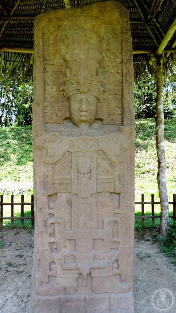
A small Maya city dwarfed politically by neighbouring Copán nonetheless produced the largest carved stone monuments of the pre-Columbian Americas. Quiriguá’s stelae and zoomorphs, raised in a burst of ambition after its ruler beheaded Copán’s king, remain among the most striking sculptural achievements of the ancient Maya world.
At a glance
Quiriguá was a minor Maya vassal state subject to the powerful city of Copán, in what is now Honduras, for most of its history. In April 738 CE its ruler K’ahk’ Tiliw Chan Yopaat captured the Copán king Waxaklajuun Ub’aah K’awiil, known as 18 Rabbit, and had him beheaded, an act of political defiance comparable to a small power assassinating a great power’s king. In the fifty years that followed, K’ahk’ Tiliw commissioned nine stelae and four zoomorphs of extraordinary scale, transforming a subordinate outpost into the site of the most ambitious stone carving of the Classic Maya period.
The city was never able to translate this sculptural achievement into lasting political power, and Quiriguá was abandoned in the early ninth century.
Key facts
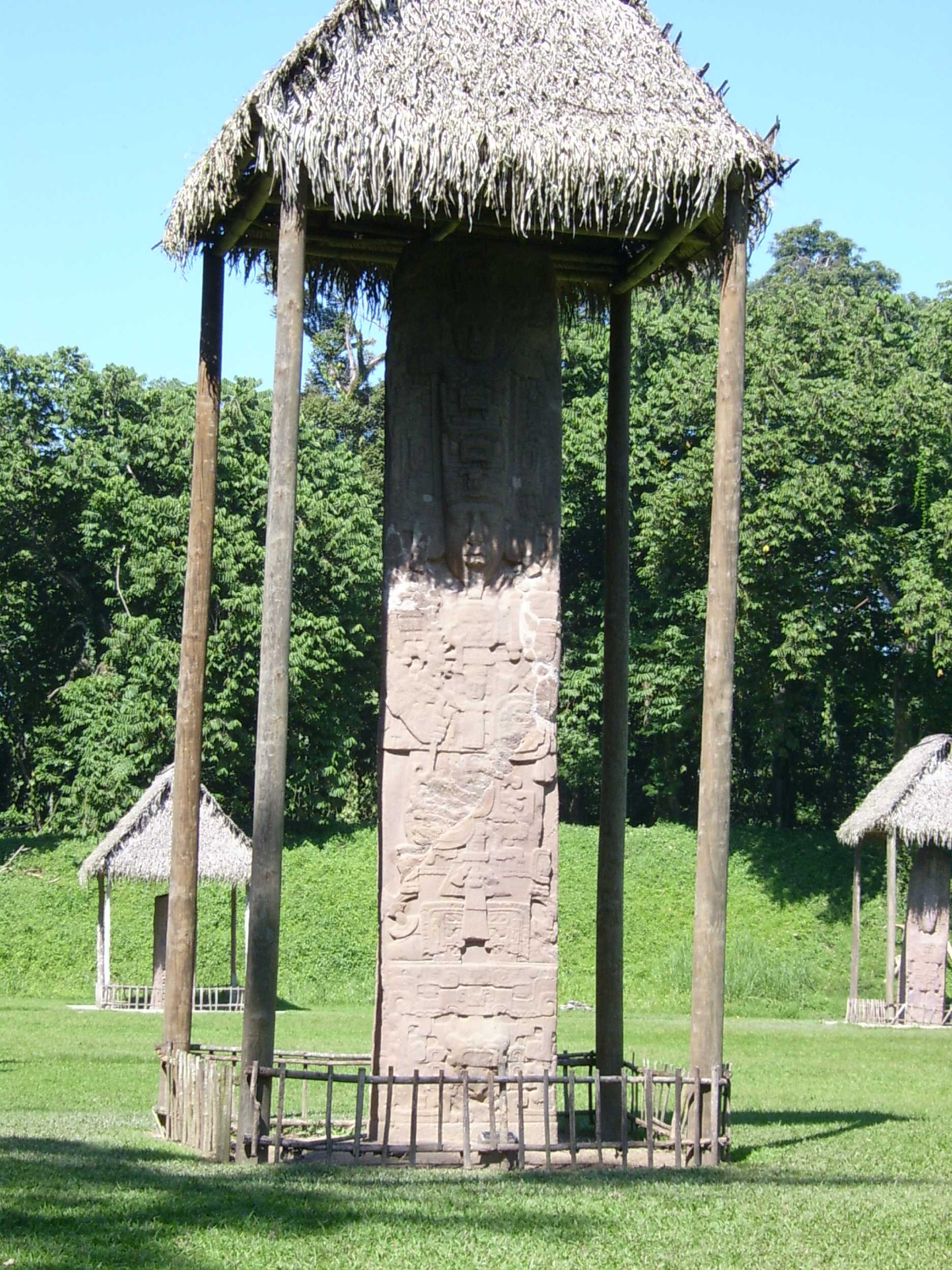
- Stela E: the tallest known pre-Columbian stone monument, standing 10.67 metres above ground with a further 3.7 metres buried for stability, a total height of 14.37 metres and an estimated weight of 65 tonnes, carved from a single sandstone block and erected in 771 CE.
- The zoomorphs: monuments carved as fantastical animals, including giant crocodiles, turtles and double-headed dragons, with the figure of the king shown within or upon the animal form. Zoomorph P, at 1.07 metres high and 3.65 metres long, shows the king seated within the jaws of a crocodilian and is regarded as the most complex single Maya sculpture known.
- The stelae: monuments A, C, D, E, F, H and J were erected between 711 and 810 CE, carved from single blocks of local sandstone and carrying extensive hieroglyphic inscriptions recording calendar dates, royal accessions and mythological narratives.
- The 738 execution: the beheading of Copán’s king Waxaklajuun Ub’aah K’awiil, builder of the celebrated Hieroglyphic Stairway, was so disruptive that Copán’s own inscriptions fall silent about his death for seventeen years.
History
The British archaeologist Alfred Percival Maudslay carried out the first systematic documentation of Quiriguá between 1881 and 1894, making plaster casts of all the monuments, now held at the Victoria and Albert Museum in London and the Peabody Museum in Cambridge, and taking the first photographs of the site. His work laid the foundations for later Maya epigraphy.
For much of the twentieth century the site was surrounded by banana plantations belonging to the United Fruit Company, the corporation that gave the world the term banana republic. The company’s decision to preserve a buffer zone around the monuments, intended for its workers and as a gesture of corporate goodwill, is thought to be the indirect reason the site survived relatively intact.
What you see
The Great Plaza, roughly 300 by 100 metres, is the central ceremonial space of the site, with eight stelae and three zoomorphs arranged in the open ground. The stelae now stand beneath thatched protective roofs, which throw dramatic diagonal light across the carved surfaces. At the south end lies the Acropolis, a partially excavated royal palace complex of multi-room corbel-vaulted structures, together with a ball court. Banana trees still surround the plaza, a visible legacy of the site’s plantation-era history.
A small museum stands near the entrance, holding casts of some monuments alongside original jade and ceramic artefacts from the excavations, and offers a useful orientation before walking the plaza.
Practical information
- Location: Quiriguá Archaeological Park lies about one kilometre from the town of Los Amates, on the CA-9 Atlantic Highway in Izabal Department.
- Visiting time: around an hour and a half is enough to see the plaza and museum; early morning visits are more comfortable given the heat and humidity of the Motagua River valley, especially in the dry season from February to April.
- Tickets and hours: check current entry fees and opening times with the site’s official channels before travelling.
Getting there
Quiriguá is around 200 kilometres east of Guatemala City on the CA-9 highway, reachable by direct bus or minibus from the capital, with the final stretch to the site from Los Amates covered by local transport. Combined with Copán across the Honduran border and Lago de Izabal to the northwest, it forms part of a well-established eastern Guatemala circuit.
Nearby
- Copán Archaeological Site — about 40 kilometres east across the Honduran border, the city ruled by 18 Rabbit, notable for the Hieroglyphic Stairway, the Great Plaza stelae, the Rosalila Temple and the original Stela B in its site museum; inscribed as a UNESCO World Heritage Site in 1980.
- Copán Ruinas — the town nearest the Honduran site, commonly used as a base for visiting both Copán and Quiriguá.
- Lago de Izabal — roughly 30 kilometres northwest, Guatemala’s largest lake, home to manatees at its river mouths.
- Castillo de San Felipe — a seventeenth-century Spanish colonial fort on Lago de Izabal, built to defend the lake against pirate raids, near the start of the Río Dulce gorge leading to Livingston on the Caribbean coast.
Sources
- Wikipedia.
- UNESCO.
Gallery
Find it on the map
See this place and what’s around it →📷 Become a Cultural Heritage Online photographer
Share your photos of places: they stay published under your name as the author. The more they're seen, the more you get noticed — and soon a contest will reward the most appreciated photos.
Log in or sign up free to add a photo