
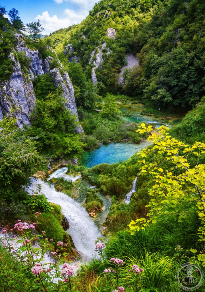
Sixteen lakes step down through the Dinaric karst of central Croatia, linked by waterfalls and separated by travertine barriers that are still forming. The colour of the water, from pale turquoise to deep green, changes with the light and the mineral content, making this one of the most distinctive freshwater landscapes in the Balkans.
At a glance
Plitvice Lakes National Park covers 296 square kilometres of forested karst in central Croatia. Sixteen terraced lakes, divided into an Upper and a Lower group, are connected by more than ninety waterfalls and separated by travertine barriers that build up naturally over time. The park was inscribed as a UNESCO World Heritage Site in 1979.
The Upper Lakes, twelve in number, sit within a forested plateau that shelters bear, wolf, lynx and deer, and include the park’s largest lake, Prošćansko jezero. The Lower Lakes, four in number, are the most visited part of the park and include the Veliki Slap, at 78 metres the tallest waterfall in Croatia, along with a network of wooden boardwalks that run close to the water.
Key facts
- Area: 296 km²
- Lakes: 16, in two groups, Upper and Lower
- Waterfalls: more than 90
- Tallest waterfall: Veliki Slap, 78 m
- Park established: 1949
- World Heritage status: inscribed 1979; placed on the Danger List between 1992 and 1997, removed in 1997
History
The Plitvice area has been settled since at least the Bronze Age, when Illyrian tribes occupied the Dinaric highlands. From the fifteenth to the eighteenth centuries the region formed a frontier zone between the Ottoman and Habsburg empires, and the Habsburgs used its forested terrain as part of the defensive Military Frontier against Ottoman incursions.
The national park was established in 1949 by the Federal People’s Republic of Yugoslavia, one of the first such parks created under the new communist state, and it was later expanded in 1997. Tourist development followed in the decades after, with international visitors arriving from the 1950s and a hotel complex built in the organic architectural style typical of Yugoslav tourism at the time.
In late March and early April 1991 the park became the site of the Battle of Plitvice Lakes, an early armed clash of the Croatian War of Independence in which a Croatian police officer, Josip Jović, was killed. Serbian forces then held the park from April 1991 until Operation Storm in August 1995. UNESCO placed the site on its Danger List in 1992 in explicit recognition of the conflict, and it was removed from that list in 1997 once the area was reintegrated into Croatia and demining, completed by 2000, made the park safe again. The lakes themselves suffered no physical damage during the war.
What you see
The Lower Lakes are reached from the park’s first entrance and are its most photographed section. Wooden boardwalks lead directly over the turquoise water, offering views such as Jezero Kaluđerovac beneath the Sastavci waterfalls, where several cascades meet in a single confluence. The Veliki Slap, fed by the Plitvica River, drops 78 metres over a rock ledge rather than a travertine formation, making it geologically distinct from the smaller cascades for which the park is best known in photographs.
In the Upper Lakes, the Galovački Buk waterfall is considered the finest example of a travertine cascade in the park, dropping 22 metres across several separate channels. The largest lake in this zone, Prošćansko jezero, sits within a forested plateau that supports a wider range of wildlife than the Lower Lakes, including bear, wolf, lynx and deer.
Throughout the park, the travertine barriers that separate the lakes are formed by calcium carbonate dissolved in the water, which precipitates as solid calcite when the water speeds up or meets algae and moss growing on submerged surfaces. This process continues to add to the barriers at a rate of around a centimetre a year, so the shape of the lakes is still slowly changing.
Practical information
- Entrances: two main entrances give access to the Lower and Upper Lakes respectively; the boardwalk sections near Entrance 1 are the most visited part of the park.
- Access management: the park operates a timed entry system, and visitor numbers are managed; current arrangements, tickets and any daily limits should be checked on the park’s official channels before visiting.
- Wildlife: bear, wolf, lynx and deer are present in the Upper Lakes area, so visitors should follow the park’s guidance on trails and behaviour.
Getting there
Plitvice Lakes National Park lies in the Dinaric karst of central Croatia, within Lika-Senj and Karlovac Counties, roughly midway between the Croatian interior and the Adriatic coast. Current transport options and timings are best confirmed through the park’s official information channels.
Nearby
- Upper Lakes — reached from the second park entrance, this forested zone holds twelve of the sixteen lakes and the park’s wildlife.
- Galovački Buk — within the Upper Lakes, this 22-metre travertine waterfall is considered the finest example of its kind in the park.
- Sastavci waterfalls — in the Lower Lakes, where several cascades converge in view of the boardwalk near Jezero Kaluđerovac.
Sources
- UNESCO World Heritage Convention
Find it on the map
See this place and what’s around it →📷 Become a Cultural Heritage Online photographer
Share your photos of places: they stay published under your name as the author. The more they're seen, the more you get noticed — and soon a contest will reward the most appreciated photos.
Log in or sign up free to add a photo