
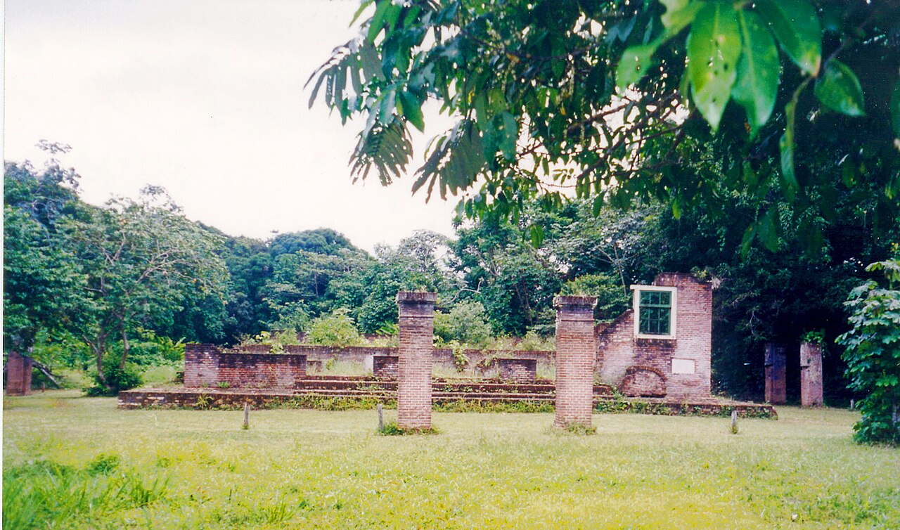
The Jewish savanna of the rainforest – ruins of the western hemisphere’s first autonomous Jewish settlement and its 1685 synagogue, UNESCO-listed 2023.
At a glance
- Type
- Archaeological settlement (UNESCO 2023)
- Period
- 1685-1832
- Style
- Sephardic colonial – brick synagogue, carved cemeteries
- Location
- Suriname River, Para district, Suriname
- Coordinates
- 5.4258, -54.9856
- Founders
- Sephardic Jews via Brazil and Amsterdam
Overview
On a bluff over the Suriname River stand the brick footings of Beracha ve Shalom – Blessing and Peace – the 1685 synagogue of Jodensavanne, where Sephardic Jews fleeing Iberian persecution built the Americas’ first autonomous Jewish agricultural colony: their own militia, courts, and sugar estates worked, in the era’s tragic entanglement, by enslaved Africans. UNESCO inscribed the site with the Cassipora cemetery in 2023.
History
Privileges from the Dutch let the nacao govern itself a century – the savanna’s Jerusalem of the jungle flourished, then faded as plantations moved and an 1832 fire closed the village. Creole descendants of the community’s enslaved and free people kept memory; restoration and the inscription joined Jewish-Atlantic and Afro-Surinamese histories in one heritage.
Architecture and Design
The synagogue’s metre-thick walls outline the hall toward the river; 450 carved gravestones – Hebrew, Portuguese, skull-and-hourglass baroque – pave the two cemeteries under the trees. The military post Cordon path and creek landing complete the colonial landscape.
Cultural significance
Jodensavanne documents religious refuge, frontier autonomy, and slavery’s economy in one clearing – the Jewish Atlantic’s most complete colonial site, and Suriname’s second listing after Paramaribo’s wooden city.
Visiting today
Day tours from Paramaribo (90 minutes by road and ferry) include the foundation, cemeteries, and Redi Doti village’s guides; the river bluff’s sunset rewards lingerers.
Getting there
Via Carolina bridge or Domburg ferry on the Suriname River road; operators in Paramaribo schedule regular departures.
Sources and resources
Find it on the map
See this place and what’s around it →Record researched and written by Luigi De Marchi for Cultural Heritage Online, 2026.
📷 Become a Cultural Heritage Online photographer
Share your photos of places: they stay published under your name as the author. The more they're seen, the more you get noticed — and soon a contest will reward the most appreciated photos.
Log in or sign up free to add a photoIs this page about you?
This page is read by travellers and heritage enthusiasts who find it on Google. Tell us how you are connected to this place and we will take it from there.