A coastal path documented in the 1823 land registry connected Livorno to Piombino through Cala di Forno, described as “a road along the marine of Livorno along the beach on every side.” The Via dei Cavalleggeri, as it became known, originated in medieval times or possibly as a variant of the Roman Aurelia road, but was formally consolidated in the 16th century by Cosimo I (1537) for military purposes.
A Fortified Coastal Defense System
The new route, situated close to the sea, connected approximately 60 structures including towers 10–15 meters high, forts, fortifications, and armed positions. This linear coastal defense system was patrolled continuously by mounted light cavalry—cavalleggeri—tasked with reconnaissance and security operations. The primary objectives were threefold: to protect against pirate raids, to prevent the arrival of ships carrying plague refugees from Liguria, France, and Spain, and to ensure safe transport of iron ore from Portoferraio on Elba to Livorno.
The path, characterized by mule-track features, wound along the rocky and sandy coastline both north of Livorno along the Tombolo and south to Torre Nuova, where it connected to the Piombino section. Because of its military function, few civilian settlements developed along the route, and the surrounding territory remained largely depressed and remote from major political centers.
Transformation and Decline
During Grand Duke Pietro Leopoldo’s road reforms, the Via dei Cavalleggeri underwent significant change. As the Maremma underwent land reclamation, water management projects, and agricultural reform, the path assumed an entirely different role. Some fortifications, such as Marina di Bibbona and Marina di Castagneto, gained commercial value from these developments, while other sections lost their strategic importance as maritime threats diminished.
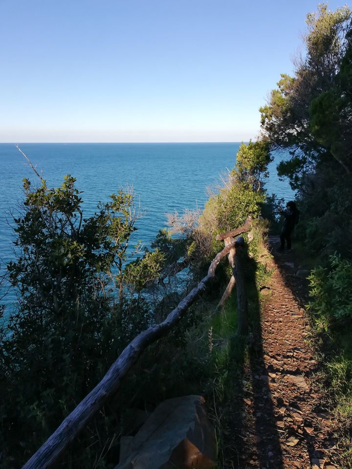
Though much of the original route has been lost to time and neglect, remnants survive along the Baratti–Piombino promontory, identified today as hiking trail number 302. This approximately 10-kilometer route extends from the Tower of Baratti north to the Gulf of Calamoresca, passing through Buca delle Fate. The first section between Baratti and Buca delle Fate preserves portions of the original retaining wall and dramatic coastal views. Some sections face erosion from sea and wind, though the path remains popular with hikers attracted to its wooded and maritime environment.
A historical note: Livorno’s present-day Terrazza Mascagni occupied a 16th-century fortification staffed by volunteer coastal sentries—the Spianata dei Cavalleggeri—who patrolled the rugged coastal road continuously for military and health surveillance purposes.
Frequently asked questions
Why did Cosimo I consolidate the Via dei Cavalleggeri in 1537?
Cosimo I established the route for military purposes to protect against pirate attacks, prevent plague-infected ships from landing, and secure the transport of iron ore from Elba to Livorno.
What happened to the Via dei Cavalleggeri after the 18th century?
During Grand Duke Pietro Leopoldo’s reforms, the route’s strategic military importance declined as land reclamation and agricultural development transformed the region and maritime threats diminished, though some fortifications gained commercial value.
Where can the original Via dei Cavalleggeri still be seen today?
The best-preserved section is hiking trail number 302 along the Baratti–Piombino promontory, approximately 10 kilometers from the Tower of Baratti to the Gulf of Calamoresca, where portions of the original retaining wall and coastal vistas remain visible.
Sources
- S1 — Sereni, Emilio. Storia del paesaggio agrario italiano. Laterza, 1961. ISBN 978-88-420-2747-8.
- S2 — Settis, Salvatore. Italia S.p.A.. L'assalto al patrimonio culturale. Einaudi, 2002. ISBN 978-88-06-16973-2.
Spotted an error? Write to editorial@culturalheritageonline.com and we correct it the same day.