

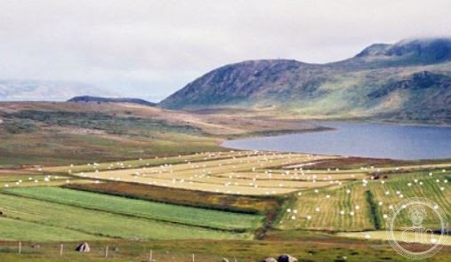
A Norse pastoral district in medieval Greenland, abandoned in the 15th century after nearly 500 years of settlement.
At a glance
Vatnahverfi, known in West Greenlandic as Tasikuluulik (“Lake District”), was the most agriculturally favourable region of the Norse Greenlanders’ Eastern Settlement. Archaeologists consider it the colony’s finest pastoral land—a distinction that made it valuable and strategically important to medieval Scandinavian settlers.
History
Norse colonists first arrived in Vatnahverfi in the late 10th century, establishing farms and communities across nearly 500 years. The district thrived as an agricultural centre until the Norse population mysteriously vanished, likely during the latter 15th century. The causes of their disappearance remain unclear, coinciding with the broader abandonment of Greenland’s Norse settlements.
What you see
Today, Vatnahverfi survives as an archaeological landscape. Norse ruins—foundation stones, field systems, and building remains—mark the sites of former farms and settlements. These material traces offer evidence of medieval pastoral life in one of the North Atlantic’s most remote European colonies.
Cultural significance
Vatnahverfi represents a crucial chapter in Norse exploration and settlement beyond Scandinavia. Its abandonment forms part of the larger historical puzzle surrounding the collapse of Greenland’s Norse colonies—a medieval diaspora with implications for understanding climate, resource scarcity, and cultural resilience in marginal environments.
Key facts
- Country: Greenland
- Settlement period: Late 10th–15th century
- Coordinates: 60.85°N, 45.39°W
- Part of the Norse Eastern Settlement (Eystribyggð)
Practical information & getting there
Vatnahverfi is an archaeological site with no permanent visitor infrastructure. Access is limited and typically requires specialized travel to remote Greenland. Consult local heritage authorities or archaeological organizations before planning a visit.
Sources & resources
Find it on the map
See this place and what’s around it →📷 Become a Cultural Heritage Online photographer
Share your photos of places: they stay published under your name as the author. The more they're seen, the more you get noticed — and soon a contest will reward the most appreciated photos.
Log in or sign up free to add a photoIs this page about you?
This page is read by travellers and heritage enthusiasts who find it on Google. Tell us how you are connected to this place and we will take it from there.