
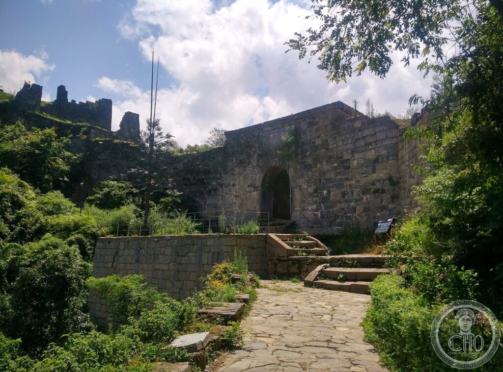
For centuries, in the multi-ethnic mountains of southwest China, the empire governed through the “tusi”: hereditary tribal chiefs who administered their own peoples in the emperor’s name. Their stone fortresses and towns, such as Hailongtun and Laosicheng, tell a unique system of balance between centre and minorities.
At a glance
The Tusi Sites, in the mountainous south-west of China, are the remains of the domains of the tusi — hereditary tribal chieftains through whom the Chinese empire governed its ethnic-minority regions from the 13th to the early 20th century. Three sites — the mountain fortress of Hailongtun, the chieftain town of Laosicheng and the Tangya domain — preserve fortresses, palaces and tombs that record this distinctive system of indirect rule, balancing imperial authority with local autonomy. They were inscribed by UNESCO in 2015.
Key facts
- UNESCO: World Heritage since 2015 (Tusi Sites)
- Three sites: Laosicheng, Tangya and the Hailongtun fortress
- The tusi system: rule through hereditary local chieftains, 13th–20th centuries
- Indirect rule: imperial authority balanced with minority autonomy
- Hailongtun: a great mountain fortress with stone gates and walls
- Ethnic regions: in the lands of the Tujia, Miao and other peoples
History
As the Chinese empire expanded into the mountainous, ethnically diverse south-west, it found direct administration difficult and instead appointed local chiefs — the tusi — who ruled their own peoples and lands in the empire’s name, passing the office down their families. This system, formalised under the Yuan, Ming and Qing dynasties, kept the peace and drew the frontier peoples into the imperial order while leaving them a measure of self-rule.
The tusi built fortresses, palaces, temples and tombs, of which Laosicheng (the seat of a Tujia chieftaincy), the Tangya domain and the formidable Hailongtun fortress are outstanding examples. The system was finally abolished in the early 20th century, leaving these sites as its monuments.
What you see
At Hailongtun, massive stone walls and gates climb a forested ridge to the ruins of the chieftain’s mountain stronghold. At Laosicheng, the foundations of a whole chieftain town — palace, streets, temples and tombs — spread along a river valley. The Tangya site adds further remains of tusi rule.
Together they reveal a vanished system of governance set in the dramatic mountain landscapes of south-west China.
Practical information
- Sites: Hailongtun (Guizhou), Laosicheng (Hunan) and Tangya (Hubei) are far apart
- Time needed: a day per site
- Note: remote; reached by road in mountain country
- Setting: across the south-western provinces
Getting there
The three Tusi Sites lie in Guizhou (Hailongtun, near Zunyi), Hunan (Laosicheng) and Hubei (Tangya), in south-western China, each reached by road. GPS (Hailongtun area): 27.80° N, 106.80° E.
Nearby
- Zunyi — the historic city near Hailongtun
- Wuling mountains — the ranges of the Tujia homeland
- Fanjingshan — the UNESCO holy mountain in Guizhou
Sources
- UNESCO World Heritage Centre — “Tusi Sites” (ref. 1474)
- State Administration of Cultural Heritage of China — official body
- Encyclopaedia Britannica — tusi
Find it on the map
See this place and what’s around it →📷 Become a Cultural Heritage Online photographer
Share your photos of places: they stay published under your name as the author. The more they're seen, the more you get noticed — and soon a contest will reward the most appreciated photos.
Log in or sign up free to add a photo