
Tsagaan Salaa Petroglyphs
An extraordinary repository of 10,000 rock figures spanning millennia, Tsagaan Salaa documents the cultural transformation from hunter-gatherer societies to nomadic pastoralism across Mongolia’s high plateaux.
At a glance
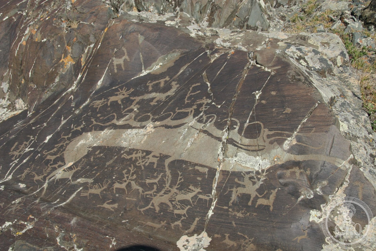
Tsagaan Salaa comprises approximately 10,000 petroglyphs distributed across 15 square kilometres in the White River Valley. The site’s artistic wealth reflects both the abundance of wildlife in ancient Mongolia and the pivotal economic shift toward livestock herding.
History
These rock carvings date from the Neolithic through Bronze Age, marking a critical transition in human settlement patterns. They chronicle the shift from nomadic hunting cultures to pastoral economies, capturing the emergence of the classic nomadic lifestyle that would define Central Asian societies for centuries. In 2011, Tsagaan Salaa was inscribed on the UNESCO World Heritage List alongside two neighbouring Altai rock art sites: Upper Tsagaan Gol and Aral Tolgoi.
What you see
The petroglyphs primarily depict livestock and large game animals—both individual subjects and expansive herds rendered in dynamic compositions. The images vary considerably in expressiveness and artistic approach, suggesting different cultural periods and creative traditions. Subject matter ranges from domestic animals to wild fauna, illustrating the dual economy that characterised the transition period.
Cultural significance
Tsagaan Salaa stands as one of Central Asia’s most important archaeological records of cultural transformation. The sheer scale and diversity of its imagery provide invaluable insight into the beliefs, economic practices, and artistic sensibilities of pre-classical Mongolian societies. These monuments illuminate the philosophical and practical dimensions of humanity’s shift toward pastoralism.
Key facts
- Country: Mongolia
- Location: Altai Mountains, Altai Tavan Bogd National Park, White River Valley
- Coordinates: 49.334°N, 88.3954°E
- Approximate figures: 10,000 petroglyphs
- Area: ~15 km²
- Dating: Neolithic to Bronze Age
- UNESCO World Heritage status: Inscribed 2011
Practical information & getting there
The site lies within Altai Tavan Bogd National Park in western Mongolia’s remote Altai Mountains. Access requires substantial preparation and local expertise; independent travel to this high-altitude region demands mountaineering experience and appropriate equipment. Plan visits during summer months when conditions permit safe access.
Sources & resources
Find it on the map
See this place and what’s around it →📷 Diventa un fotografo di Cultural Heritage Online
Condividi le tue foto dei luoghi: restano pubblicate con la tua firma come autore. Più vengono viste, più ti fai conoscere — e presto un concorso premierà le foto più apprezzate.
Accedi o registrati gratis per aggiungere una foto