
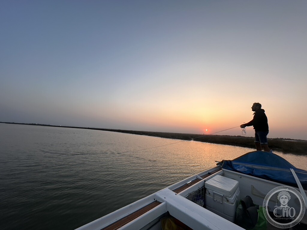
Before Venice was a city, the lagoon was a refuge: shallow water, mudflats and salt marsh that mainland refugees could navigate but invading fleets could not. From that defensive geography grew a self-governing republic lasting eleven centuries, and it remains one of the Mediterranean’s largest wetlands and a vital stopover for waterbirds.
At a glance
The Venetian Lagoon is a shallow, semi-enclosed body of water along the northern Adriatic coast, covering roughly 550 square kilometres. A chain of narrow barrier islands, the lidi, separates it from the open sea; three inlets—Lido, Malamocco and Chioggia—connect the two. Venice itself occupies only a cluster of islands within this wider system, alongside Murano, Burano, Torcello and the Giudecca. Around them lie tidal mudflats, salt marshes known as barene, and navigable channels, in a landscape inhabited since well before the Roman era. In 1987 UNESCO inscribed this larger territory, not the city alone, under the name “Venice and its Lagoon.”
Key facts
- Area: roughly 550 square kilometres, the largest wetland in the Mediterranean basin.
- Formation: lagoon environment from around the 8th century BC, evolving from an older river-delta marshland.
- Sea connections: three inlets—Lido, Malamocco and Chioggia—through the barrier islands.
- Refuge settlement: mainland populations moved onto the islands from the 5th century AD, fleeing the Huns in 452 and the Lombards in 568.
- Political span: first doge traditionally elected in 697; the Republic of Venice dissolved on 12 May 1797.
- Ecology and status: important wintering site for more than 200,000 waterbirds across about 60 species; World Heritage Site since 1987.
History
The lagoon began to take its present form around the 8th century BC, when an older river-delta marshland fed by the Po, Adige, Brenta and other Veneto rivers settled into a tidal, semi-enclosed system. For centuries it was used mainly for hunting and fishing. That changed as Roman order collapsed in the west. The Huns sacked Aquileia in 452, and the Lombards moved through the Veneto in 568; each shock pushed more people from Altino, Aquileia and Padua out onto the islands. What made the lagoon a refuge was not distance but difficulty. The water is shallow nearly everywhere, threaded by channels that shift with tide and silt, flanked by mudflats and salt marsh that are barely land and barely water. Navigation depended on memory and on wooden posts marking the deep channels; remove the posts and even a Venetian could run aground. An army or war fleet built for the open Adriatic lacked that local knowledge. For over a thousand years this geography kept hostile forces from taking Venice by force from sea or land.
Out of that safety grew a state. Byzantine authority faded through the seventh century, and by tradition the lagoon communities elected their first doge, Paolo Lucio Anafesto, in 697, the date the Republic later claimed as its founding. The result was not a monarchy but a republic: a doge elected for life by a closed aristocratic council, bound by oaths and by the promissione ducale, the constitutional curbs that grew stricter over the centuries. This state came to dominate Adriatic and eastern Mediterranean trade, built the Arsenal as Europe’s largest pre-modern industrial complex, and at its height held territory from Lombardy to Cyprus and Crete. The Republic lasted, by its own reckoning, eleven hundred years. It ended on 12 May 1797, when the Great Council voted itself out of existence in the face of Napoleon’s army and the last doge, Ludovico Manin, abdicated the same day. No comparable medieval or early modern Italian or European state matched that span of continuous self-government without foreign conquest.
What you see
From the water, the lagoon reads as a low, shifting landscape of barene—flat silty islets just above the tideline, colonised by sea lavender, glasswort and cordgrass. These marshes filter the water, cushion the tides, and support species found nowhere else, while bricole, wooden posts, mark the navigable channels through the shallows. A few traditional fishermen’s casoni, reed-roofed or brick huts built on the barene, still stand far from the main tourist routes, weathered and partly reclaimed by vegetation.
The more familiar landmarks appear as points in this wider geography: the campanile of Torcello across the water, the old fish market known as Pescaria Vecia on Burano, and San Giorgio Maggiore seen from Riva San Biasio. The inhabited islands—Murano, Burano, Torcello, the Giudecca—are best reached by vaporetto, while the barene and casoni are largely visible only from a boat well outside the historic centre.
Practical information
- Access: the lagoon surrounds Venice on every side; the Murano, Burano and Torcello vaporetto lines run from Fondamente Nove, and private boats offer further access.
- Barene and casoni: visible mainly from the water, well outside the historic centre.
- Flood protection: the MOSE mobile barrier system has operated at the three inlets since 2020 to address acqua alta flooding.
- Status: inscribed by UNESCO in 1987 as “Venice and its Lagoon.”
Getting there
The lagoon surrounds Venice on every side. The Murano, Burano and Torcello vaporetto lines run from Fondamente Nove, and private boats offer access to the less visited barene and casoni. Much of this landscape is visible only from the water, beyond the historic centre.
Nearby
- Murano — an island in the lagoon, reached on the vaporetto line from Fondamente Nove.
- Burano — lagoon island with the old fish market Pescaria Vecia on its own Fondamenta della Giudecca.
- Torcello — lagoon island whose campanile is visible across the water.
- San Giorgio Maggiore — seen across the water from Riva San Biasio.
Sources
- Wikipedia (Italian), Storia di Venezia and Laguna di Venezia
- Wikipedia (English), Republic of Venice
- Biodiversity Gateway and Deep Blue Venice
- Il Bo Live (Università di Padova)
- Sistema Venezia (Regione Veneto)
Find it on the map
See this place and what’s around it →Record researched and written by Carla Szathvary for Cultural Heritage Online, 2026.
📷 Become a Cultural Heritage Online photographer
Share your photos of places: they stay published under your name as the author. The more they're seen, the more you get noticed — and soon a contest will reward the most appreciated photos.
Log in or sign up free to add a photo