

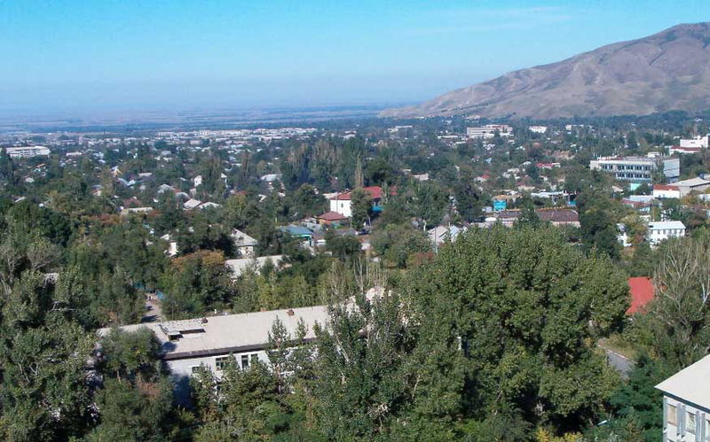
A regional administrative center in southeastern Kazakhstan, Talgar anchors the area between the country’s largest city and the alpine landscape beyond.
At a glance
Talgar serves as the administrative hub of Talgar District in Almaty Region. Located 25 kilometers east of Almaty, the town sits strategically between the metropolitan zone and the mountain towns of the region, including Esik.
Cultural significance
Talgar’s importance lies in its role as a connecting point between Almaty and the surrounding Almaty Region, serving local administrative and economic functions for its district.
Key facts
- Country: Kazakhstan
- Region: Almaty Region
- Status: Administrative center of Talgar District
- Distance from Almaty: 25 kilometers
- Coordinates: 43.3° N, 77.23° E
- Population (2009): 45,529
Practical information & getting there
Talgar is accessible from Almaty, located 25 kilometers to the west. The town can be reached by road through the Almaty Region’s network connecting to major centers.
Sources & resources
Find it on the map
See this place and what’s around it →📷 Become a Cultural Heritage Online photographer
Share your photos of places: they stay published under your name as the author. The more they're seen, the more you get noticed — and soon a contest will reward the most appreciated photos.
Log in or sign up free to add a photo