
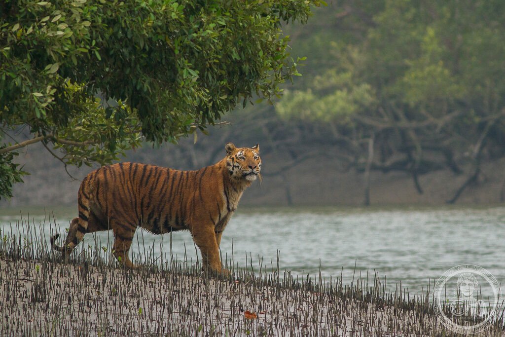
Where the Ganges and the Brahmaputra pour into the sea, a thousand islands of mud and forest form the Sundarbans: the largest stretch of mangrove in the world. In this labyrinth of brackish channels lives the Bengal tiger, famous here for swimming between the islands, queen of a unique and fragile ecosystem.
At a glance
The Sundarbans, in the delta where the Ganges, Brahmaputra and Meghna rivers meet the Bay of Bengal, form the largest mangrove forest in the world, shared between India and Bangladesh. A vast labyrinth of tidal channels, mudflats and salt-tolerant forest, it is famous as the home of the Royal Bengal tiger, here known for swimming between the islands, alongside crocodiles, dolphins and abundant birdlife. The Indian Sundarbans National Park was inscribed by UNESCO in 1987.
Key facts
- UNESCO: World Heritage since 1987 (Sundarbans National Park)
- Largest mangrove forest: the greatest tidal mangrove system on Earth
- Bengal tiger: a famous, water-loving tiger population
- River delta: the mouths of the Ganges and Brahmaputra
- Rich wildlife: estuarine crocodiles, river dolphins, water birds
- Shared site: continues across the border into Bangladesh
History
The name Sundarbans — “beautiful forest”, or the forest of the sundari mangrove — describes the immense wetland built by the silt of the great rivers as they reach the sea. Long the haunt of fishers, honey-gatherers and woodcutters who venture into it with fear of the tiger, it has its own folklore and forest deities.
As pressure on the delta grew, the core forest was protected as a tiger reserve and national park, and the Indian Sundarbans was inscribed by UNESCO in 1987 (the Bangladeshi side was listed separately in 1997). The mangroves shelter the coast from cyclones and support the tiger and countless other species, while facing threats from rising seas and human pressure.
What you see
The park is explored by boat through the maze of brown tidal creeks between walls of mangrove, watching the banks for tigers, crocodiles basking on the mud, spotted deer, wild boar and kingfishers, with watchtowers at a few clearings. Sightings of the elusive tiger are rare and prized.
The endless green of the mangroves under a wide delta sky, threaded with water, is the experience of the Sundarbans.
Practical information
- Park: visited by boat; permits and guides arranged through tour operators
- Best time: November–February
- Time needed: one to three days, often on a boat cruise
- Note: tiger sightings are uncommon; enjoy the wider ecosystem
Getting there
The Indian Sundarbans lie south of Kolkata, in West Bengal, reached by road and then boat from points such as Godkhali, about 100 km from the city. GPS: 21.95° N, 88.90° E.
Nearby
- Kolkata — the great city of West Bengal, to the north
- Bay of Bengal — the sea into which the delta drains
- Bangladesh Sundarbans — the larger forest across the border
Sources
- UNESCO World Heritage Centre — “Sundarbans National Park” (ref. 452)
- West Bengal Forest Department — official body
- Encyclopaedia Britannica — Sundarbans
Find it on the map
See this place and what’s around it →📷 Become a Cultural Heritage Online photographer
Share your photos of places: they stay published under your name as the author. The more they're seen, the more you get noticed — and soon a contest will reward the most appreciated photos.
Log in or sign up free to add a photo