
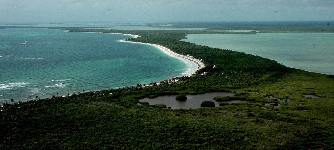
A vast protected landscape spanning 5,280 square kilometers of Caribbean coast and jungle in Quintana Roo, where Mayan ruins, coral reefs, and endangered wildlife coexist under UNESCO protection.
At a glance
Sian Kaʼan—meaning “gate of heaven” in Yuatec Mayan—encompasses both terrestrial and marine ecosystems across eastern Quintana Roo. The reserve stretches across seven coastal municipalities and protects approximately 320,000 hectares of interconnected natural areas, from the Banco Chinchorro reefs in the south to Isla Contoy in the north.
History
Established in 1986, the reserve became a UNESCO World Heritage Site the following year. The landscape bears traces of both ancient and recent human activity: 23 known Maya archaeological sites, including Muyil, testify to pre-Columbian settlement, while ruins of the Decauville railway (operated 1905–1932 between Vigía Chico and Santa Cruz) mark the industrial era.
Today, conservation efforts involve collaboration among scientists, technicians, fishermen, farmers, and Mayan communities, with more than 200 projects completed to date.
What you see
The reserve’s landscape is defined by contrast: dense tropical jungle gives way to mangrove systems, cenotes, lagoons, and a section of living coral reef in the Caribbean. Maya structures, including ceremonial centers and residential platforms, emerge from the vegetation at sites like Muyil. Industrial archaeology remains visible in scattered railway infrastructure.
Cultural significance
Sian Kaʼan represents a critical intersection of cultural and natural heritage. The reserve protects endangered and migratory species while safeguarding Maya archaeological remains and supporting indigenous communities transitioning to sustainable ecotourism. Educational initiatives—books, journals, and training programs—strengthen environmental awareness among local populations and international audiences.
Key facts
- Country: Mexico
- Location: Tulum Municipality, Quintana Roo
- Coordinates: 19.5° N, 87.75° W
- Area: 5,280 square kilometers (2,040 sq mi)
- Established: 1986
- UNESCO World Heritage Site: 1987
- Archaeological sites: 23 known Maya sites
Practical information & getting there
The reserve lies within reach of Tulum, a major hub on Mexico’s Caribbean coast accessible by road from Cancún. Access is managed through authorized tour operators and research institutions to protect the ecosystem. The Amigos de Sian Kaʼan organization coordinates visits, conservation work, and community partnerships.
Sources & resources
Find it on the map
See this place and what’s around it →📷 Become a Cultural Heritage Online photographer
Share your photos of places: they stay published under your name as the author. The more they're seen, the more you get noticed — and soon a contest will reward the most appreciated photos.
Log in or sign up free to add a photo