

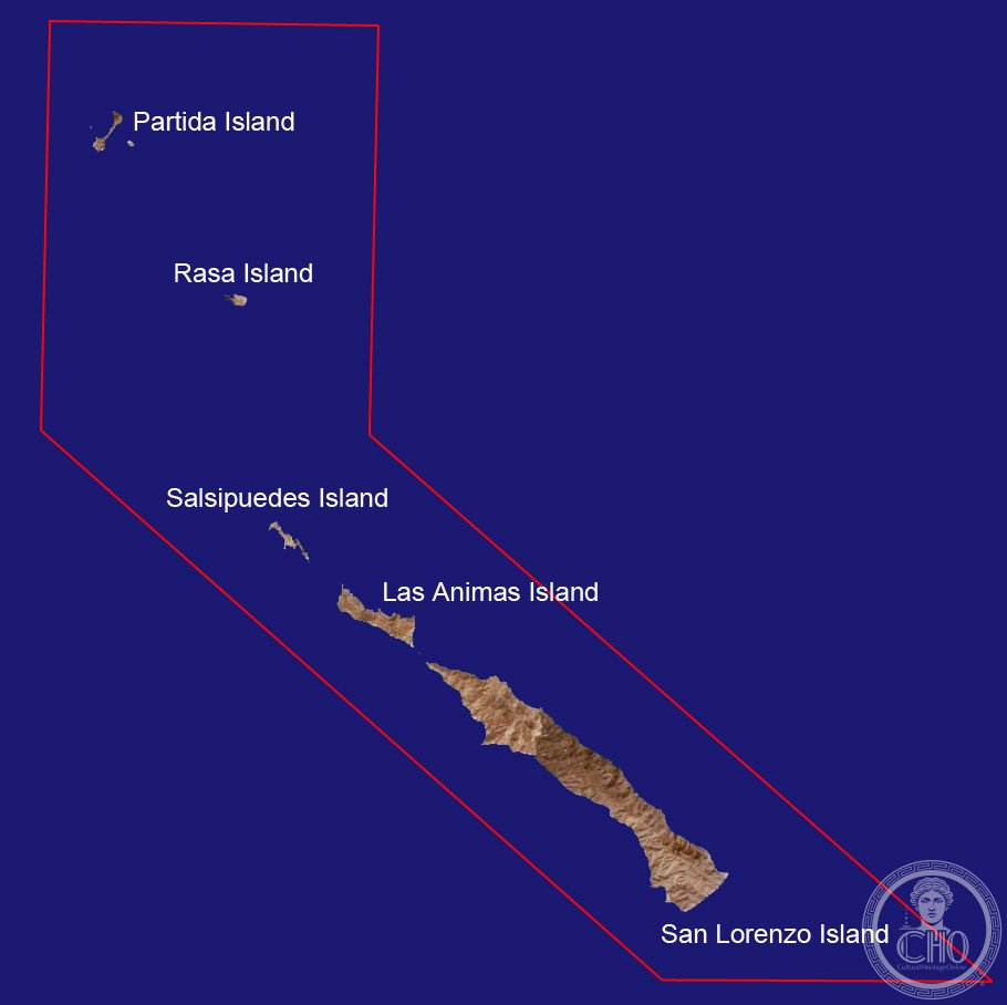
A protected archipelago in Mexico’s Gulf of California, San Lorenzo is a biodiversity hotspot sheltering endangered marine and terrestrial species within a pristine desert-sea ecosystem.
At a glance
San Lorenzo Marine Archipelago National Park encompasses San Lorenzo Island and surrounding waters in the Gulf of California, off eastern Baja California. The site ranks among the Gulf’s most ecologically vital areas, designated for federal protection under Mexican environmental law. The archipelago lies within Mexicali municipality, separated from the mainland by the Salsipuedes Channel.
History
The archipelago was formally recognized as a national park and protected under Mexico’s Norma Oficial Mexicana NOM-059-SEMARNAT-2001 due to its critical role as habitat for endangered species. This federal designation acknowledges the region’s irreplaceable ecological value within the Gulf of California system.
What you see
San Lorenzo is characterized by desert island terrain meeting open sea. The archipelago displays the stark beauty of Mexico’s northwest coast—rocky outcrops, sparse vegetation adapted to arid conditions, and rich tidal zones. Marine habitats include shallow reefs and channels supporting diverse fish, bird, and mammal populations.
Cultural significance
The archipelago holds profound scientific and conservation importance. As a refuge for endangered species and a representative ecosystem of the Gulf of California—itself a UNESCO World Heritage Site—San Lorenzo exemplifies the region’s role in global biodiversity. The site represents Mexico’s commitment to preserving one of the world’s most biodiverse marine environments.
Key facts
- Country: Mexico
- Location: Gulf of California, off Baja California
- Municipality: Mexicali, Baja California
- Coordinates: 28.7725, −112.9975
- Protected under: Norma Oficial Mexicana NOM-059-SEMARNAT-2001
Practical information & getting there
Access to the archipelago is restricted to protect its ecology. Visitors interested in viewing the site should consult Mexico’s National Commission of Natural Protected Areas (CONANP). The nearest city is Mexicali, located on the mainland east of the Salsipuedes Channel.
Sources & resources
Find it on the map
See this place and what’s around it →📷 Become a Cultural Heritage Online photographer
Share your photos of places: they stay published under your name as the author. The more they're seen, the more you get noticed — and soon a contest will reward the most appreciated photos.
Log in or sign up free to add a photo