

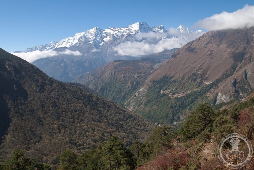
Sagarmatha is the Nepali name of Everest, the “forehead of the sky”: 8,849 metres, the highest point on Earth. The park around it holds a world of glaciers, legendary summits and deep valleys, inhabited by the Sherpa, the Himalayan people whose Buddhist culture is inseparable from these mountains.
At a glance
Sagarmatha National Park, in the Solukhumbu region of north-eastern Nepal, surrounds the Nepali side of Mount Everest — Sagarmatha, at 8,849 m the highest point on Earth — along with other great Himalayan peaks, glaciers and deep valleys. It is the homeland of the Sherpa people, whose Buddhist culture, monasteries and mountaineering tradition are bound up with these mountains. A landscape of extreme altitude and dramatic beauty, it was inscribed by UNESCO in 1979.
Key facts
- UNESCO: World Heritage since 1979 (Sagarmatha National Park)
- Mount Everest: Sagarmatha, the highest mountain on Earth (8,849 m)
- Great peaks: Lhotse, Cho Oyu, Ama Dablam and others
- Glaciers: the Khumbu Glacier and icefall among them
- Sherpa homeland: the Buddhist people of the high Khumbu
- Wildlife: snow leopard, Himalayan tahr and musk deer
History
The Khumbu valleys beneath Everest have been home to the Sherpa people for centuries; originally from Tibet, they built villages, terraced fields and Buddhist monasteries such as Tengboche high among the peaks, and revere the mountains as the abode of deities. The world’s attention turned to the region with the quest to climb Everest, first achieved in 1953 by Edmund Hillary and the Sherpa Tenzing Norgay.
Since then the Khumbu has become the great gateway for Everest expeditions and trekkers, transforming the local economy while bringing pressures of crowds and waste. The national park, created in 1976 and inscribed by UNESCO in 1979, protects the mountains, glaciers and wildlife, and the living Sherpa culture within them.
What you see
Trekking routes from Lukla lead up the Khumbu through Sherpa villages such as Namche Bazaar, past the hilltop monastery of Tengboche with its backdrop of Ama Dablam, to viewpoints of Everest, Lhotse and Nuptse and on toward Everest Base Camp and the Khumbu Glacier. Prayer flags, mani stones and yak trains line the trails.
The vision of the world’s highest peaks above the Sherpa valleys and monasteries is the wonder of Sagarmatha.
Practical information
- Park: explored on multi-day treks, usually from Lukla
- Best time: spring and autumn for clear mountain weather
- Time needed: 10–14 days for the classic treks
- Note: very high altitude; acclimatise carefully
Getting there
Sagarmatha National Park is in the Solukhumbu district of north-eastern Nepal. Most visitors fly to the mountain airstrip of Lukla and trek in from there. GPS: 27.90° N, 86.70° E.
Nearby
- Namche Bazaar — the main Sherpa town and trekking hub
- Tengboche Monastery — the famous monastery beneath Ama Dablam
- Everest Base Camp — the goal of the classic trek
Sources
- UNESCO World Heritage Centre — “Sagarmatha National Park” (ref. 120)
- Department of National Parks and Wildlife Conservation (Nepal) — official body
- Encyclopaedia Britannica — Mount Everest
Find it on the map
See this place and what’s around it →📷 Become a Cultural Heritage Online photographer
Share your photos of places: they stay published under your name as the author. The more they're seen, the more you get noticed — and soon a contest will reward the most appreciated photos.
Log in or sign up free to add a photo