
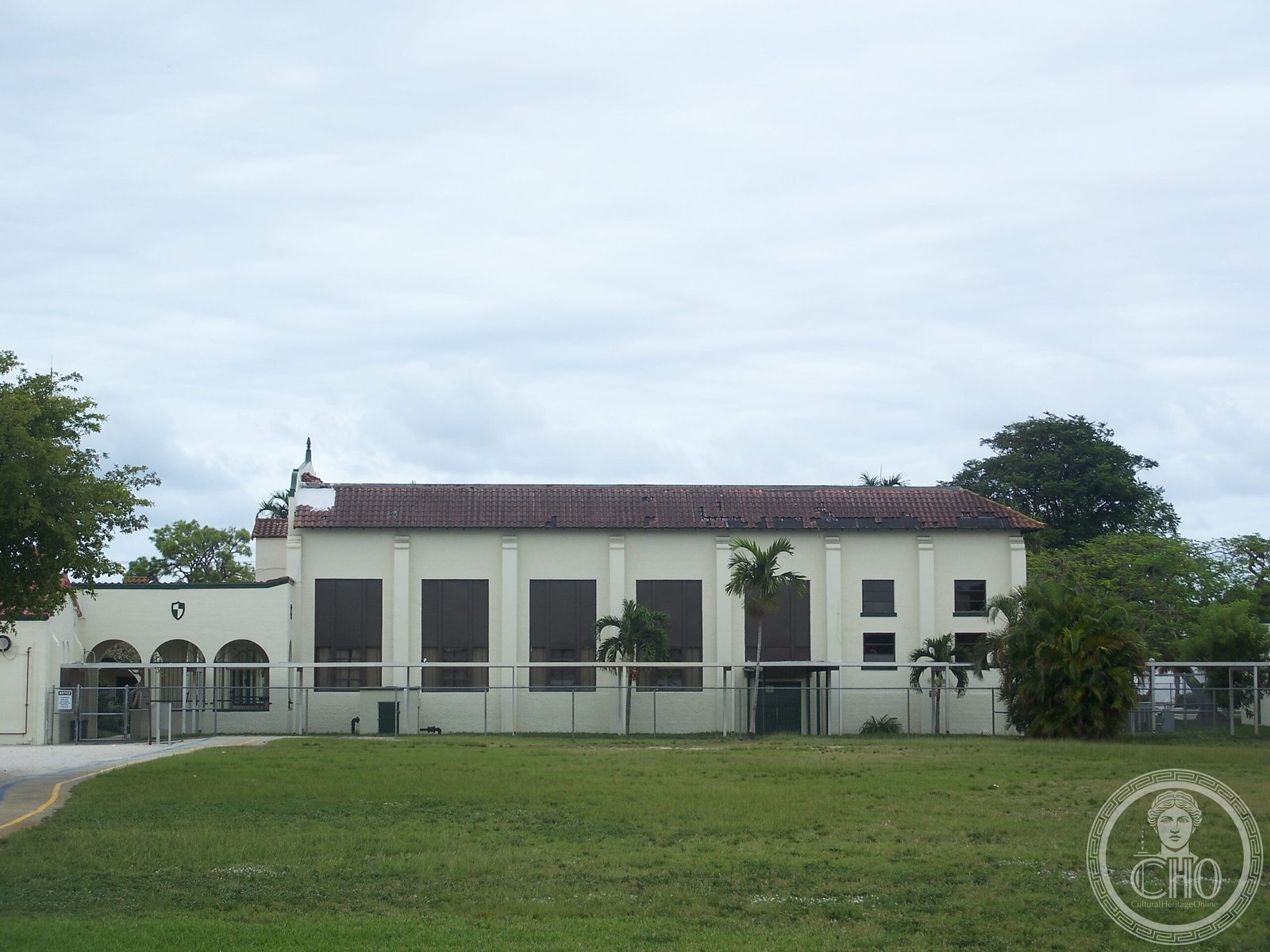
A historic public school in Broward County, recognized on the National Register of Historic Places for its significance to the community.
At a glance
Oakland Park Elementary School serves grades Pre-K through fifth grade in the Broward County Public Schools system. The school sits at 936 Northeast 33rd Street and has long been an educational anchor for the Oakland Park neighborhood, with enrollment that reflects the linguistic diversity of South Florida.
History
The school was added to the U.S. National Register of Historic Places on June 9, 1988, marking its recognition as a building of historical importance to the region.
What you see
Little architectural detail is documented in available sources. The building remains in active use as a functioning elementary school within the Broward County public education system.
Cultural significance
Oakland Park Elementary serves a multilingual student population, with many students speaking Spanish or Creole as their first language. The school’s English for Speakers of Other Languages program reflects the cultural composition of South Florida and its role in the broader history of American public education.
Key facts
- Located at 936 Northeast 33rd Street, Oakland Park, Florida
- Part of Broward County Public Schools
- Added to the National Register of Historic Places: June 9, 1988
- Serves grades Pre-K through 5th grade
- School mascot: Eagle
- Coordinates: 26.1681, −80.1351
Practical information & getting there
The school is located in Oakland Park, a municipality in Broward County. As a functioning public school, visiting is subject to standard school access policies. For inquiries about tours or historical information, contact Broward County Public Schools.
Sources & resources
Find it on the map
See this place and what’s around it →📷 Become a Cultural Heritage Online photographer
Share your photos of places: they stay published under your name as the author. The more they're seen, the more you get noticed — and soon a contest will reward the most appreciated photos.
Log in or sign up free to add a photoIs this page about you?
This page is read by travellers and heritage enthusiasts who find it on Google. Tell us how you are connected to this place and we will take it from there.