
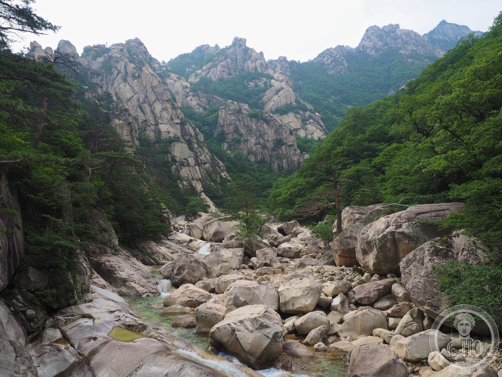
A 1,638-meter peak straddling the Korean border, Mount Kumgang has captivated artists and pilgrims for centuries with its dramatic granite formations, seasonal waterfalls, and dense forests.
At a glance
Mount Kumgang spans 40 km east to west and 60 km north to south across the Taebaek Mountains, covering 530 km². The mountain is located approximately 50 km from Sokcho, South Korea. Its name derives from the Sanskrit word vajra (lightning and diamond) and the Buddhist concept of an unwavering mind—achala—toward ultimate truth.
History
Mount Kumgang has been celebrated in Korean culture for centuries. During the Joseon Dynasty, the mountain held such prestige that when King Jeongjo granted meritorious official Kim Man-deok a wish, her desire was simply to travel and behold Mount Kumgang’s beauty.
From 1998 onward, three public touring courses opened jointly managed by South Korea’s Hyundai Asan and North Korea. Tourism was valued not merely as commerce but as a pathway for peaceful inter-Korean communication. Tours were indefinitely suspended following the Mount Kumgang tourist shooting incident on July 11, 2008.
What you see
The mountain comprises numerous peaks, unique rock formations, waterfalls, and geological features shaped by millennia of weathering. Coniferous and broadleaf forests blanket the slopes. Divisions into Inner Kumgang, Outer Kumgang, Sea Kumgang, and sometimes New Kumgang reflect distinct geographical character within the broader region.
Cultural significance
Mount Kumgang holds profound spiritual and artistic importance in Korean and East Asian culture. Generations of artists have drawn inspiration from its landscape, making it a frequent subject of painting, poetry, and literature. The mountain’s four seasonal names—Kumgang (spring), Bongraesan (summer), Pungaksan (autumn), and Gaegolsan (winter)—each celebrate distinct aesthetic qualities, embodying the principle that the mountain’s character transforms with the seasons.
Key facts
- Height: 1,638 meters
- Location: Straddling North Korea (Kumgang, Kosong, and Tongchon counties) and South Korea (Gangwon State)
- Part of the Taebaek Mountains
- Area: 530 km²
- Coordinates: 38.6567°N, 128.105°E
- UNESCO World Heritage Site
Practical information & getting there
Mount Kumgang is located approximately 50 km from Sokcho, South Korea. Historically, tourists made reservations through Hyundai Asan or its agencies and completed procedures at the Hwajinpo Asan Rest Area. Tours have been indefinitely suspended since July 2008. Current access and visiting conditions require verification with official sources.
Sources & resources
Find it on the map
See this place and what’s around it →📷 Become a Cultural Heritage Online photographer
Share your photos of places: they stay published under your name as the author. The more they're seen, the more you get noticed — and soon a contest will reward the most appreciated photos.
Log in or sign up free to add a photo