
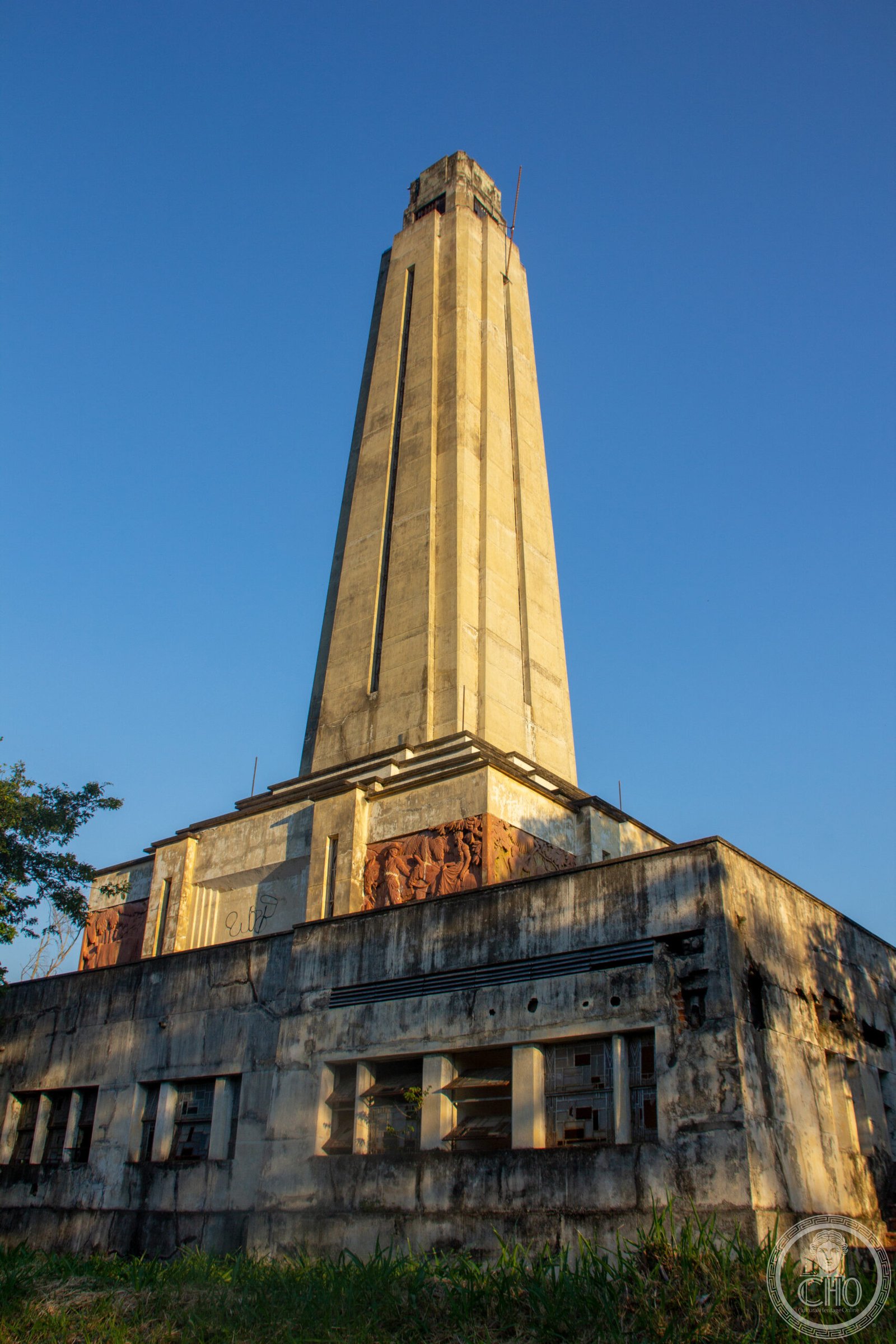
A modernist monument and former rest area marking a dramatic stretch of Brazil’s most important highway, where engineering and landscape meet in the Serra das Araras.
At a glance
This roadside monument stands at Kilometer 226 of the Rodovia Presidente Dutra, the BR-116 corridor connecting Rio de Janeiro and São Paulo. It serves as both a functional way station and a sculptural landmark in the mountainous Serra das Araras region.
History
The monument was built as part of Brazil’s mid-twentieth-century infrastructure expansion, when the Presidente Dutra highway represented a major achievement in connecting the country’s industrial heartland. The structure reflects the era’s confidence in modernist design applied to public works.
What you see
The monument combines practical roadside architecture with sculptural ambition. Its design integrates with the surrounding landscape of the Serra das Araras, a mountain range that poses significant engineering challenges for highway construction.
Cultural significance
The monument represents the mid-century Brazilian faith in modernism as the visual language of national progress. It marks an important pass along a highway that fundamentally reshaped Brazil’s economic geography and remains iconic in Brazilian infrastructure history.
Key facts
- Country: Brazil
- City: Piraí, Rio de Janeiro state
- Location: Kilometer 226, Rodovia Presidente Dutra (BR-116)
- Coordinates: -22.672964, -43.832545
- Type: Monument and former rest area
Practical information & getting there
The monument is accessible from the Rodovia Presidente Dutra, the main highway connecting Rio de Janeiro and São Paulo. It lies in Piraí, in the Serra das Araras region of Rio de Janeiro state. For current access and visiting conditions, check locally before planning your journey.
Sources & resources
Find it on the map
See this place and what’s around it →📷 Become a Cultural Heritage Online photographer
Share your photos of places: they stay published under your name as the author. The more they're seen, the more you get noticed — and soon a contest will reward the most appreciated photos.
Log in or sign up free to add a photoIs this page about you?
This page is read by travellers and heritage enthusiasts who find it on Google. Tell us how you are connected to this place and we will take it from there.