
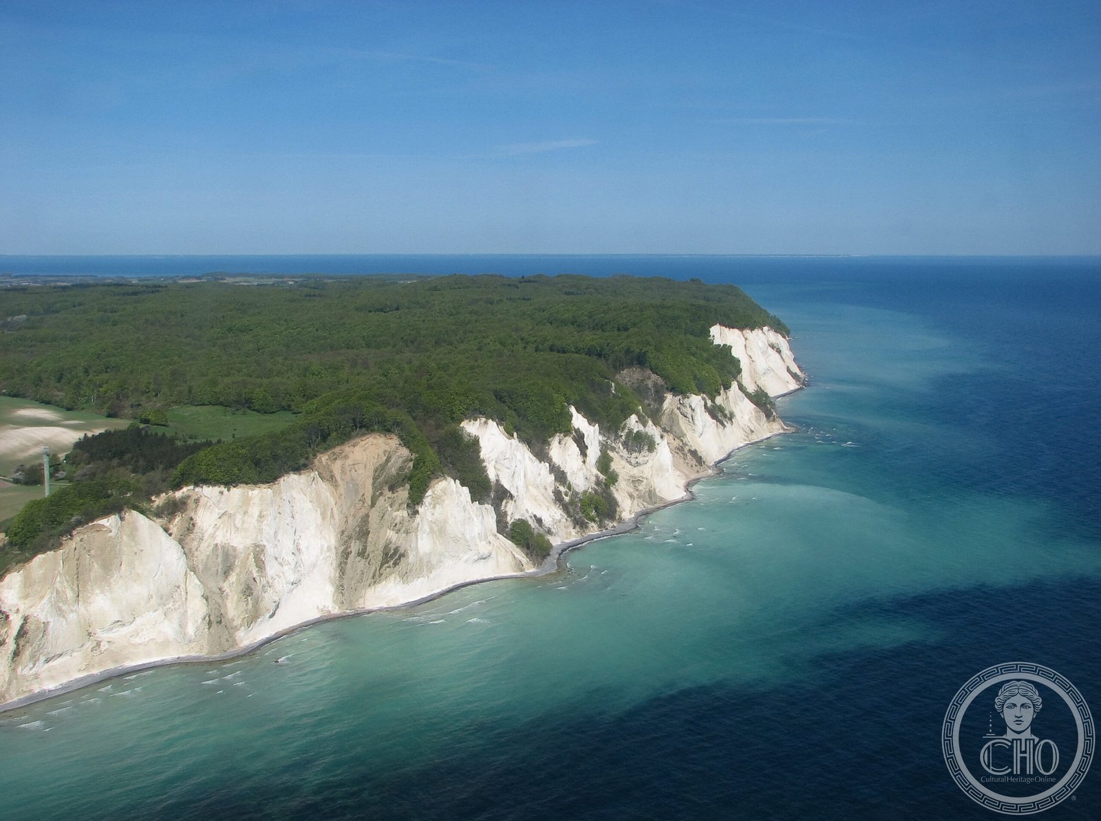
A 6-kilometre stretch of dramatic limestone and chalk cliffs rising 128 metres above the Baltic Sea, Møns Klint reveals geological history in its white-faced ramparts and stands as one of Denmark’s most striking natural monuments.
At a glance
Møns Klint comprises sheer white cliffs along the eastern coast of the Danish island of Møn, with the highest point, Dronningestolen, reaching 128 metres above sea level. The surrounding landscape of woodlands, pastures and steep hills creates a distinctive natural reserve that attracts approximately 250,000 visitors annually. In July 2025, the site gained UNESCO World Heritage status, recognising its geological and ecological significance.
History
The cliffs themselves were formed during the Quaternary period, shaped by glacial and post-glacial processes over millennia. Modern recognition of the site’s importance came with the opening of the GeoCenter Møns Klint on 29 May 2007, inaugurated by Queen Margrethe II. The centre, designed by PLH Architects following an international design competition, serves as an interpretive gateway to the geological wonders of the cliffs.
What you see
The cliffs present a striking vertical face of limestone and chalk, some sections falling a sheer 120 metres to the sea. Adjacent to the coastal ramparts, the terrain rises into steep hills, including Aborrebjerg at 142 metres—among Denmark’s highest points. Well-maintained paths accommodate walkers, riders and cyclists, with designated routes along the cliff tops descending via steps to the shore at several locations. The GeoCenter building, set near the cliff edge, offers contemporary exhibition space designed to complement rather than dominate the landscape.
Cultural significance
Møns Klint represents a remarkable open-air geology museum, its striated white walls documenting the region’s ice-age heritage. The site embodies the interplay between geological processes and human stewardship, combining scientific interest with outdoor recreation and aesthetic experience. UNESCO’s 2025 recognition affirms its status as a landscape of international importance.
Key facts
- Country: Denmark
- Location: Eastern coast of Møn island, Baltic Sea
- Coordinates: 54.96°N, 12.55°E
- Highest cliff: Dronningestolen, 128 m above sea level
- Cliffs extend: 6 kilometres
- Annual visitors: approximately 250,000
- UNESCO World Heritage Site: yes (inscribed July 2025)
- GeoCenter opened: 29 May 2007, designed by PLH Architects
Practical information & getting there
The cliffs and adjoining park operate as a protected nature reserve. Clearly marked paths accommodate walkers, riders and cyclists of varying ability. Steps descend to the shore at multiple points. The GeoCenter Møns Klint provides interpretation of the site’s geological significance. For current visiting hours, facilities and travel information, consult the official GeoCenter website and local Danish tourism resources.
Sources & resources
Find it on the map
See this place and what’s around it →📷 Become a Cultural Heritage Online photographer
Share your photos of places: they stay published under your name as the author. The more they're seen, the more you get noticed — and soon a contest will reward the most appreciated photos.
Log in or sign up free to add a photo