
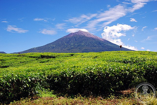
Sumatra’s largest protected wilderness spans four provinces and encompasses over 13,700 square kilometers of biodiverse forest, mountain ranges, and volcanic landscapes.
At a glance
Kerinci Seblat National Park represents one of Southeast Asia’s most significant conservation areas. Its vast expanse crosses West Sumatra, Jambi, Bengkulu, and South Sumatra, forming a critical ecological corridor through the island’s interior.
History
The park was established to protect Sumatra’s remaining primary forests and their exceptional biodiversity. Further information about its founding and development is limited in available sources.
What you see
The landscape encompasses tropical rainforests, volcanic peaks, and mountain valleys. The terrain varies significantly across its four provincial sectors, creating diverse ecosystems within a single protected region.
Cultural significance
The park protects irreplaceable forest habitats and serves as a sanctuary for Sumatra’s endangered wildlife. Its scale and geographic reach make it essential to regional ecological stability and species conservation efforts across the island.
Key facts
- Country: Indonesia
- Total area: 13,791 km²
- Spans four provinces: West Sumatra, Jambi, Bengkulu, South Sumatra
- Coordinates: -2.42, 101.48
Practical information & getting there
Access points vary by province. The park’s scale means visitor facilities and trails differ across sectors. Contact local provincial authorities for current information on access, guided tours, and accommodation options.
Sources & resources
Find it on the map
See this place and what’s around it →📷 Become a Cultural Heritage Online photographer
Share your photos of places: they stay published under your name as the author. The more they're seen, the more you get noticed — and soon a contest will reward the most appreciated photos.
Log in or sign up free to add a photo