
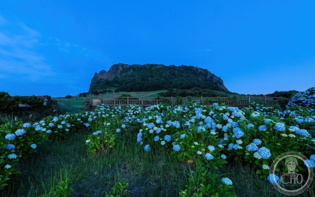
Off the coast of South Korea, the island of Jeju is entirely the work of volcanoes: dominated by the dome of Hallasan, the highest mountain in the country, it is dotted with cones, craters and one of the finest systems of lava tubes in the world. A varied and spectacular volcanic landscape, between sea, forest and flows of stone.
At a glance
Jeju, a large island off the southern coast of South Korea, is entirely volcanic in origin. The UNESCO site brings together three of its finest features: Hallasan, a shield volcano that is the highest mountain in South Korea; Seongsan Ilchulbong, a dramatic tuff cone rising from the sea; and the Geomunoreum lava-tube system, among the finest networks of volcanic caves in the world, hung with lava stalactites and multicoloured formations. This volcanic landscape was inscribed by UNESCO in 2007.
Key facts
- UNESCO: World Heritage since 2007 (Jeju Volcanic Island and Lava Tubes)
- Hallasan: a shield volcano, South Korea’s highest mountain (1,947 m)
- Seongsan Ilchulbong: a tuff cone rising sheer from the sea
- Lava tubes: the Geomunoreum cave system, among the world’s finest
- Volcanic landscape: cones, craters and lava formations
- Sunrise Peak: Seongsan is famed for its sunrises
History
Jeju was built up by volcanic eruptions over hundreds of thousands of years, leaving the broad shield of Hallasan at its centre, hundreds of smaller cones (oreum) across the island, and, where rising magma met the sea, explosive tuff cones such as Seongsan Ilchulbong, its crater open like a great bowl above the water. Flowing lava also formed long tubes underground, the Geomunoreum system, with caves of striking size and beauty.
Long inhabited and with its own distinctive culture — including the famous female free-divers, the haenyeo — Jeju is both a living island and a showcase of volcanic processes. Its three outstanding volcanic features were inscribed together by UNESCO in 2007.
What you see
Trails climb Hallasan to its summit crater lake, and steps lead up Seongsan Ilchulbong for its famous sunrise over the sea-girt crater. Parts of the lava-tube system, such as Manjanggul, are open to visitors, revealing vast tunnels, lava columns and formations. Across the island, cones, waterfalls and the volcanic coast complete the scene.
The variety of volcanic wonders — mountain, crater, cave and coast — on one island is the marvel of Jeju.
Practical information
- Island: reached by frequent flights and ferries from the mainland
- Best time: spring and autumn; the island is mild year-round
- Time needed: two or more days
- Note: Seongsan is busy at sunrise; book Hallasan trails in advance
Getting there
Jeju Island lies off the southern coast of South Korea, reached by very frequent flights and ferries from Seoul and Busan. The sites are spread across the island and reached by road. GPS: 33.36° N, 126.53° E.
Nearby
- Hallasan — the central shield volcano and national park
- Manjanggul — the visitable lava tube
- Jeju coast — the volcanic shores and waterfalls
Sources
- UNESCO World Heritage Centre — “Jeju Volcanic Island and Lava Tubes” (ref. 1264)
- Korea Cultural Heritage Administration — official body
- Encyclopaedia Britannica — Jeju Island
Find it on the map
See this place and what’s around it →📷 Become a Cultural Heritage Online photographer
Share your photos of places: they stay published under your name as the author. The more they're seen, the more you get noticed — and soon a contest will reward the most appreciated photos.
Log in or sign up free to add a photo