

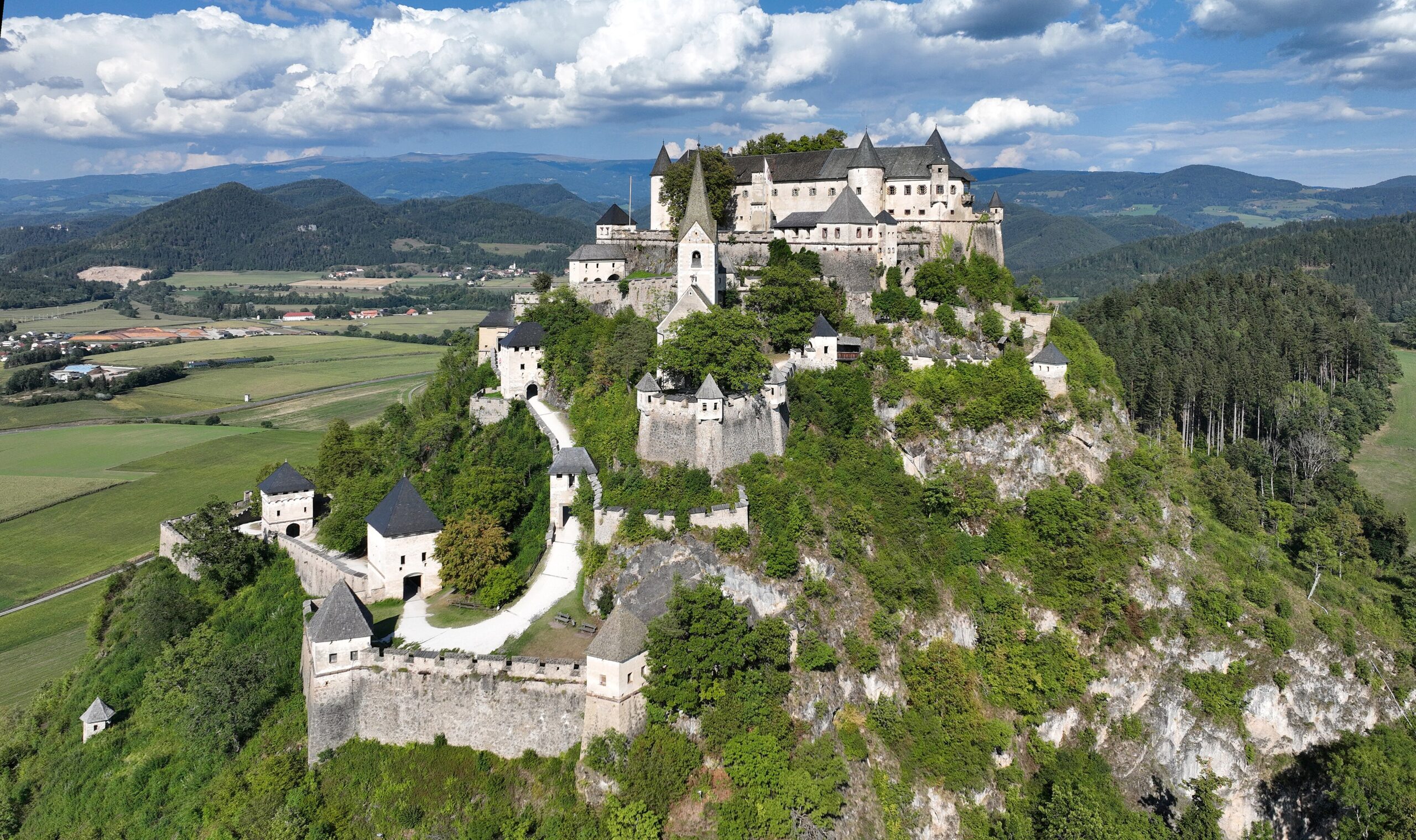
Perched atop a 172-metre dolomite rock, this formidable medieval fortress ranks among Austria’s most celebrated castles, commanding the Carinthian landscape near Sankt Veit an der Glan.
At a glance
Hochosterwitz Castle crowns a dramatic natural pinnacle in Carinthia’s eastern region. The rock fortress has become one of Austria’s defining landmarks and a magnet for visitors seeking authentic medieval architecture and sweeping alpine views.
History
The castle rises from a dolomite formation that has shaped settlement patterns in this corner of Carinthia for centuries. Its strategic position overlooking the surrounding valleys made it a fortress of considerable regional importance.
What you see
The castle’s most striking feature is its spectacular setting: a 172-metre-high rock that appears to thrust the structure skyward. Medieval stone walls and fortifications cling to the dolomite outcrop, creating one of Austria’s most visually arresting silhouettes against the Carinthian sky.
Cultural significance
Hochosterwitz represents both medieval military engineering and the enduring relationship between human ambition and dramatic landscape. The castle symbolizes Carinthia’s rich architectural heritage and continues to captivate those drawn to the intersection of history and natural geography.
Key facts
- Country: Austria
- Location: St. Georgen am Längsee, Carinthia
- Rock height: 172 metres (564 feet)
- Coordinates: 46.755°N, 14.454°E
- Geology: Dolomite formation
Practical information & getting there
The castle is situated east of Sankt Veit an der Glan in Carinthia. Its prominence on the landscape makes it visible from considerable distances. As a major tourist attraction, visitor facilities and access information are available through local tourism offices and the castle’s official channels.
Sources & resources
Find it on the map
See this place and what’s around it →📷 Become a Cultural Heritage Online photographer
Share your photos of places: they stay published under your name as the author. The more they're seen, the more you get noticed — and soon a contest will reward the most appreciated photos.
Log in or sign up free to add a photoIs this page about you?
This page is read by travellers and heritage enthusiasts who find it on Google. Tell us how you are connected to this place and we will take it from there.