
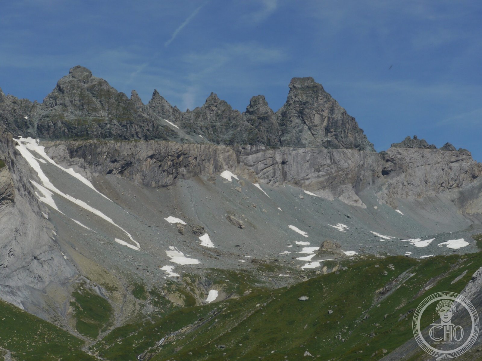
A UNESCO-recognized geological landmark revealing 100 kilometers of Alpine thrust movement, where ancient rock layers were thrust northward over younger stone, creating dramatic cliff exposures across three Swiss cantons.
At a glance
The Glarus thrust is a major thrust fault spanning the Alps of eastern Switzerland, extending across the cantons of Glarus, St. Gallen, and Graubünden. Its horizontal orientation and the dramatic relief of the region create some of the most visible geological formations in the Alpine range, making it a significant site for understanding mountain-building processes.
History
During the Alpine orogeny, the Helvetic nappes—ancient rock sequences—were thrust more than 100 kilometers northward over the external Aarmassif and Infrahelvetic complex. This massive crustal displacement inverted the natural order of rock layers, placing older Permo-Triassic formations atop younger Jurassic, Cretaceous, and Paleogene rocks—a reversal that puzzled geologists until thrust-fault mechanics were understood.
What you see
The thrust forms a visible contact between two distinct rock sequences. Below lie younger limestones, flysch, and molasse of Jurassic to Paleogene age. Above rest the older Permo-Triassic Verrucano group—rocks normally found at greater depth. The horizontal nature of this contact, combined with steep mountain slopes, produces exceptional cliff exposures across a large area.
Famous outcrops appear at Lochsite near the town of Glarus and along the Tschingelhörner cliffs between Elm and Flims. The Martinsloch, a natural hole in the Tschingelhörner cliff face, adds a distinctive feature to this geological landmark.
Cultural significance
The Glarus thrust is one of the world’s most important natural laboratories for studying Alpine geology and tectonics. Its recognition as a UNESCO World Heritage site reflects its global significance for Earth science education and research. The site demonstrates how vast horizontal displacements shaped European mountain topography.
Key facts
- Country: Switzerland
- Cantons: Glarus, St. Gallen, Graubünden
- Coordinates: 46.92°N, 9.25°E
- UNESCO World Heritage: Yes
- Thrust displacement: More than 100 kilometers
- Rock age contrast: Permo-Triassic (older, upper) over Jurassic-Paleogene (younger, lower)
Practical information & getting there
The Glarus thrust is best experienced through hiking and mountaineering in the region. The Lochsite area near Glarus town and the Tschingelhörner cliff between Elm and Flims offer accessible viewpoints. Eastern Switzerland is well-served by rail and road; consult local tourism offices in Glarus canton for current access conditions and guided geological tours.
Sources & resources
Find it on the map
See this place and what’s around it →📷 Become a Cultural Heritage Online photographer
Share your photos of places: they stay published under your name as the author. The more they're seen, the more you get noticed — and soon a contest will reward the most appreciated photos.
Log in or sign up free to add a photo