
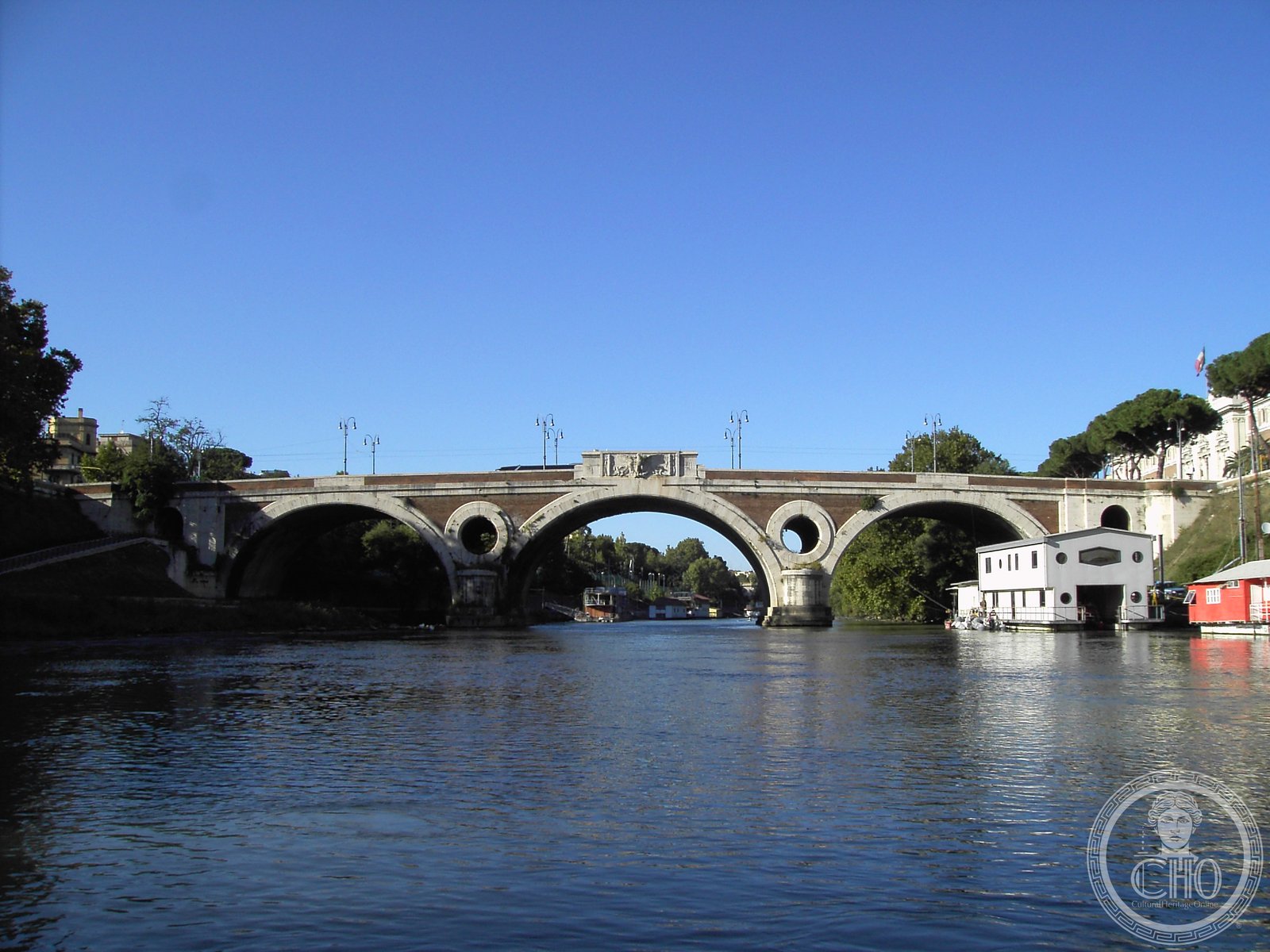
A modernist bridge spanning the Tiber, designed by Augusto Antonelli and inaugurated in 1929 during the Fascist era, the structure retains its original early-twentieth-century engineering.
At a glance
The Giacomo Matteotti Bridge crosses the Tiber River in Rome. Originally designed under the name Ponte delle Milizie, it represents a significant engineering achievement of the interwar period. The bridge connects central districts and remains an important transport artery in the city.
History
Augusto Antonelli designed the bridge in 1924. Construction began that same year and proceeded for five years. On 21 April 1929, the bridge was inaugurated under the name Littorio, reflecting the terminology of Fascist Italy. The structure has since been renamed in honor of Giacomo Matteotti, the socialist politician and anti-Fascist activist.
What you see
The bridge exemplifies early-twentieth-century modernist design principles applied to civil engineering. Its structural form reflects the technological innovations and construction methods of the 1920s. The work of Antonelli demonstrates the period’s confidence in contemporary materials and forms.
Cultural significance
The bridge documents Rome’s urban expansion and modernization during the interwar decades. Its renaming represents a shift in how the city commemorates its past, moving from Fascist-era nomenclature toward recognition of democratic and anti-Fascist figures. The structure remains emblematic of 1920s Italian engineering.
Key facts
- Address: Ponte Matteotti, 00192 Roma
- Coordinates: 41.9143748, 12.4706423
- Designed by: Augusto Antonelli
- Construction: 1924–1929
- Inauguration: 21 April 1929
Practical information
The bridge is freely accessible as a public crossing. Hours of operation and access restrictions are not listed; consult local Rome tourism resources for current conditions.
Getting there
The Giacomo Matteotti Bridge is centrally located in Roma. You can reach it via public transport or on foot from surrounding neighborhoods. Check journey-planning apps for specific transit routes to the bridge.
See the place
Sources & resources
Find it on the map
See this place and what’s around it →📷 Become a Cultural Heritage Online photographer
Share your photos of places: they stay published under your name as the author. The more they're seen, the more you get noticed — and soon a contest will reward the most appreciated photos.
Log in or sign up free to add a photoIs this page about you?
This page is read by travellers and heritage enthusiasts who find it on Google. Tell us how you are connected to this place and we will take it from there.