

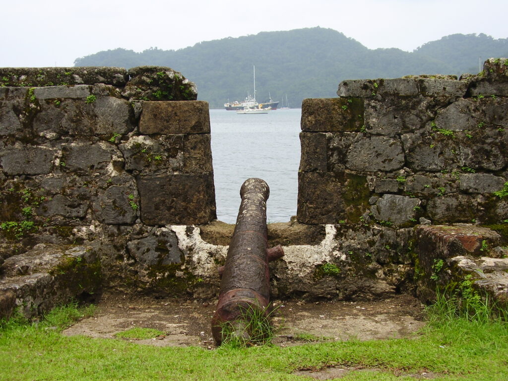
Magnificent Spanish military fortifications built to defend the Caribbean trade routes of the colonial empire.
At a glance
These paired forts represent some of the finest surviving examples of 17th- and 18th-century military architecture in the Americas. Constructed on Panama’s Caribbean coast, they guarded one of the most strategically vital shipping passages in the Spanish colonial world.
History
The Spanish Crown built these fortifications during the 17th and 18th centuries to protect transatlantic trade flowing through the Caribbean. Portobelo and San Lorenzo formed part of an integrated defence system designed to safeguard merchant vessels and colonial wealth against pirates and rival European powers.
The sites’ strategic importance grew as Spain’s Caribbean commerce expanded, making them essential nodes in the empire’s global trade network.
What you see
The fortifications showcase the military engineering sophistication of the Spanish Empire. Built with stone and designed to withstand naval assault, the structures combine European fortress principles with adaptations suited to tropical Caribbean conditions. Bastions, walls, and gun emplacements remain visible across both sites.
Cultural significance
UNESCO recognised these ruins as outstanding testimony to 17th- and 18th-century colonial military power and ambition. They illuminate the scale of Spain’s investment in protecting transatlantic commerce and reveal the architectural expertise deployed to defend imperial interests across the Atlantic World.
Key facts
- Country: Panama
- Region: Colón Province, Caribbean coast
- Period: 17th–18th centuries
- Coordinates: 9.5539, -79.6558
- UNESCO World Heritage Site: inscribed 1980 (Criteria i, iv)
Practical information & getting there
The fortifications are located on the coast of Colón Province. Specific access details and current visiting conditions should be confirmed locally, as some areas may have restricted access or require permits. Check with regional tourism authorities in Colón for up-to-date information and guided tour availability.
The first plans for these defences were drawn up in 1586 by the military engineer Bautista Antonelli, and UNESCO dates the beginning of work on the Portobelo forts to the 1590s.
Sources & resources
Find it on the map
See this place and what’s around it →
Advertisement. Pictured, from the Cleveland Museum of Art (CC0) and not for sale: a parure of about 1850, a Lalique brooch, a Castellani bangle. How we handle this
📷 Become a Cultural Heritage Online photographer
Share your photos of places: they stay published under your name as the author. The more they're seen, the more you get noticed — and soon a contest will reward the most appreciated photos.
Log in or sign up free to add a photoIs this page about you?
This page is read by travellers and heritage enthusiasts who find it on Google. Tell us how you are connected to this place and we will take it from there.
This entry stays online and free either way — and a free account lets you add to it yourself.