
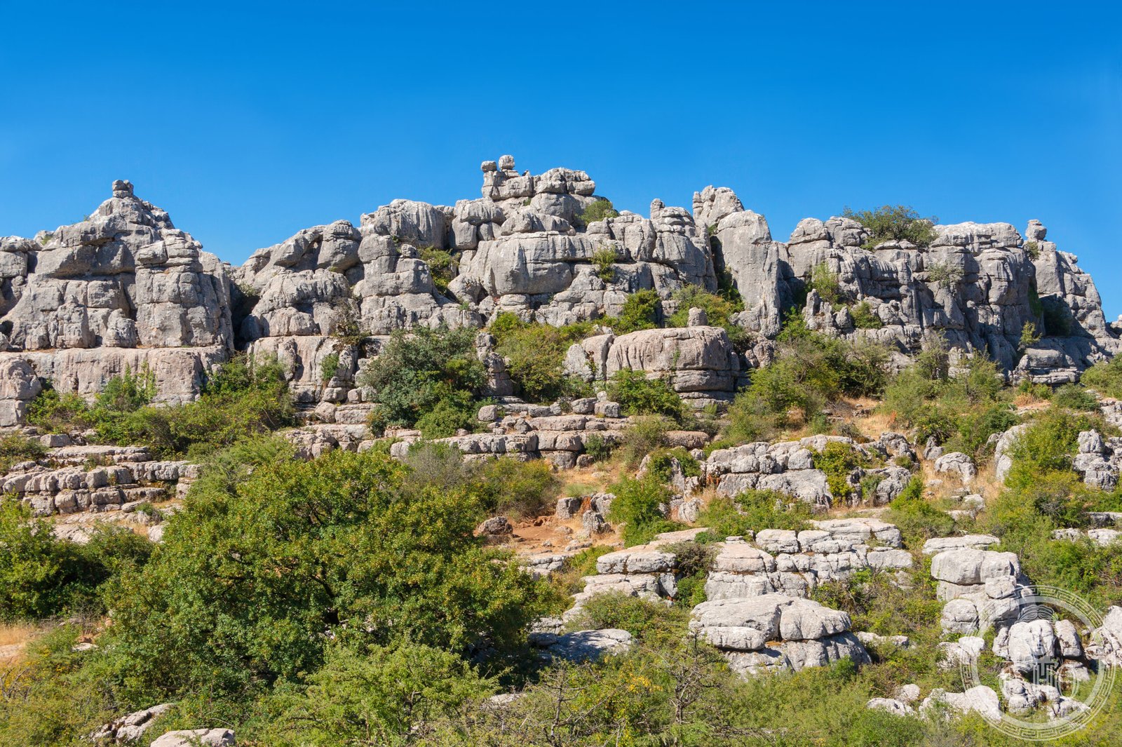
A spectacular karst landscape of weathered limestone formations, protected as a nature reserve in one of Europe’s most dramatic mountain settings.
At a glance
El Torcal de Antequera preserves an extraordinary terrain of naturally sculpted limestone peaks and ridges. The reserve spans the Sierra del Torcal range south of Antequera in Málaga province, offering visitors a rare encounter with Alpine karst geology at the edge of Andalusia.
History
The site was recognized for its geological significance early in the 20th century. In July 1929, El Torcal was designated a Natural Site of National Interest—an early acknowledgement of its scientific value. Formal protection expanded in October 1978 with the creation of a Natural Park Reserve covering approximately 17 square kilometres.
What you see
The landscape defies conventional description. Erosion has carved the limestone into jagged ridges, deep ravines, and fissured formations that resemble sculpture more than geology. These unusual landforms rank among the most impressive karst landscapes in Europe, shaped over millennia by wind, water, and chemical weathering.
Cultural significance
El Torcal holds importance as both a scientific and aesthetic resource. The reserve demonstrates the dramatic power of natural processes to reshape the Earth’s surface, while offering insights into Mediterranean geology and alpine ecosystems. Its designation reflects Spain’s early commitment to preserving distinctive natural heritage.
Key facts
- Country: Spain
- Region: Province of Málaga, Andalusia
- Protected status: Natural Park Reserve (established October 1978); Natural Site of National Interest (established July 1929)
- Area: approximately 17 square kilometres
- Coordinates: 36.96°N, 4.55°W
Practical information & getting there
The reserve lies south of the city of Antequera, accessible via the A45 road. The site’s walking trails offer varying difficulty levels through the karst terrain. Check local conditions before visiting, as weather and ground stability can affect access to certain areas.
Sources & resources
Find it on the map
See this place and what’s around it →📷 Become a Cultural Heritage Online photographer
Share your photos of places: they stay published under your name as the author. The more they're seen, the more you get noticed — and soon a contest will reward the most appreciated photos.
Log in or sign up free to add a photoIs this page about you?
This page is read by travellers and heritage enthusiasts who find it on Google. Tell us how you are connected to this place and we will take it from there.