
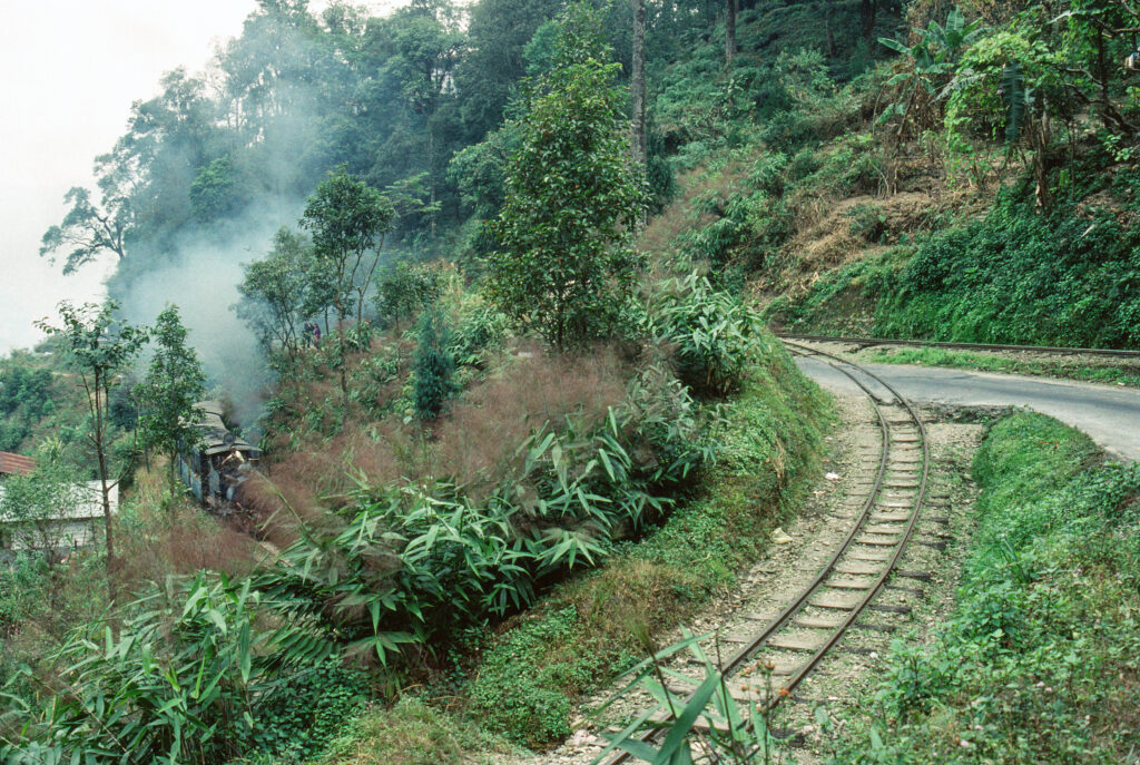
The line from the Bengal plains to Darjeeling is 610 millimetres wide and gains about two thousand metres of height by looping over itself and reversing up zig-zags. It has been doing it since 1881.
At a glance
The Darjeeling Himalayan Railway climbs from New Jalpaiguri, near sea level, to Darjeeling at roughly 2,200 metres, on a gauge of 610 millimetres — two feet. There is no rack rail and no cable: the little locomotives hold the gradient with adhesion alone, and where the hill is too steep for that, the line folds back on itself. Six zig-zags and three spirals do the work, and one of the spirals takes the track over its own head. It is the reason the railway was inscribed as a World Heritage Site in 1999, inside the listing of the Mountain Railways of India.
Key facts
- Where: New Jalpaiguri to Darjeeling, West Bengal, India
- Coordinates: 26.6839, 88.4439 (Darjeeling terminus) — open in Google Maps
- Gauge: 610 mm (2 ft)
- Opened: Siliguri–Kurseong in 1880, the full line to Darjeeling on 4 July 1881
- Built by: Franklin Prestage, agent of the Eastern Bengal Railway; construction by Gillanders, Arbuthnot and Company
- Altitude gained: from about 100 m at New Jalpaiguri to about 2,200 m at Darjeeling
- Highest station: Ghum, at 2,260 m
- World Heritage: inscribed 5 December 1999, criteria (ii) and (iv), as part of the Mountain Railways of India
History
Before the railway, the road up to Darjeeling was worked by tonga carts along the Hill Cart Road, the route that is still the main road today. In 1878 Siliguri was joined to Calcutta by a metre-gauge line, and Franklin Prestage, an agent of the Eastern Bengal Railway, proposed a steam tramway up the mountain. A committee set up by Ashley Eden, lieutenant governor of Bengal, accepted the scheme in 1879 and construction began the same year, with Gillanders, Arbuthnot and Company as contractors. Track reached Tindharia by March 1880 and Kurseong was opened to traffic in August 1880; the full line into Darjeeling opened on 4 July 1881.
The gradient was the problem from the start. The line at first followed the cart road, and in places the road was steeper than the locomotives could climb. In 1882 four loops and four zig-zags were built between Sukna and Gayabari to bring the ruling gradient down to a uniform 1 in 28 — the manoeuvre that gives the line its character, and that a passenger feels as the train doubling back on itself, the same houses passing a second time in the opposite direction. The railway was extended a quarter of a mile to Darjeeling Bazar in 1886; Darjeeling station was renovated in 1891.
It has never stopped being a working railway. Indian Railways owns it and the Northeast Frontier Railway operates it, with headquarters at Kurseong. Six diesel locomotives now handle most of the scheduled service; steam survives on the tourist workings, hauled by vintage British-built B-Class locomotives — the small black engines that appear on every postcard of the line.
What you see
A two-foot railway is a different scale of thing from a normal one: the track is narrow enough to follow on foot, the carriages sit low, and the locomotives — the B-Class especially — look like working models rather than machines. What the traveller actually sees, though, is the hill. The line runs through forest and past tea gardens, cuts through rock faces and crosses the road again and again; near Kurseong it threads between houses and shops, close enough to the street that a passenger can be handed a cup of tea. Ghum, the summit station at 2,260 metres, is the highest railway station in India.
The engineering is deliberately modest and that is the point of the listing: a late nineteenth-century mountain railway built by men who could not drill tunnels cheaply and did not try. Where a viaduct would be built today, this line went round, and where going round was not enough, it went back.
Practical information
- The short trip: daily tourist trains run from Darjeeling to Ghum and back — about two hours, and the easiest way to see the line
- The long one: the steam-hauled Red Panda service from Darjeeling to Kurseong
- Booking: seats on the tourist trains sell out in season; book ahead
- Best light: morning, before the cloud builds on the ridge
Getting there
The line begins at New Jalpaiguri, the railhead for the region and the station that connects with the main Indian network, including the route from Kolkata. Darjeeling itself is reached by the railway or by road up the Hill Cart Road from Siliguri. The nearest airport is Bagdogra, between Siliguri and New Jalpaiguri, about three hours by road from Darjeeling.
Nearby
- Kurseong — halfway up the line, and the railway’s headquarters
- Ghum — the summit station, with the Darjeeling Himalayan Railway museum
- The tea gardens of the Darjeeling ridge, which the line crosses on its climb
Sources
- Wikipedia, Darjeeling Himalayan Railway — gauge, construction history, the 1882 loops and zig-zags, rolling stock and the 1999 inscription (read 21 October 2026)
- UNESCO World Heritage Centre, Mountain Railways of India — the listing the Darjeeling line forms part of, criteria (ii) and (iv)
- Coordinates of the Darjeeling terminus from the article’s own coordinate record (26°41′2″N 88°26′38″E), carried to four decimals
Find it on the map
See this place and what’s around it →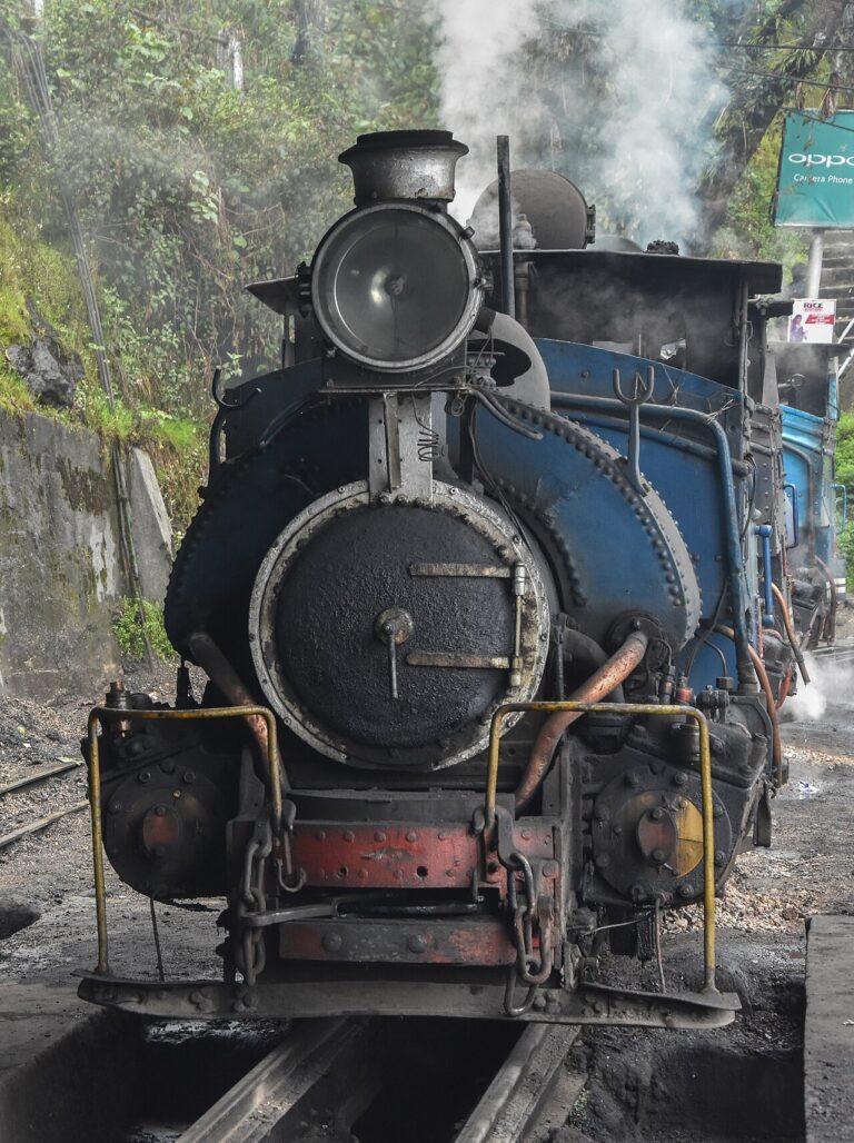

📷 Become a Cultural Heritage Online photographer
Share your photos of places: they stay published under your name as the author. The more they're seen, the more you get noticed — and soon a contest will reward the most appreciated photos.
Log in or sign up free to add a photoIs this page about you?
This page is read by travellers and heritage enthusiasts who find it on Google. Tell us how you are connected to this place and we will take it from there.