
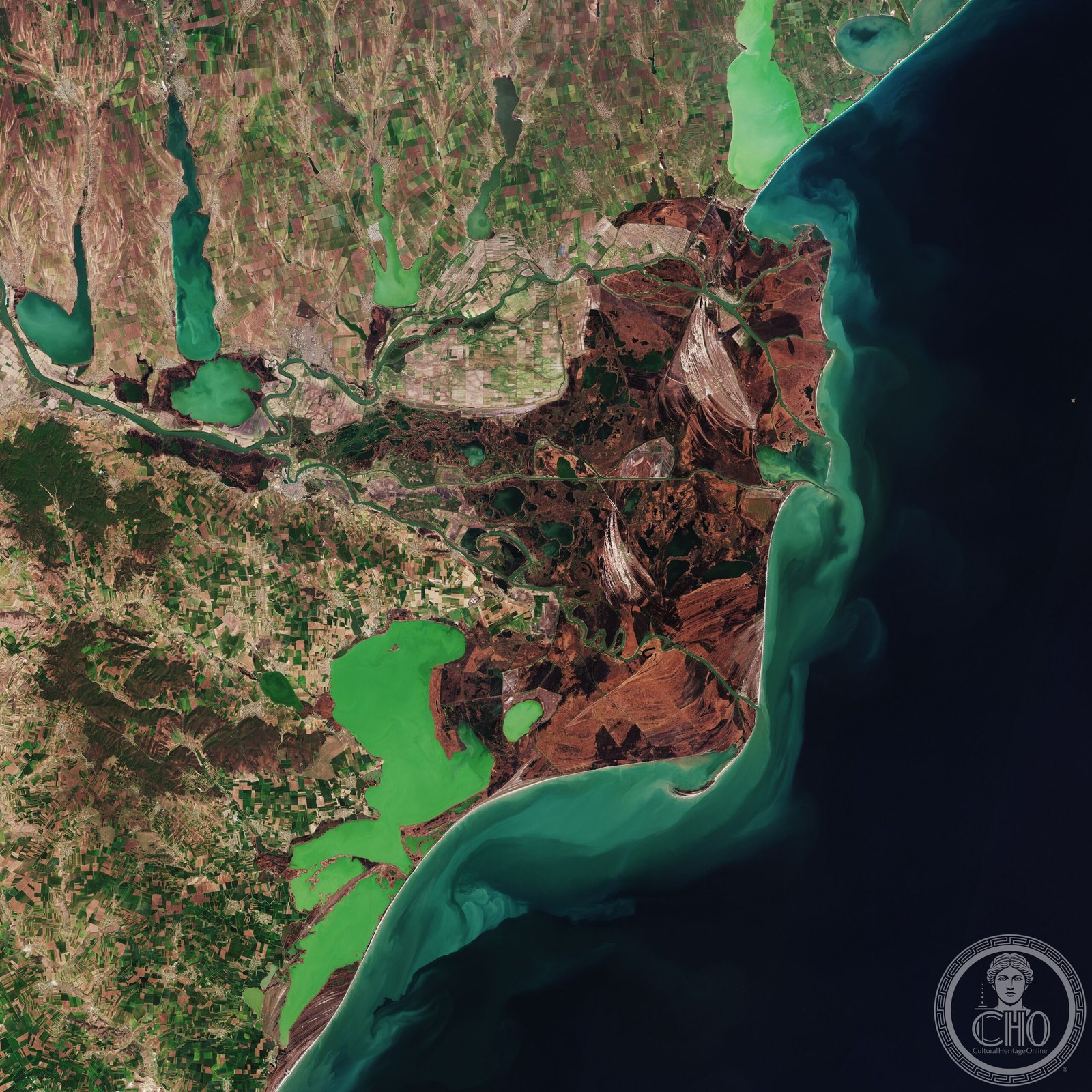
Europe’s second-largest river delta and best-preserved wetland system, where the Danube meets the Black Sea.
At a glance
The Danube Delta spans approximately 4,152 square kilometres across Romania’s Tulcea County and Ukraine’s Odesa Oblast. Including the adjoining Razim–Sinoe lagoon complex to the south, the total protected area reaches 5,165 square kilometres—a landscape of channels, lakes, and wetlands unmatched in ecological integrity anywhere on the European continent.
History
The delta marks the terminus of Europe’s second-longest river after its 2,860-kilometre journey from the Black Forest. The Razim–Sinoe lagoon complex, geologically and ecologically integrated with the delta proper, formed through millennia of fluvial and marine processes that shaped this distinctive ecosystem.
What you see
The Danube Delta is a working landscape rather than a monument—a vast network of interconnected waterways, reed beds, and freshwater lakes. Three main branches distribute the river’s flow: the Kilia, Sulina, and Saint George arms, each carving distinct passages through the sediment-rich terrain. The landscape continuously reshapes itself through natural accretion and erosion.
Cultural significance
The delta represents Europe’s largest and most pristine wetland. Its exceptional biodiversity—supporting globally significant bird populations, rare fish species, and endemic flora—makes it irreplaceable for scientific study and nature conservation. The region sustains traditional fishing communities and supports crucial ecological functions for the entire Black Sea basin.
Key facts
- Location: Romania (Tulcea County) and Ukraine (Odesa Oblast)
- Surface area: 4,152 km² (delta proper); 5,165 km² (including Razim–Sinoe lagoons)
- Coordinates: 45.2°N, 29.5°E
- UNESCO World Heritage Site: Yes
Practical information & getting there
The delta is accessible from Tulcea, Romania’s gateway city to the region, served by regular transport connections. Boat tours and guided excursions are standard ways to explore the channels and observe wildlife. The wetlands are best visited during spring and autumn when bird migration is most active. Consult local tourism authorities for current conditions and access restrictions.
Sources & resources
Find it on the map
See this place and what’s around it →📷 Become a Cultural Heritage Online photographer
Share your photos of places: they stay published under your name as the author. The more they're seen, the more you get noticed — and soon a contest will reward the most appreciated photos.
Log in or sign up free to add a photo