
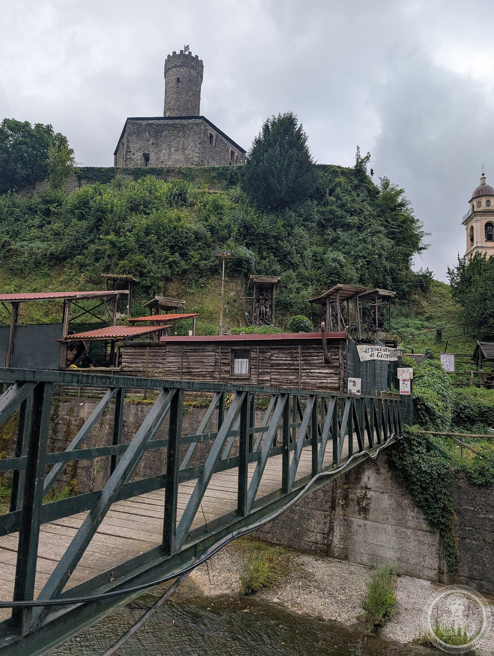
A medieval defensive tower overlooking the Stura Valley, built to protect merchants and travellers from successive waves of invasion across northern Italy.
At a glance
Castello Spinola stands on a hillside east of Campo Ligure, a strategic settlement that served as a commercial hub and waypoint for traders travelling between the Riviera and Monferrato. The fortress exemplifies the medieval need for fortified structures in a valley corridor repeatedly crossed by invading armies.
History
Campo’s location in the middle of the Stura Valley made it a natural transit point for merchants and travellers. The valley’s geographical position exposed it to successive waves of invasion: Visigoths, Lombards, and Franks all passed through, prompting residents to construct watchtowers and fortified buildings for defence. The castle tower was among the first defensive structures erected, positioned on a hilltop overlooking the settlement below.
What you see
The tower measures 5.85 metres in diameter and rises 28 metres in height. Its walls, 1.70 metres thick at the base, demonstrate the substantial construction required to withstand medieval warfare. The cylindrical form and elevation provided both observation and protection for the valley settlement.
Cultural significance
Castello Spinola represents the practical military architecture of the early medieval period in Liguria. It illustrates how valley settlements adapted to repeated invasions by developing defensive systems that balanced their role as commercial centres with the need to protect inhabitants and passing trade.
Key facts
- Address: Via Convento, 1, 16013 Campo Ligure (GE)
- Coordinates: 44.5379841, 8.7003364
- Website: http://www.comune.campo-ligure.ge.it/it/il-castello
- Phone: 340 471 2796
Practical information
Opening hours and ticket prices change through the year, so we do not republish them here: the current ones are on comune.campo-ligure.ge.it. What does not change is where it is: Via Convento, 1, 16013, at 44.5379841, 8.7003364.
Getting there
The castle is located in Campo Ligure, accessible via Via Convento in the town centre. For directions and public transport options to the Stura Valley, consult local travel resources.
See the place
Sources & resources
Find it on the map
See this place and what’s around it →📷 Become a Cultural Heritage Online photographer
Share your photos of places: they stay published under your name as the author. The more they're seen, the more you get noticed — and soon a contest will reward the most appreciated photos.
Log in or sign up free to add a photoIs this page about you?
This page is read by travellers and heritage enthusiasts who find it on Google. Tell us how you are connected to this place and we will take it from there.