
High on a limestone cliff above the old road linking Babylon and Ecbatana, Darius the Great had his account of seizing the Achaemenid throne carved in three languages. The trilingual text became the key that let nineteenth-century scholars unlock cuneiform script, opening the whole of Mesopotamian literature to modern readers.
At a glance
Bisotun’s carved panel sits on a mountain face above the ancient royal highway that once linked Babylon and Ecbatana, today’s Hamadan. The relief, roughly three by five and a half metres, shows Darius I standing life-size with one foot on the chest of the defeated rebel Gaumata, while nine other rebel kings stand bound before him and the god Ahura Mazda looks on from a winged disk overhead. Below runs an inscription of some 1,200 lines in three cuneiform scripts, Old Persian, Elamite and Babylonian, setting out Darius’s own account of how he took the throne in 522 BCE and put down nineteen revolts across the empire.
It was here, in the 1830s and 1840s, that the British officer Henry Rawlinson copied the text while suspended by ropes against the cliff face. His decipherment, completed by 1851, cracked all three scripts and gave scholars access to the vast corpus of Mesopotamian writing that followed.
Key facts
- Location: Bisotun, Kermanshah Province, western Iran (34.3925° N, 47.4379° E)
- Carved: c.520–518 BCE, on the orders of Darius I
- Languages: Old Persian, Elamite and Babylonian, set out in parallel cuneiform columns
- Subject: Darius’s seizure of the throne in 522 BCE and his suppression of nineteen subsequent revolts
- Decipherment: Henry Rawlinson, working between 1835 and 1851
- Status: UNESCO World Heritage Site, inscribed in 2006
History
Darius I, who reigned from 522 to 486 BCE, built Persepolis, organised the Royal Road from Susa to Sardis, and ruled the largest empire the ancient world had yet seen, stretching from Egypt and Mesopotamia through Persia and Central Asia to the northwest frontier of India. The Bisotun inscription is that empire’s foundation myth, carved at the most visible point on its busiest highway.
The text answers a real crisis. When Cambyses II died in 522 BCE, a priest named Gaumata claimed to be Cambyses’s murdered brother Bardiya and took the throne. Darius, a collateral member of the royal family with no direct claim, organised six other Persian nobles to kill him, then spent the following months crushing revolt after revolt. At Bisotun he casts every opponent as a follower of druj, the Lie, set against asha, the truth and cosmic order he claimed to embody.
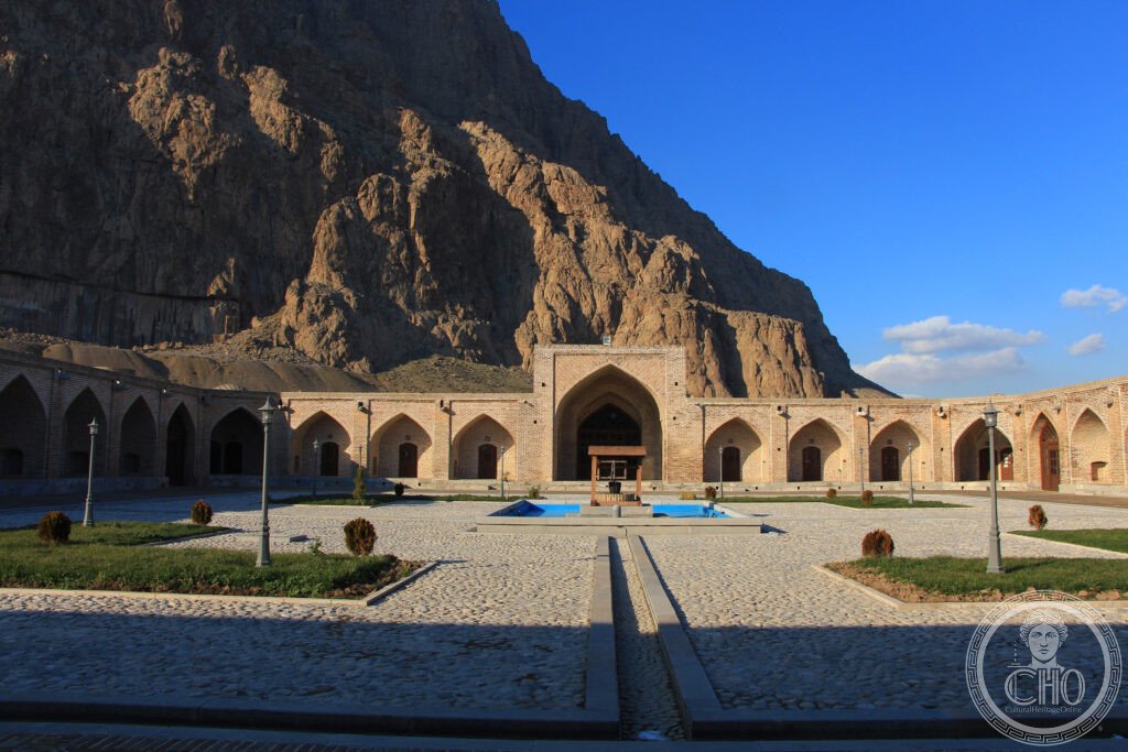
The cliff carries later layers too: a Seleucid statue of a reclining Heracles from 148 BCE, now kept in the site museum; a Parthian relief of King Gotarzes II on horseback, with its own Parthian cuneiform text; a Sasanid bridge; and the remains of a Silk Road caravanserai, evidence that the site remained a landmark on the east–west trade route for millennia after Darius’s masons had finished their work.
What you see
The protected area takes in the mountain and its surroundings. Visitors view the relief and inscription from a distance below the cliff, where the carvings sit high above ground level; binoculars help pick out the detail. A trail leads around the base of the site, and the Behistun Museum there holds plaster casts of the inscription, the Seleucid Heracles figure, and explanatory material in English.
Practical information
- Access: the site is reached by local bus or taxi from Kermanshah; check current services and prices with the site’s official channels before travelling
- Entry and hours: ticket costs and opening times change, so confirm these directly with the site management ahead of a visit
- What to bring: binoculars are genuinely useful given the height of the carvings
- Combine with: the Sasanid rock reliefs at Taq-e Bostan and the Anahita Temple platform at Kangavar
Getting there
Bisotun lies some 30 km from Kermanshah, the provincial capital, which has an airport served by flights from Tehran and can also be reached by road from the capital, roughly 525 km away. From Kermanshah, local buses and taxis run out to the site.
Nearby
- Taq-e Bostan — about 4 km from Kermanshah; Sasanid rock reliefs carved into a cliff at a spring, including the investiture of Ardashir II and the hunting scenes of Khusrow II
- Anahita Temple, Kangavar — about 45 km east; a large Seleucid and Parthian temple platform, partially excavated
- Shushtar Historical Hydraulic System — about 370 km south; a UNESCO World Heritage Site inscribed in 2009, with Achaemenid and Sasanid dams, tunnels and mill houses, including the Band-e Kaisar bridge-dam and the Gargar Canal
Sources
- Wikipedia, Bisotun
- Wikipedia, Behistun Inscription
- Wikipedia, Darius the Great
- Wikipedia, Henry Rawlinson
- UNESCO, Bisotun (WHS reference 1222)
Find it on the map
See this place and what’s around it →📷 Become a Cultural Heritage Online photographer
Share your photos of places: they stay published under your name as the author. The more they're seen, the more you get noticed — and soon a contest will reward the most appreciated photos.
Log in or sign up free to add a photo