
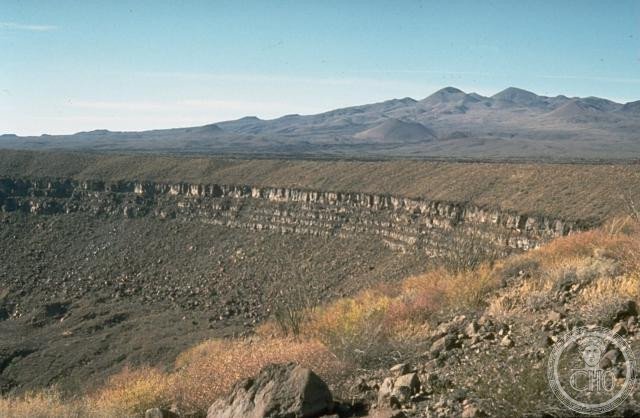
A vast protected landscape where volcanic deserts meet the Gulf of California, encompassing ancient craters, dunes, oases and critical coastal ecosystems.
At a glance
Covering 1.65 million hectares across northwestern Mexico, this UNESCO Biosphere Reserve spans volcanic formations, arid desert, and the culturally rich delta region where the Colorado River meets the sea. The landscape reveals millions of years of geological history through its craters and dunes, while supporting diverse plant communities adapted to extreme aridity.
History
Established in 1993 by presidential decree as the Reserva de la Biosfera del Alto Golfo de California y Delta del Río Colorado, the reserve was expanded in 1995 to encompass a larger protective zone. Today it is managed by municipal authorities across three jurisdictions: Mexicali in Baja California, and Puerto Peñasco and San Luis Río Colorado in Sonora.
Local communities have inhabited these transition areas for generations. As of 2016, approximately 69,700 people lived across 210 locations within and adjacent to the reserve, many engaged in agriculture, forestry, cattle raising, and manufacturing.
What you see
The reserve’s landscape is dominated by the El Pinacate y Gran Desierto formation, a striking expanse of volcanic geology. Visitors encounter volcanic craters rising from sand dunes, freshwater oases providing rare respite in the desert, and pristine beaches along the Gulf of California shoreline. This variety of topography and microhabitats creates distinct ecological zones within a single protected area.
Cultural significance
The reserve protects one of North America’s most important transitional ecosystems, where desert meets sea. Its designation as a UNESCO Biosphere Reserve recognizes both its geological importance and its role as a buffer zone for traditional land uses and modern economic activity, balancing conservation with the needs of local communities and international commerce.
Key facts
- Country: Mexico
- State: Sonora (with portions extending into Baja California)
- Area: 1,652,110 hectares (6,378.8 square miles)
- Coordinates: 31.61°N, 113.86°W
- UNESCO Biosphere Reserve: Yes (established 1993, extended 1995)
- Population in reserve area (2016): approximately 69,700 across 210 locations
Practical information & getting there
The reserve is accessible from Puerto Peñasco and San Luis Río Colorado in Sonora. Both towns offer services and accommodation. The landscape is remote and arid; plan accordingly for water, fuel, and supplies before venturing into the reserve’s interior. Local municipal offices in the three managing municipalities can provide guidance on access and designated zones.
Sources & resources
Find it on the map
See this place and what’s around it →📷 Become a Cultural Heritage Online photographer
Share your photos of places: they stay published under your name as the author. The more they're seen, the more you get noticed — and soon a contest will reward the most appreciated photos.
Log in or sign up free to add a photo