
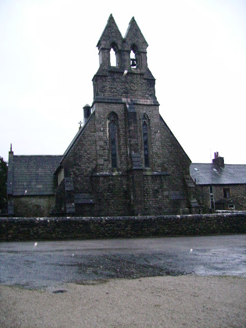
A working Roman Catholic parish church in rural Lancashire, serving the small village of Yealand Conyers and linked with neighbouring congregations.
At a glance
St Mary’s Church stands at the south end of Yealand Conyers village, an active Roman Catholic place of worship. The church is part of the Diocese of Lancaster and maintains pastoral ties with St Mary of the Angels in Bolton-le-Sands and Our Lady of Lourdes in Carnforth.
History
The church’s role as a Catholic parish reflects the religious heritage of Lancashire, historically a region of Catholic practice in England. Though its earliest construction and founding details require further research, St Mary’s has endured as an active religious community.
What you see
The building is designated Grade II listed, a recognition of its architectural or historical merit within England’s heritage system. Located at the village’s southern boundary, it forms part of Yealand Conyers’ modest built landscape.
Cultural significance
St Mary’s represents continuity of Catholic worship in rural Lancashire. Its listing reflects its value to both local community and national heritage, preserving a place of faith in an agricultural setting.
Key facts
- Location: Yealand Conyers, Lancashire, United Kingdom
- Coordinates: 54.1605, -2.7614
- Designation: Grade II listed building (National Heritage List for England)
- Denomination: Roman Catholic, Diocese of Lancaster
- Status: Active parish church
Practical information & getting there
St Mary’s Church is located in Yealand Conyers, a village in northwest England. For service times and visitor information, contact the Diocese of Lancaster or visit directly. The church’s listing status means its exterior is protected; opening times may vary.
Sources & resources
Find it on the map
See this place and what’s around it →📷 Become a Cultural Heritage Online photographer
Share your photos of places: they stay published under your name as the author. The more they're seen, the more you get noticed — and soon a contest will reward the most appreciated photos.
Log in or sign up free to add a photoIs this page about you?
This page is read by travellers and heritage enthusiasts who find it on Google. Tell us how you are connected to this place and we will take it from there.