
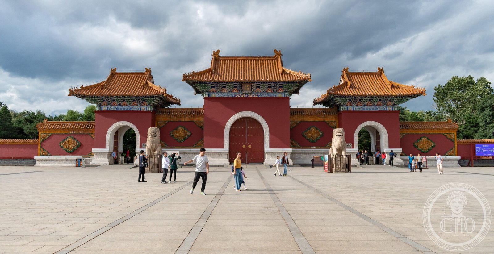
The monumental tomb of Hong Taiji, founder of the Qing dynasty, stands within Shenyang’s Beiling Park as a testament to imperial grandeur and architectural ambition.
At a glance
Zhaoling, also known as Beiling or the North Mausoleum, holds Hong Taiji and Empress Xiaoduanwen. Built between 1643 and 1651, the complex and its surrounding park cover 3.3 million square metres, making it the largest of the three imperial tombs north of the Great Wall. Once forbidden to ordinary people, it was opened to the public in 1928.
History
Hong Taiji established the Later Jin state and declared himself emperor of the Great Qing. His mausoleum was constructed over eight years following his death, reflecting the ambitions of a dynasty in its formative years. The imperial grounds were originally restricted territory; access remained forbidden to commoners until 1927–28, when the Fengtian Province government transformed the site into a public park.
What you see
A ceremonial row of animal statues leads toward the tomb, a traditional feature of imperial Chinese burial grounds. The surrounding landscape includes historic buildings, mature pine trees, and artificial lakes. Flower gardens occupy the western approach; several lakes lie to the east. Within Beiling Park’s 330 hectares stands a dedicated Children’s Garden.
Cultural significance
Zhaoling embodies the architectural and ceremonial traditions of early Qing imperial culture. Its scale and preservation make it a landmark in the history of Chinese funerary architecture. The conversion of a forbidden imperial domain into public parkland reflects twentieth-century shifts in how societies relate to historical power and privilege.
Key facts
- Country: China
- Location: Huanggu District, Shenyang, Liaoning Province
- Coordinates: 41.8499°N, 123.4216°E
- Construction period: 1643–1651
- Park area: 330 hectares (820 acres)
- UNESCO status: Not inscribed
Practical information & getting there
Zhaoling is situated within Beiling Park in northern Shenyang, an accessible urban location. The site functions as both a historical monument and public recreation area, open to visitors year-round. For current hours and any seasonal closures, consult local tourism resources before planning your visit.
Sources & resources
Find it on the map
See this place and what’s around it →📷 Become a Cultural Heritage Online photographer
Share your photos of places: they stay published under your name as the author. The more they're seen, the more you get noticed — and soon a contest will reward the most appreciated photos.
Log in or sign up free to add a photoIs this page about you?
This page is read by travellers and heritage enthusiasts who find it on Google. Tell us how you are connected to this place and we will take it from there.