
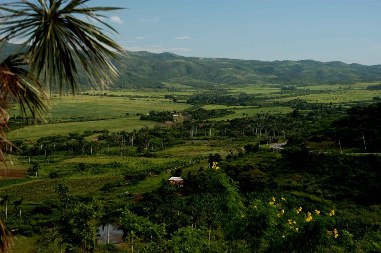
Three interconnected valleys that became the heart of Cuba’s sugar industry, now a UNESCO World Heritage Site preserving the memory of colonial plantation wealth and the labour that built it.
At a glance
Valle de los Ingenios comprises three valleys—San Luis, Santa Rosa, and Meyer—located 12 kilometres outside Trinidad. Between the late 18th and late 19th centuries, this region dominated Cuba’s sugar economy. At its peak, over fifty mills operated across the valleys, supported by the labour of more than 30,000 enslaved workers. Today, remains of over 70 former mills are scattered across the 270 square-kilometre site.
History
The three valleys emerged as a centre for sugar production during the late 18th century, when Caribbean sugar demand accelerated wealth creation across Cuba. The industry sustained itself into the 19th century before decline set in. In 1988, Valle de los Ingenios and the neighbouring colonial town of Trinidad were jointly inscribed as a UNESCO World Heritage Site, recognised for their testimony to the early sugar trade and its legacy.
What you see
The landscape itself is the principal artifact—a terrain shaped by industrial agriculture and colonial infrastructure. Visitors encounter the ruins and foundations of mills, plantation structures, and the remains of workers’ settlements. These physical traces illustrate the scale and organisation of sugar production at its height.
Cultural significance
Valle de los Ingenios represents a crucial chapter in Atlantic history. The site documents the brutal mechanics of the plantation economy and the central role of enslaved African labour in generating colonial wealth. Its UNESCO designation honours both the industrial heritage and the necessity of remembering the human cost embedded in these landscapes.
Key facts
- Country: Cuba
- Location: Near Trinidad, 12 km outside the town
- Coordinates: 21.84°N, 79.87°W
- Area: 270 square kilometres
- UNESCO World Heritage Site: Inscribed 1988 (jointly with Trinidad)
- Peak mills in operation: Over 50
- Surviving mill sites: Over 70
Practical information & getting there
The valleys lie near the colonial town of Trinidad, a UNESCO site in its own right. Access is by road from Trinidad; local guides can orient you to the scattered mill sites. The terrain is rural and requires self-directed exploration. Check with Trinidad’s tourism office for current access and site conditions before visiting.
Sources & resources
Find it on the map
See this place and what’s around it →📷 Become a Cultural Heritage Online photographer
Share your photos of places: they stay published under your name as the author. The more they're seen, the more you get noticed — and soon a contest will reward the most appreciated photos.
Log in or sign up free to add a photoIs this page about you?
This page is read by travellers and heritage enthusiasts who find it on Google. Tell us how you are connected to this place and we will take it from there.