
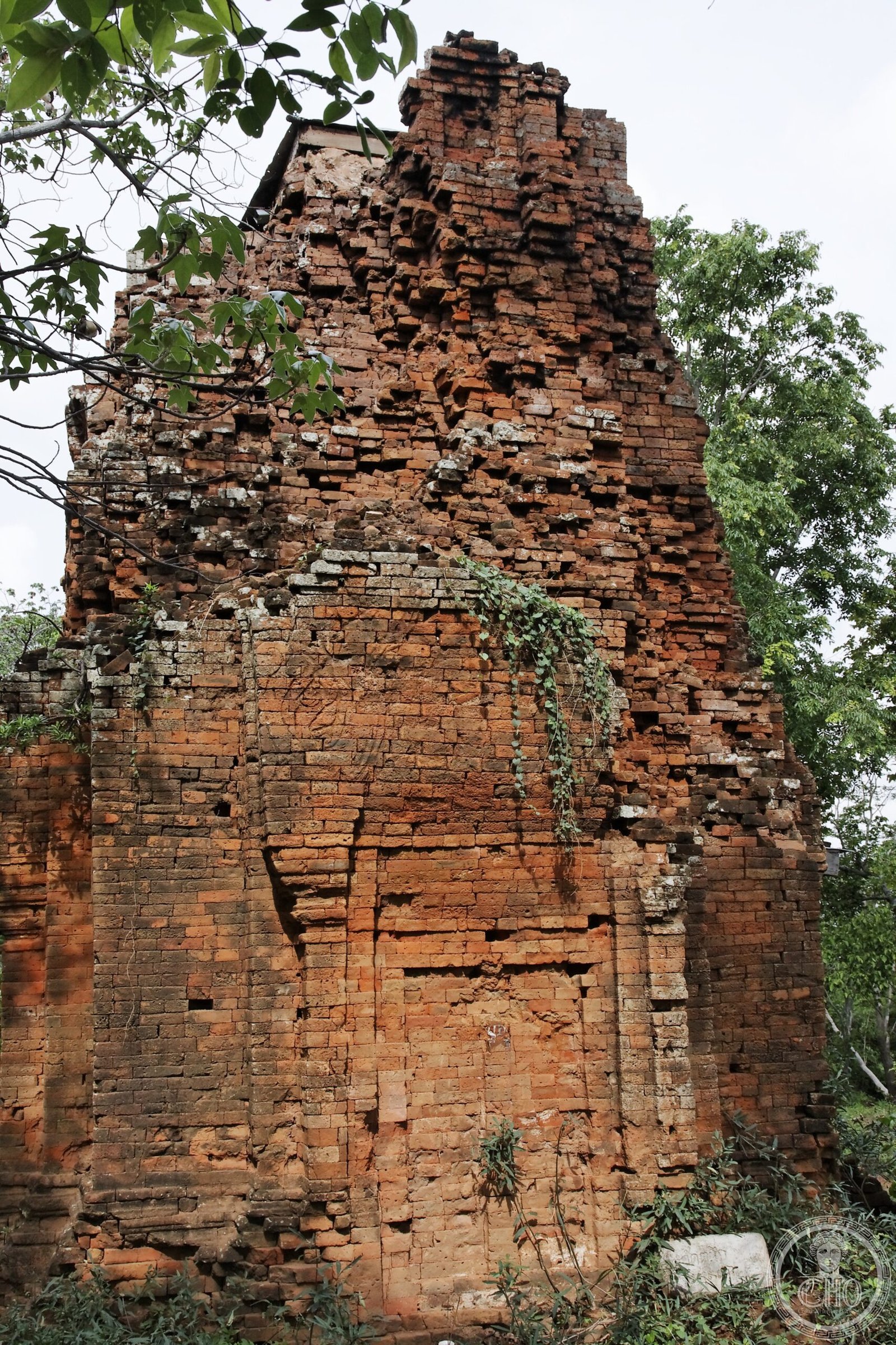
A protected wilderness spanning 594 square kilometres where Thailand’s eastern mountains meet the Dangrek Range near the Cambodian border, encompassing forest, ancient temple ruins, and complex recent history.
At a glance
Ta Phraya National Park protects a vast tract of mountainous terrain at the confluence of two major ranges. Elevations rise from 206 to 579 metres, with Khao Pran Nut as the highest peak. The park straddles four districts across two provinces—primarily Ta Phraya District in Sa Kaeo, with sections extending into Buriram Province.
History
Established in 1996, Ta Phraya National Park was created to protect a significant natural area along Thailand’s eastern frontier. Between the 1970s and 1990s, the border zone hosted refugee camps for Cambodians displaced by conflict. The park now preserves both ecological and archaeological heritage from the region’s layered past.
What you see
Within the park stand remnants of Khmer civilization, notably Prasat Khao Lon and other ancient temple structures. These ruins reflect the cultural reach of the Khmer empire into what is now eastern Thailand, scattered across the forested landscape among the mountains.
Cultural significance
Ta Phraya National Park forms part of the Dong Phayayen–Khao Yai Forest Complex, recognised as a UNESCO World Heritage Site. The park protects both natural biodiversity and archaeological evidence of regional history spanning centuries, from Khmer kingdoms to twentieth-century displacement and refuge.
Key facts
- Location: Sa Kaeo Province, Thailand (primarily); also Buriram Province
- Area: 594 square kilometres (371,250 rai)
- Elevation range: 206–579 metres
- Established: 1996
- Coordinates: 14.12°N, 102.66°E
- UNESCO World Heritage Site: Part of Dong Phayayen–Khao Yai Forest Complex
Practical information & getting there
The park lies in remote terrain near the Thai-Cambodian border. Access is primarily from Sa Kaeo Province. Contact local authorities or Thailand’s Department of National Parks, Wildlife and Plant Conservation for current visiting conditions, permits, and accessibility information.
Sources & resources
- Ta Phraya National Park – Wikipedia
- Cultural Heritage Online
Find it on the map
See this place and what’s around it →📷 Become a Cultural Heritage Online photographer
Share your photos of places: they stay published under your name as the author. The more they're seen, the more you get noticed — and soon a contest will reward the most appreciated photos.
Log in or sign up free to add a photo