
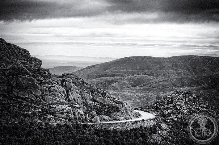
Swartberg Mountains
A sweeping range of dark peaks that rise above the Little Karoo, the Swartberg forms a dramatic barrier between two of South Africa’s most distinctive semi-arid landscapes. At over 2,000 metres, these mountains are among the tallest in the Western Cape.
At a glance
The Swartberg Mountains stretch nearly 230 kilometres across the Western Cape, from south of Laingsburg to the Willowmore–Uniondale area. Their name means “black mountain” in English, reflecting their dark geological character. The range forms part of the Cape Fold Belt, one of the world’s major mountain systems.
History
The Swartberg’s geological origins lie in the same ancient tectonic processes that created the Cape Fold Belt, a vast system of mountains shaped by continental collision over hundreds of millions of years. The range has long marked a significant boundary in the South African landscape, separating the Little Karoo to the south from the Great Karoo to the north.
What you see
Two main mountain chains run roughly east to west along the range’s length. Most peaks exceed 2,000 metres, making the Swartberg the dominant topographical feature of the Western Cape. The mountains’ dark colouring comes from their geological composition as part of the Cape Fold Belt. Dramatic passes cut through the range, creating natural corridors through the landscape.
Cultural significance
The Swartberg Mountains form a crucial ecological and geographical boundary in South Africa. Much of the range now lies within a UNESCO World Heritage Site, recognising its geological and landscape importance. The mountains define two distinct semi-arid regions—the Little Karoo and Great Karoo—each with its own character and ecological value.
Key facts
- Country: South Africa
- Region: Western Cape province
- Coordinates: −33.37°S, 22.35°E
- Length: Approximately 230 kilometres
- Elevation: Most peaks above 2,000 metres
- UNESCO: Part of a World Heritage Site
- Geological formation: Cape Fold Belt
Practical information & getting there
The Swartberg Mountains are accessible from major towns in the Western Cape. Several passes traverse the range, offering routes for exploration. You can reach the area from Laingsburg to the west or the Willowmore–Uniondale region to the east. Contact local tourism offices for current access information and guided exploration options.
Sources & resources
Find it on the map
See this place and what’s around it →📷 Diventa un fotografo di Cultural Heritage Online
Condividi le tue foto dei luoghi: restano pubblicate con la tua firma come autore. Più vengono viste, più ti fai conoscere — e presto un concorso premierà le foto più apprezzate.
Accedi o registrati gratis per aggiungere una fotoDo you manage this place?
This page is read by travellers and heritage enthusiasts who find it on Google. Keep it accurate — and make it work for you. Free for non-profit heritage institutions.