
A remote sanctuary in the heart of the Gulf of California, San Pedro Mártir Island teems with marine and avian life despite its harsh desert climate and complete absence of human settlement.
At a glance
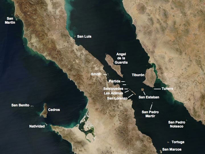
This uninhabited island, measuring 2 km long and 1.5 km wide, floats 51 km from Baja California and 53 km from Sonora’s coast. Since 2002, it has formed the core of the San Pedro Mártir Biosphere Reserve—a natural laboratory of adaptive evolution comparable to the Galápagos Islands.
History
The Seri Indians left the only permanent trace of human presence: stone benches built to aid nest construction and egg collection. During the late 19th and early 20th centuries, commercial guano mining flourished, with deposits shipped to Europe for fertilizer. Mining operations inadvertently introduced black rats, an invasive species finally eradicated in 2007 through island-wide poison spraying. In 2005, San Pedro Mártir gained UNESCO World Heritage status as part of the Islands and Protected Areas of the Gulf of California.
What you see
The island’s landscape is striking: guano deposits blanket the surface in white, while sparse vegetation struggles in the arid climate. Mexican giant cardon cacti—elephant cacti reaching 60 feet tall—dominate the flora. These structures are pollinated by a unique bee subspecies (Diadasus rinconis petrinus) found nowhere else. Near-vertical cliffs encircle the island, offering only two marginal anchorages and no safe landing.
Cultural significance
San Pedro Mártir ranks among the world’s most productive marine ecosystems, supporting extraordinary densities of small pelagic fish that sustain massive bird and whale populations. It hosts the largest nesting colonies of brown boobies and blue-footed boobies globally, alongside the fourth most important sea lion breeding site in the Gulf. Two endemic lizard species—the San Pedro Mártir whiptail and San Pedro Side-blotched Lizard—have evolved to scavenge fish scraps from seabird kills. The island’s 292 fauna and flora species include 42 protected by Mexican law and 30 threatened species.
Key facts
- Country: Mexico
- Location: Gulf of California, 51 km from Baja California, 53 km from Sonora
- Area: 2.729 km² (272 hectares)
- Dimensions: 2 km long, 1.5 km maximum width
- UNESCO World Heritage Site: 2005 (Islands and Protected Areas of the Gulf of California)
- Biosphere Reserve designation: 2002
- Coordinates: 28.38°N, 112.31°W
Practical information & getting there
San Pedro Mártir is intentionally inaccessible to visitors. The island’s near-vertical cliffs and treacherous coastline permit only poor anchorages in fair weather. Landing was historically possible near a small southeastern isthmus but is now strictly forbidden to protect the biosphere reserve. Access to the biosphere reserve is restricted; enquire with Mexican environmental authorities (CONANP) in Sonora or visit from a distance by boat in the Gulf of California.
Sources & resources
Find it on the map
See this place and what’s around it →📷 Become a Cultural Heritage Online photographer
Share your photos of places: they stay published under your name as the author. The more they're seen, the more you get noticed — and soon a contest will reward the most appreciated photos.
Log in or sign up free to add a photo