
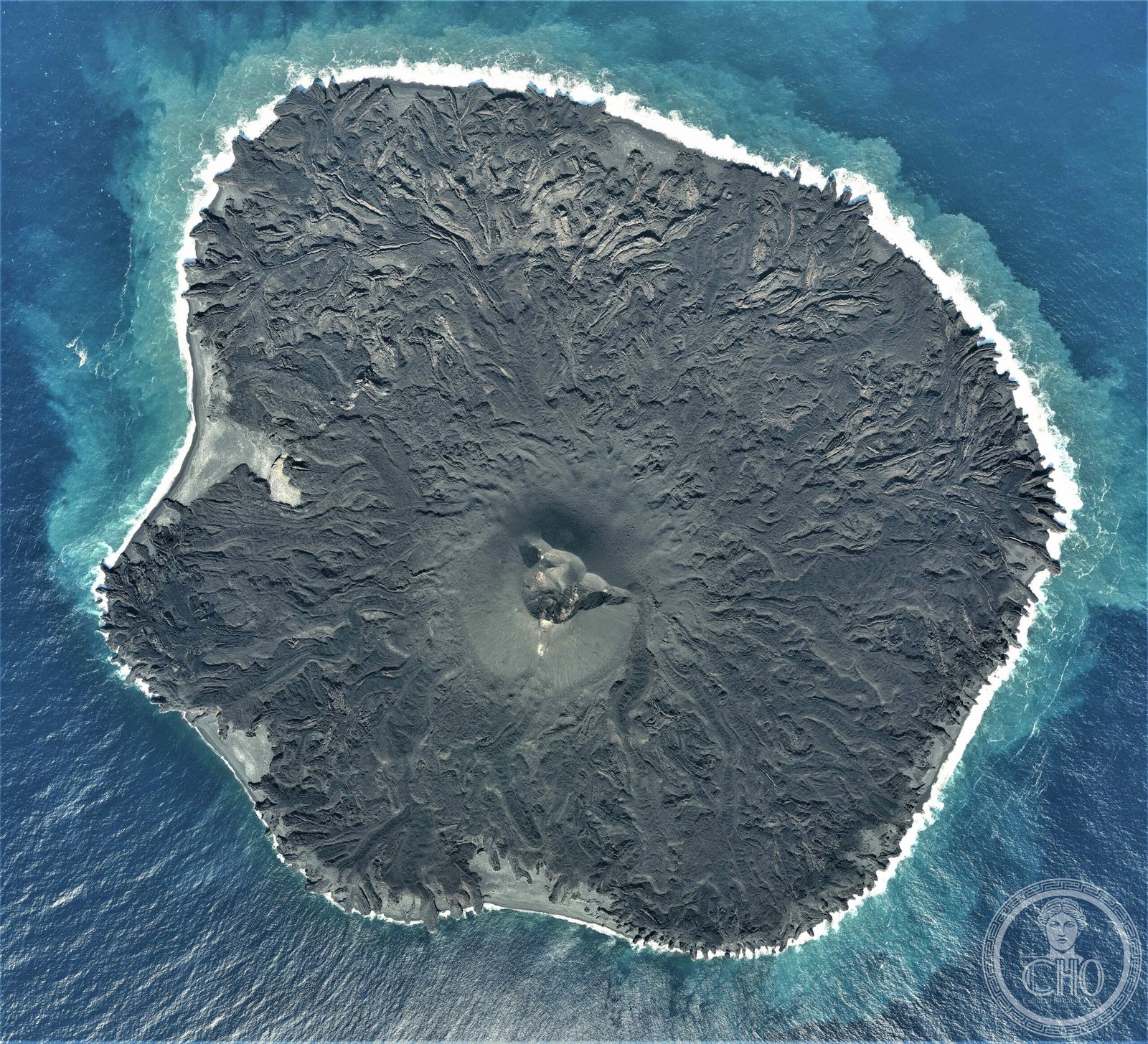
A volcanic island born from the sea, Nishinoshima has grown dramatically over the past five decades through repeated eruptions, transforming from a submerged ridge into a terrestrial landform that now spans 4.1 square kilometers and attracts scientific study worldwide.
At a glance
Nishinoshima is a volcanic island located roughly 940 kilometers south-southeast of Tokyo, part of the Volcano Islands arc. Situated about 130 kilometers west of Chichijima—the nearest inhabited Ogasawara island—Nishinoshima remains largely uninhabited and geologically active, offering a rare window into volcanic island formation in real time.
History
Originally the above-water peak of an underwater caldera ridge, Nishinoshima first gained attention in 1974 when submarine volcanic eruptions enlarged the island. A much more dramatic transformation began in November 2013 when renewed eruptions captured global scientific attention. A new volcanic cone rose rapidly, reaching approximately 142 meters by July 2016. Major eruptions continued intermittently through 2017, 2018, and 2019–2020, with volcanic gas emissions persisting for months after each event. By August 2020, the island had stabilized at 4.1 square kilometers, with vegetation and fauna beginning to recolonize the fresh volcanic terrain.
What you see
The island’s visible landscape consists entirely of volcanic formations. A prominent cone dominates the terrain, rising over 140 meters above sea level. Dark volcanic rock covers most surfaces, with sparse vegetation beginning to establish in sheltered areas and lower elevations as the ecosystem recovers from repeated eruptions.
Cultural significance
Nishinoshima represents a living laboratory of volcanic geology and island biogeography. The island’s rapid growth through documented eruptions provides scientists with unprecedented opportunities to study how new landmasses form and how life recolonizes barren terrain. Its isolation and relatively recent emergence make it invaluable for understanding ecosystem succession.
Key facts
- Country: Japan
- Region: Ogasawara Islands (Volcano Islands arc)
- Coordinates: 27.25°N, 140.87°E
- Current area: 4.1 km² (as of August 2020)
- Distance from Tokyo: 940 km south-southeast
- Distance from nearest inhabited island: 130 km west of Chichijima
Practical information & getting there
Nishinoshima is not accessible to tourists. The island remains a restricted natural preserve studied only by authorized researchers. Access to the Ogasawara Islands generally requires a 24-hour ferry from Tokyo; inquire with local tour operators and the Ogasawara Village government about viewing opportunities from boats in surrounding waters.
Sources & resources
Find it on the map
See this place and what’s around it →📷 Become a Cultural Heritage Online photographer
Share your photos of places: they stay published under your name as the author. The more they're seen, the more you get noticed — and soon a contest will reward the most appreciated photos.
Log in or sign up free to add a photoIs this page about you?
This page is read by travellers and heritage enthusiasts who find it on Google. Tell us how you are connected to this place and we will take it from there.