
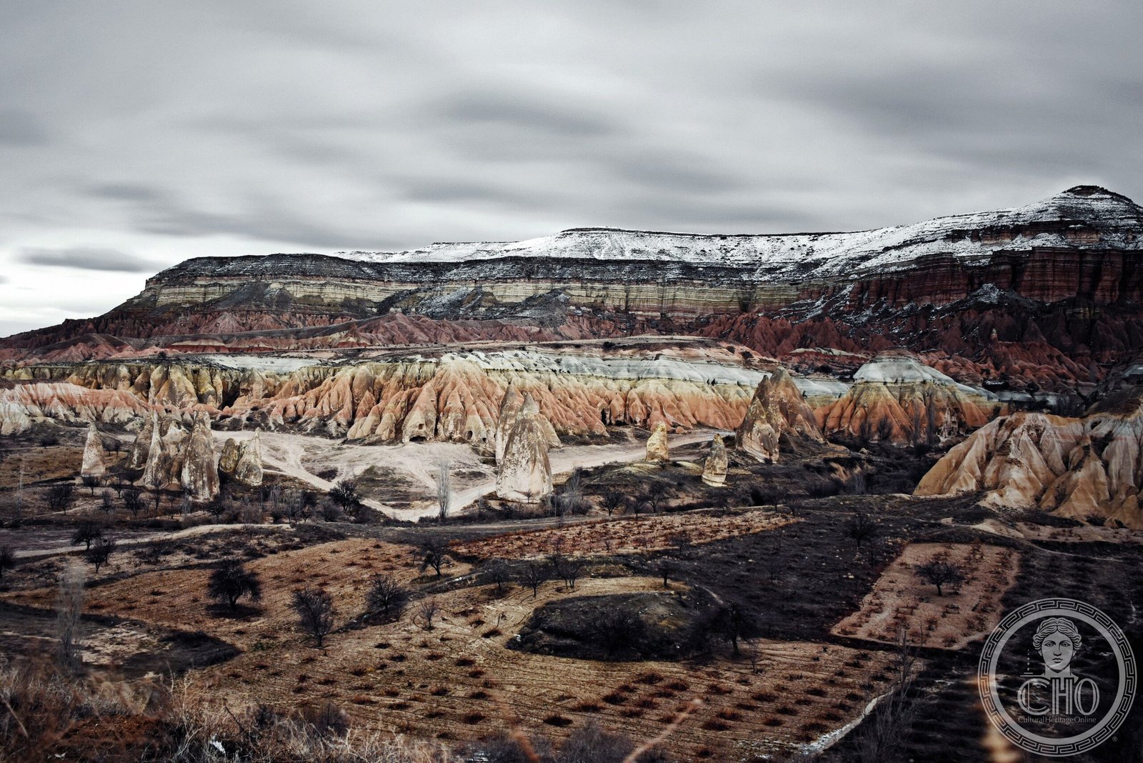
A vast Cappadocian landscape carved by wind and water into otherworldly rock formations, concealing a hidden realm of ancient underground cities and dwellings.
At a glance
Göreme National Park sprawls across nearly 100 square kilometers of central Cappadocia. The park’s defining feature is its dramatic eroded terrain—soft volcanic rock shaped into towering cones, pillars, and hollowed ridges by millennia of weathering. Beneath this surreal surface lies an intricate network of underground settlements, carved by ancient inhabitants seeking shelter and refuge.
History
The underground cities and rock dwellings of Göreme developed over centuries as successive populations—from Byzantine Christians to earlier Hittite and Phrygian peoples—sought security and sanctuary in Cappadocia’s soft tuff rock. The park’s significance grew with Christian monastic communities, who established churches and monasteries within the stone formations. In 1985, UNESCO recognized the site as a World Heritage property under the designation “Göreme National Park and the Rock Sites of Cappadocia,” acknowledging its archaeological and cultural importance.
What you see
The landscape presents an extraordinary geology of fairy chimneys—cone-shaped rock formations topped with harder basalt caps that have resisted erosion. The park reveals interconnected underground chambers, passages, and entire subterranean towns engineered into the bedrock. Rock-cut churches and monastic spaces showcase Byzantine iconography and carved architectural details. Ventilation shafts, storage rooms, and residential quarters demonstrate sophisticated ancient engineering adapted to volcanic terrain.
Cultural significance
Göreme embodies the ingenuity of ancient peoples who transformed hostile geology into thriving settlements. The site represents a unique fusion of natural wonder and human adaptation, revealing how communities carved sanctuary from stone. The park preserves evidence of multiple civilizations and faiths, making it a palimpsest of Anatolian history and a testament to Byzantine monastic life in Asia Minor.
Key facts
- Location: Nevşehir Province, Cappadocia, central Turkey
- Area: approximately 100 km² (39 sq mi)
- UNESCO World Heritage Site: 1985
- Coordinates: 38.65°N, 34.86°E
- Designation: Göreme National Park and the Rock Sites of Cappadocia
Practical information & getting there
The park is accessible year-round from the town of Göreme. You can explore on foot through designated trails, hire local guides, or arrange tours from nearby villages. The site offers options ranging from casual walks to more demanding hikes through the fairy chimneys and valleys. Nearby towns provide accommodation and services; visit during spring or autumn for optimal weather and fewer crowds.
Sources & resources
Find it on the map
See this place and what’s around it →📷 Become a Cultural Heritage Online photographer
Share your photos of places: they stay published under your name as the author. The more they're seen, the more you get noticed — and soon a contest will reward the most appreciated photos.
Log in or sign up free to add a photo