
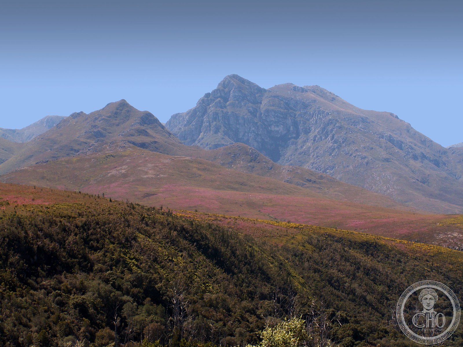
A 142-square-kilometre mountain wilderness in the Langeberg range, named for a 19th-century hermit who guarded his apiaries fiercely. The terrain ranges from fynbos peaks to ancient valley forests and dramatic river gorges.
At a glance
Boosmansbos sprawls across the eastern Langeberg mountains, 20 km north of Heidelberg. Grootberg peak reaches 1,637 m at the wilderness heart, while the Duiwenhoks River’s tributaries carve gorges 200 m above sea level on the southern edge. The area preserves mountain fynbos and valley forest, including South Africa’s westernmost natural forest.
History
The wilderness takes its name—’angry man’s forest’—from an early 19th-century hermit resident known for frightening visitors to his apiaries. The area’s human history centres on this solitary beekeeper, though the forests themselves have endured for millennia.
What you see
The landscape divides into distinct zones. High mountain fynbos dominates the peaks, where Erica, everlasting plants, and the rare Langeberg rambling aloe thrive. The valleys shelter sickle-leaved yellowwood, stinkwood, and red alder—ancient forest species. The Grootvadersbosch Nature Reserve, enclosed within the wilderness, contains 250 hectares of old-growth woodland, the most western natural forest surviving in South Africa. Duiwenhoks River gorges cut precipitously through the southern terrain.
Cultural significance
Boosmansbos conserves rare plant species and represents a crucial refuge for mountain fynbos biodiversity. The Grootvadersbosch forests are botanically and ecologically significant as South Africa’s last vestige of western natural forest. The wilderness also preserves a narrative of solitary settlement and human stewardship of marginal lands.
Key facts
- Area: 142 km² (55 sq mi)
- Highest point: Grootberg peak, 1,637 m (5,371 ft)
- Location: 20 km north of Heidelberg, Western Cape Province
- Coordinates: 33°55′S, 20°52′E
- Contains Grootvadersbosch Nature Reserve (250 ha)
- Rainfall occurs year-round; mid-summer and mid-winter are driest
Practical information & getting there
The wilderness is accessed via 64 km of maintained footpaths. A popular circular route of 27 km can be completed in two days, offering immersion in both fynbos and forest ecosystems. Weather patterns vary by season; bergwind conditions (hot, dry winds) occur during the driest periods.
Sources & resources
Find it on the map
See this place and what’s around it →📷 Become a Cultural Heritage Online photographer
Share your photos of places: they stay published under your name as the author. The more they're seen, the more you get noticed — and soon a contest will reward the most appreciated photos.
Log in or sign up free to add a photoIs this page about you?
This page is read by travellers and heritage enthusiasts who find it on Google. Tell us how you are connected to this place and we will take it from there.