
Lençóis Maranhenses National Park
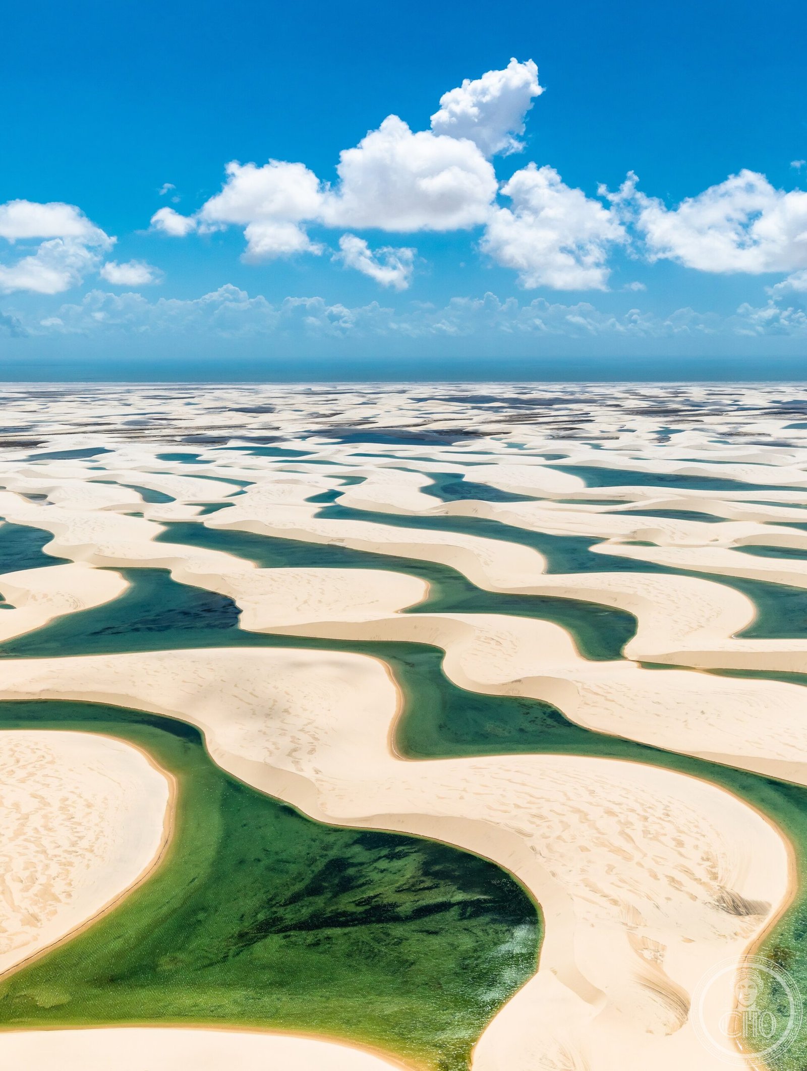
A vast landscape of rolling sand dunes transformed into freshwater lagoons during the rainy season, creating one of the world’s most visually distinctive ecosystems.
At a glance
Lençóis Maranhenses covers 155,000 hectares of northeastern Brazil’s coast, where impermeable bedrock traps rainwater in the valleys between dunes, forming transient lagoons. The park stretches 70 kilometers along the Atlantic, combining dramatic natural processes with ecological richness.
History
The park was protected on June 2, 1981, establishing formal conservation of this exceptional landscape. In July 2024, UNESCO designated it a World Heritage Site, recognizing its exceptional beauty and unique natural character on a global scale.
What you see
The terrain is dominated by undulating sand dunes interspersed with interdune valleys. During the rainy season, these depressions fill with freshwater lagoons of striking turquoise and emerald hues, creating a dramatically changing landscape. The 70-kilometer coastline borders the Baía de São José to the west.
Cultural significance
The park is celebrated internationally for its singular natural beauty and ecological importance. Its unique hydrological system—where freshwater accumulates without external drainage—distinguishes it as a rare geomorphological phenomenon. The site has become increasingly popular with ecotourists seeking pristine natural environments.
Key facts
- Location: Maranhão state, northeastern Brazil, east of Baía de São José
- Size: 155,000 hectares (380,000 acres)
- Coastline: 70 kilometers
- Protected: June 2, 1981
- UNESCO World Heritage Site: July 2024
- Coordinates: -2.53°, -43.12°
- Habitat: Four endangered species among diverse wildlife populations
Practical information & getting there
The park’s remote location in Maranhão requires planning. Rainy season (July to September) fills the lagoons; the dry season offers easier access to the dunes. Basic facilities exist, but accommodation is limited. Consult current travel advisories and arrange transportation to nearby towns before visiting.
Sources & resources
Find it on the map
See this place and what’s around it →📷 Diventa un fotografo di Cultural Heritage Online
Condividi le tue foto dei luoghi: restano pubblicate con la tua firma come autore. Più vengono viste, più ti fai conoscere — e presto un concorso premierà le foto più apprezzate.
Accedi o registrati gratis per aggiungere una foto