
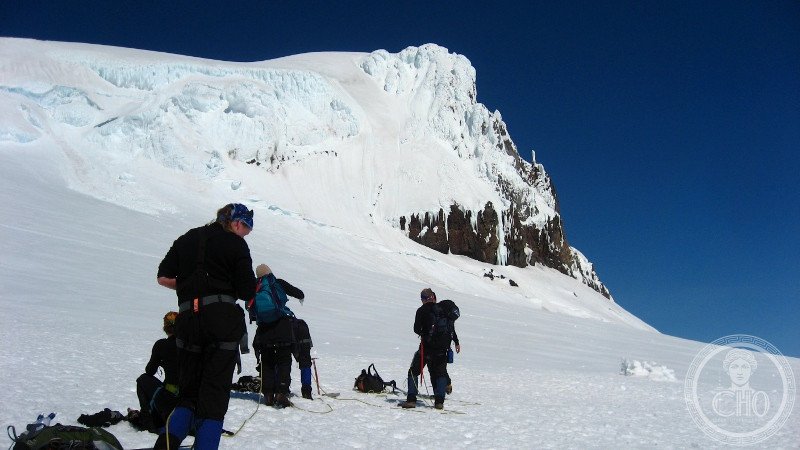
Iceland’s largest national park encompasses Europe’s biggest glacier and landscape shaped by rivers, ice, volcanoes, and geothermal forces.
At a glance
Vatnajökull National Park spans 14% of Iceland’s total area, making it Europe’s second-largest national park by area. The park protects Vatnajökull glacier itself—at 7,700 square kilometres, Europe’s largest—along with dramatic surrounding terrain shaped by dynamic geological processes. It merged two previously independent national parks: Skaftafell in the southwest and Jökulsárgljúfur in the north.
History
The park was enlarged northward in 2019 and achieved UNESCO World Heritage status on 5 July 2019, recognizing its outstanding geological and ecological value.
What you see
The park’s primary distinction lies in its extraordinary landscape diversity. Glacial ice dominates vast expanses, while powerful rivers carve through bedrock below. Volcanic cones and calderas punctuate the terrain, evidence of Iceland’s position on the Mid-Atlantic Ridge. Geothermal features—hot springs and steam vents—emerge across the landscape, creating a living laboratory of Earth’s geological forces working in concert.
Cultural significance
Vatnajökull represents one of the world’s most visually dramatic examples of glacial-volcanic interaction. The park demonstrates how glaciers, water, fire, and geothermal energy sculpt landscapes in real time, making it invaluable for understanding Iceland’s distinctive natural heritage and the broader processes that shape polar and volcanic regions.
Key facts
- Location: Iceland (coordinates 64.5°N, 17°W)
- Glacier area: 7,700 km² (largest in Europe)
- National park coverage: 14% of Iceland
- UNESCO World Heritage Site: inscribed 2019
- One of three national parks in Iceland
Practical information & getting there
The park is accessible from multiple points across Iceland’s interior and southern regions. Services and visitor facilities vary by location; planning ahead is essential for remote areas. Summer offers better access; winter conditions can be severe.
Sources & resources
Find it on the map
See this place and what’s around it →📷 Become a Cultural Heritage Online photographer
Share your photos of places: they stay published under your name as the author. The more they're seen, the more you get noticed — and soon a contest will reward the most appreciated photos.
Log in or sign up free to add a photo