
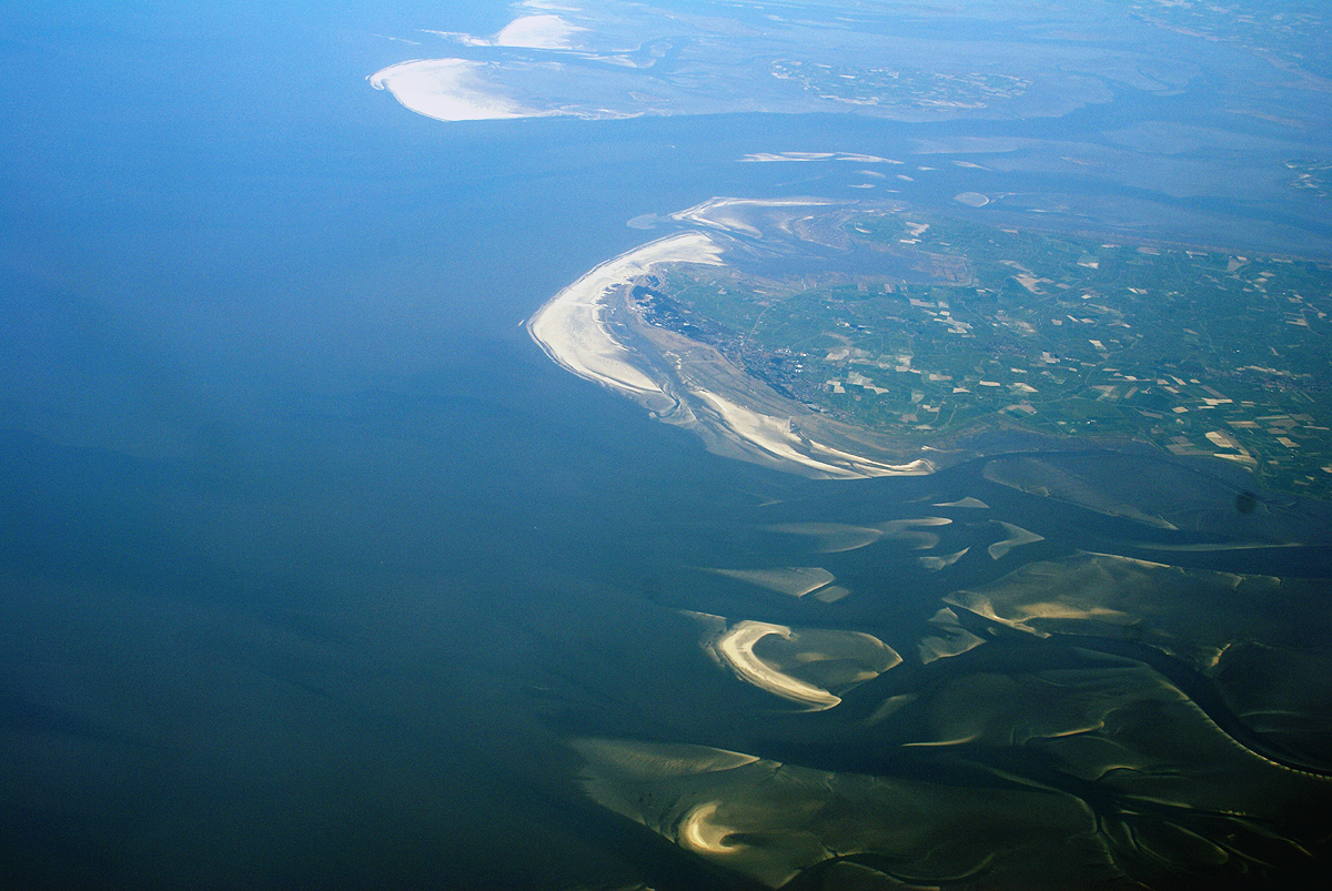
Germany’s largest national park preserves a vast coastal wetland of mudflats, salt marshes and undyked islands—a landscape shaped by tides and home to porpoises, migratory birds and rare eelgrass meadows.
At a glance
Stretching 4,410 square kilometres from the Danish maritime border to the Elbe estuary, this protected area encompasses some of Europe’s most dynamic intertidal terrain. Approximately 68% remains permanently submerged; 30% emerges and floods with the tides. The park’s scale and ecological integrity make it exceptional among German national parks.
History
The parliament of Schleswig-Holstein established the national park on 1 October 1985 under the National Park Act of 22 July 1985. A significant expansion followed in 1999, broadening protection across the region. In 1990, the park gained UNESCO biosphere reserve designation. On 26 June 2009, it became part of the Wadden Sea UNESCO World Heritage Site, recognised alongside Dutch and other German sections for its undisturbed ecosystem and biodiversity.
What you see
The landscape divides into distinct zones. The North Frisian area reveals mudflats stretching 40 kilometres wide in places, interspersed with geest-based and marsh islands and Halligen—low, undyked islands that flood seasonally. Southward, larger sandbanks dominate the mudflat environment. Salt marshes form the terrestrial component, gradually transitioning between water and land.
Cultural significance
The Wadden Sea represents one of the world’s largest mudflat ecosystems, shaped by millennia of tidal action. Beyond its geological importance, it functions as a critical refuge for migratory birds and marine mammals. Porpoises, shelducks and eelgrass characterise the Schleswig-Holstein section, reflecting the park’s role in sustaining North Atlantic biodiversity during seasonal movements.
Key facts
- Country: Germany
- Region: Schleswig-Holstein
- Area: 4,410 km²—Germany’s largest national park
- Established: 1 October 1985
- Expanded: 1999
- UNESCO Biosphere Reserve: 1990
- UNESCO World Heritage Site: 26 June 2009
- Coordinates: 54.456302, 8.646408
Practical information & getting there
The park spans the coast of Schleswig-Holstein between the North Sea and mainland. Access points vary; many visitors explore from towns along the coast. Tidal schedules are essential for planning walks across mudflats and to islands. For current opening times, facilities and guided tours, consult local visitor centres in North Frisia or contact the park administration directly.
Sources & resources
Find it on the map
See this place and what’s around it →📷 Become a Cultural Heritage Online photographer
Share your photos of places: they stay published under your name as the author. The more they're seen, the more you get noticed — and soon a contest will reward the most appreciated photos.
Log in or sign up free to add a photo