
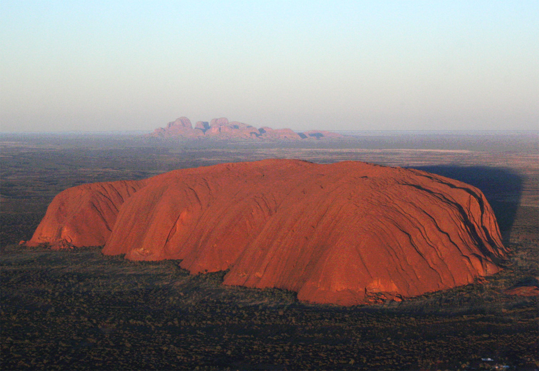
A vast expanse of red desert in central Australia, home to two of the continent’s most iconic geological formations and a landscape sacred to the Anangu people for tens of thousands of years.
At a glance
Uluṟu-Kata Tjuṯa National Park protects 1,326 square kilometres of remote Outback wilderness in Australia’s Northern Territory. The park centres on two monumental rock formations: Uluru, the colossal dome of rust-red sandstone, and Kata Tjuta, a cluster of thirty-six domed peaks rising dramatically from the desert floor 40 kilometres to the west.
History
The landscape holds profound cultural significance for the Anangu people, the traditional owners, whose connection to the land extends back thousands of years. In 1987, the park was inscribed as a UNESCO World Heritage Site in recognition of its outstanding natural and cultural value, honouring both its geological importance and its role as a living cultural landscape for Indigenous Australians.
What you see
Uluru dominates the landscape—a massive inselberg rising 348 metres above the surrounding plains, its surface shifting in colour from deep burgundy to glowing orange as light changes throughout the day. Kata Tjuta presents a contrasting form: a labyrinth of towering ridges and valleys sculpted by wind and water over millions of years, with walkable gorges offering intimate views of the rock formations and desert vegetation.
Cultural significance
Both formations are central to Anangu songlines and Dreaming stories, embedding the landscape with layers of spiritual meaning. The park’s inscription as a World Heritage Site recognises it as a place where natural grandeur and Indigenous cultural heritage are inseparably bound—a rare honour reflecting both criteria.
Key facts
- Location: Northern Territory, Australia (25°19′S, 131°01′E)
- Area: 1,326 square kilometres
- UNESCO World Heritage Site: Listed 1987
- Uluru height: 348 metres above plain
- Kata Tjuta: 40 kilometres west of Uluru
Practical information & getting there
The park lies 440 kilometres south-west of Alice Springs and 1,943 kilometres south of Darwin. You can reach it via the Stuart and Lasseter Highways. The Outback Highway, linking Western Australia and Queensland as Australia’s third transcontinental route, passes through the park. Visitor facilities and ranger-led interpretive programs are available on-site; consult the park authority for current opening times and entry requirements.
Sources & resources
Find it on the map
See this place and what’s around it →📷 Become a Cultural Heritage Online photographer
Share your photos of places: they stay published under your name as the author. The more they're seen, the more you get noticed — and soon a contest will reward the most appreciated photos.
Log in or sign up free to add a photo