Afghanistan holds two UNESCO World Heritage Sites, both inscribed on the List of World Heritage in Danger and both reachable — with considerable effort — from Kabul: the Ghurid Minaret of Jam in a remote river gorge, and the shattered but resonant Cultural Landscape of the Bamiyan Valley. From Cultural Heritage Online.
Cultural Landscape and Archaeological Remains of the Bamiyan Valley 240 km · 6 hr by road or 1.5 hr by domestic flight
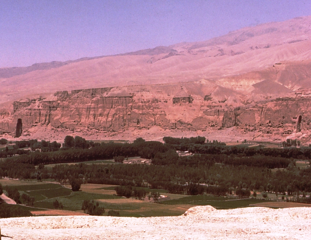
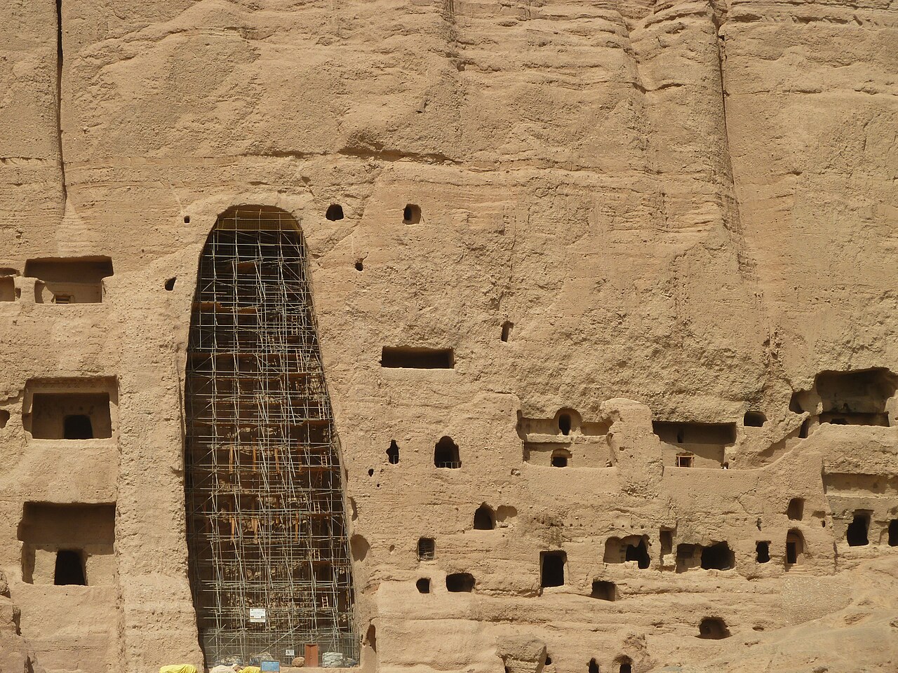
The Bamiyan Valley sits at an elevation of around 2,500 metres in the Hindu Kush, enclosed by terracotta-coloured cliffs that Buddhist monks honeycombed with more than a thousand cave cells over a period spanning roughly the 2nd to the 8th centuries AD. Two colossal standing Buddhas — one 53 metres high, the other 38 metres — were carved directly into the cliff face between the 4th and 5th centuries and then elaborately painted. They stood as the largest examples of standing Buddha sculpture in the world for over a millennium. In March 2001 the Taliban demolished both statues with explosives and artillery over the course of several weeks, an act of deliberate heritage destruction that drew international condemnation. The two empty niches that remain are not an absence so much as a presence: they are among the most recognisable outlines in the history of art.
The wider valley contains additional layers of significance. Hundreds of cave chapels in the subsidiary gorges of Foladi and Kakrak preserve fragmentary frescoes in a hybrid style — late Sasanian, Gandharan, and early Central Asian Buddhist — that date from the 5th through 8th centuries AD and represent some of the earliest surviving examples of oil-based painting anywhere in the world. UNESCO inscribed the site in 2003 under criteria I, II, III, IV, and VI, placing it on the Danger List from the moment of inscription because of the ongoing instability and the risk of further damage to the caves and their frescoes. About 75 kilometres west of the valley lies Band-e Amir, a chain of six deep-blue crater lakes formed by natural travertine dams, which became Afghanistan’s first national park in 2009 and is commonly visited in combination with Bamiyan.
The road from Kabul crosses the Shibar Pass and takes roughly six hours under normal conditions; Ariana Afghan Airlines has at times operated domestic flights to Bamiyan Airport in approximately 90 minutes, though schedules since 2021 depend on Taliban aviation policy. Since the Taliban regained control of Afghanistan in August 2021, independent international tourism has effectively ceased. Access for foreign nationals requires coordination with Taliban-controlled ministries and is subject to unpredictable restrictions. The site itself has reportedly not suffered additional intentional damage since 2001, and the cave frescoes remain under ongoing conservation attention from international bodies, though at reduced capacity.
Getting there: By road from Kabul via the Shibar Pass (approx. 6 hr); domestic flight to Bamiyan Airport when operational (approx. 90 min). Allow: A minimum of two full days to cover the main cliff site, the subsidiary valley gorges, and Band-e Amir. Best for: Specialists in Central Asian Buddhist art, heritage professionals, and researchers able to operate within the current access framework.
Minaret and Archaeological Remains of Jam 320 km · 8+ hr by road
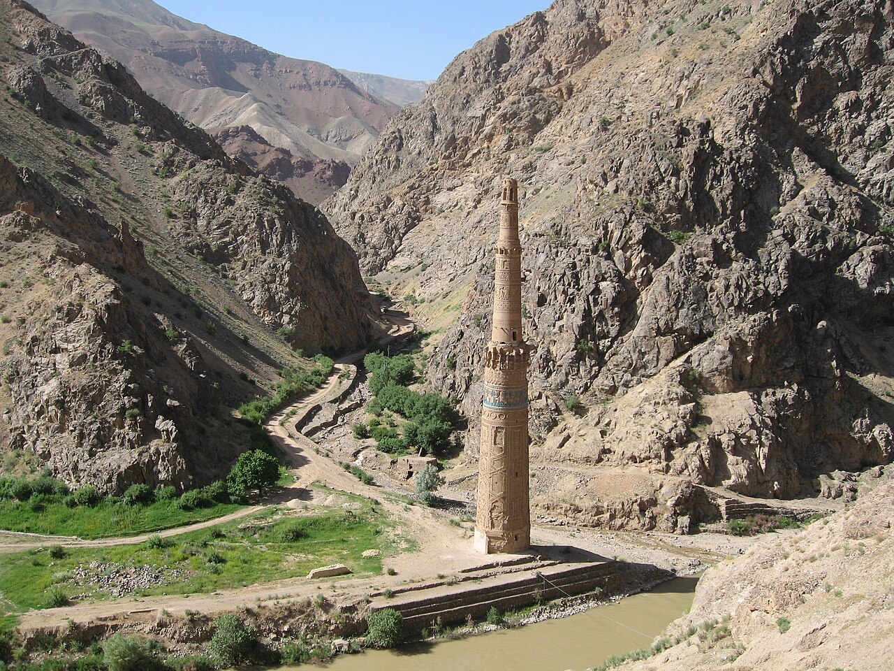
Rising 65 metres from the gravel bed at the confluence of the Hari Rud and Jam rivers in Ghor Province, the Minaret of Jam is one of the most improbable monuments in the world. It was built around 1190 AD under the Ghurid sultan Ghiyas ud-Din Muhammad bin Sam, at a moment when the Ghurid sultanate controlled a territory stretching from Nishapur to Bengal. The minaret is clad in intricate terracotta brickwork arranged in geometric bands, interspersed with turquoise tile inserts and panels of Kufic calligraphy containing the entire Surah Maryam from the Quran. At 65 metres, it was the second tallest minaret of its era — surpassed only by the Qutb Minar in Delhi, a structure the Ghurids themselves built and which borrowed directly from the Jam prototype. The existence of this minaret strongly suggests that a major Ghurid city once occupied this valley, possibly the seasonal capital of Firozkoh mentioned in medieval sources, though its remains have yet to be excavated systematically.
The minaret was unknown outside Afghanistan until a geographical survey in 1957 located it by following accounts in medieval Islamic texts. The surrounding gorge — steep walls of bare rock dropping directly into the river — has no road in the conventional sense: access from the nearest town of Shahrak in Ghor Province involves a track that is impassable for much of the year and crosses the river multiple times. This near-total inaccessibility has, paradoxically, protected the minaret from the kind of large-scale looting that devastated other Afghan sites in the 1990s, though the foundations suffer seasonal flood damage from the Hari Rud. UNESCO inscribed the site in 2002 and placed it on the Danger List simultaneously, citing flooding, seismic risk, and the absence of legal protection. Very little formal conservation work has been possible given the security situation.
Getting there: By road from Kabul to Chaghcharan (approx. 12 hr), then onward to Shahrak and the site via rough track (additional 4-6 hr); helicopter access from Herat is the only reliable option for researchers. Allow: Multiple days for the full journey from Kabul, with weather and road conditions highly variable. Best for: Researchers and documentary teams with specialist logistical support; not a site reachable by independent travellers under current conditions.
Frequently Asked Questions
How many UNESCO World Heritage Sites are near Kabul?
Afghanistan has two UNESCO World Heritage Sites in total, and both are accessible from Kabul: the Cultural Landscape and Archaeological Remains of the Bamiyan Valley (240 km northwest) and the Minaret and Archaeological Remains of Jam (320 km west). Both were inscribed on the List of World Heritage in Danger at the time of their UNESCO inscription — Jam in 2002 and Bamiyan in 2003 — and both retain that Danger List status today.
Is it currently possible to visit either site?
Since the Taliban resumed control of Afghanistan in August 2021, independent international tourism has effectively stopped. Both sites are theoretically accessible for researchers and heritage professionals who can obtain the necessary permissions from Taliban-controlled ministries, but there are no tourist infrastructure services in place and conditions are unpredictable. Travellers should consult current government travel advisories, all of which as of 2026 advise against travel to Afghanistan.
When is the best time of year to visit the Bamiyan Valley?
The window between late May and early October offers the most reliable road conditions through the Shibar Pass and the mildest weather in the valley, which sits above 2,500 metres and experiences harsh winters with heavy snowfall. Band-e Amir’s extraordinary crater lakes are most striking under summer light. Spring (April-May) brings the risk of flooding on mountain roads, and the Hari Rud that surrounds the Minaret of Jam runs at its highest and most dangerous during snowmelt.
Why were the Bamiyan Buddhas destroyed, and what remains?
The Taliban demolished the two colossal standing Buddhas in March 2001, declaring them idolatrous. Despite international appeals — including from Muslim-majority countries and UNESCO — the statues were destroyed with explosives, artillery, and anti-aircraft guns over several weeks. The two enormous niches carved into the cliff remain intact and are themselves inscribed as part of the UNESCO site. Inside the cliff complex, hundreds of monastic caves survive, and fragments of wall frescoes — some identified in 2008 as among the world’s earliest surviving oil paintings — remain in the subsidiary gorges, under ongoing but limited international conservation attention.