North Pole

The term North Pole generally indicates the most northerly (or northerly) point of any celestial body (eg a planet or a star) and by convention is used as the primary reference system with respect to the south pole.
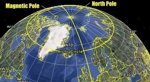
When we say: show me the North, or where exactly is the North Pole, exactly where on the Earth are we turning?
The question is not strange because in the north, and therefore in the north poles, there is more than one. Limiting ourselves to the most common, we can find at least five: the geographic North Pole, also called the terrestrial North Pole or true north, the magnetic North Pole, the geomagnetic North Pole, the North Pole of inaccessibility and the North Celestial Pole.

Referring to the Earth, the term can indicate different geographical points located on the earth's surface, most of which are located in the Arctic Ocean, and is also used to refer generically to that region of the world called the Arctic or in some cases to the territory included within the Arctic Circle.

With "North Pole" we can also mean the positive magnetic pole (P) of a magnet, the magnetic one varies over the years.

The position of the four poles in 2003:
1: Geographic North Pole - Terrestrial
2: Magnetic North Pole
3: Geomagnetic North Pole
4: North Pole of Inaccessibility
5: North Celestial Pole
The north pole of inaccessibility.
Unlike the others, it is not characterized by physical peculiarities, but, like the other poles of inaccessibility, it has the characteristic of being complex to reach.
In this case the indicates the point of the Arctic Ocean furthest from each coastline and it is the one inserted in this map that coincides with the Geographic one.
It is located about 1 100 km from the nearest coast at the following geographical coordinates: 84 ° 03′N - 174 ° 51′W.
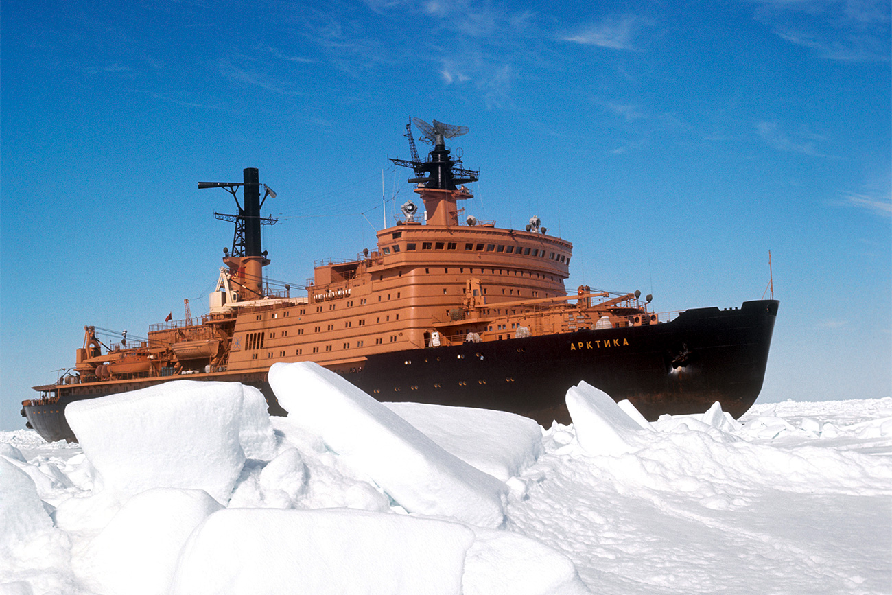
The first flyby of this particular geographical place was made in 1927 by Hubert Wilkins; later, in 1958 it was first reached by a Soviet icebreaker.
The legend
Many legends related to the figure of Santa Claus predict that his house is located in the North Pole.

Here he is helped by his elves and receives letters from the children with requests for gifts that he then builds
History
Until the 19th century it was believed that the geographic north pole was a fixed point, however this belief was disproved thanks to very accurate measurements based on the observation of the stars and studies carried out by the American astronomer Seth Carlo Chandler (1846-1913) .
Chandler in 1891 discovered that the geographic north pole, seen from above, is not motionless but moves, describing an approximate circle, around a point called the "mean pole of rotation", this motion was later named in his honor the Chandler oscillation.

The Chandler oscillation has a period of about 435 days and the imperfect circle it describes around the mean rotation pole, which has an average amplitude of about 6 meters), is due to the irregular shape of the Earth and the imperfect alignment of the 'axis of rotation of the earth with the axis of inertia of the earth.
This misalignment causes the Earth to oscillate slightly over rotating on its axis, similar to the motion of a slightly unbalanced top. There are several theories on the causes of this misalignment, initially it was believed that they were to be found in earthquakes but recent studies carried out by Richard Gross of the Jet Propulsion Laboratory would have shown that the main causes are attributable to variations in sea water pressure on the seabed. due to changes in the percentage of dissolved salts in the water.
It would be desirable that the system of terrestrial coordinates (latitude, longitude and orography) refers to fixed morphological points, however due to natural phenomena such as: continental drift, volcanism, erosion and other factors, there are no systems in which all the characteristics geographical areas are fixed.
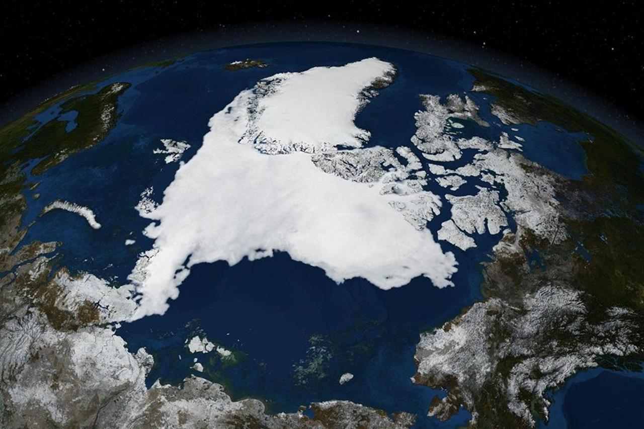
To overcome the problems that the lack of fixed reference points can generate, the International Earth Rotation and Reference Systems Service (IERS) and the International Astronomical Union (UAI) have developed a mathematical model called the International Earth Reference System (ITRS). The north pole of this model defines the geographic north pole and does not coincide with the earth's rotation axis.
EXPLORATIONS:
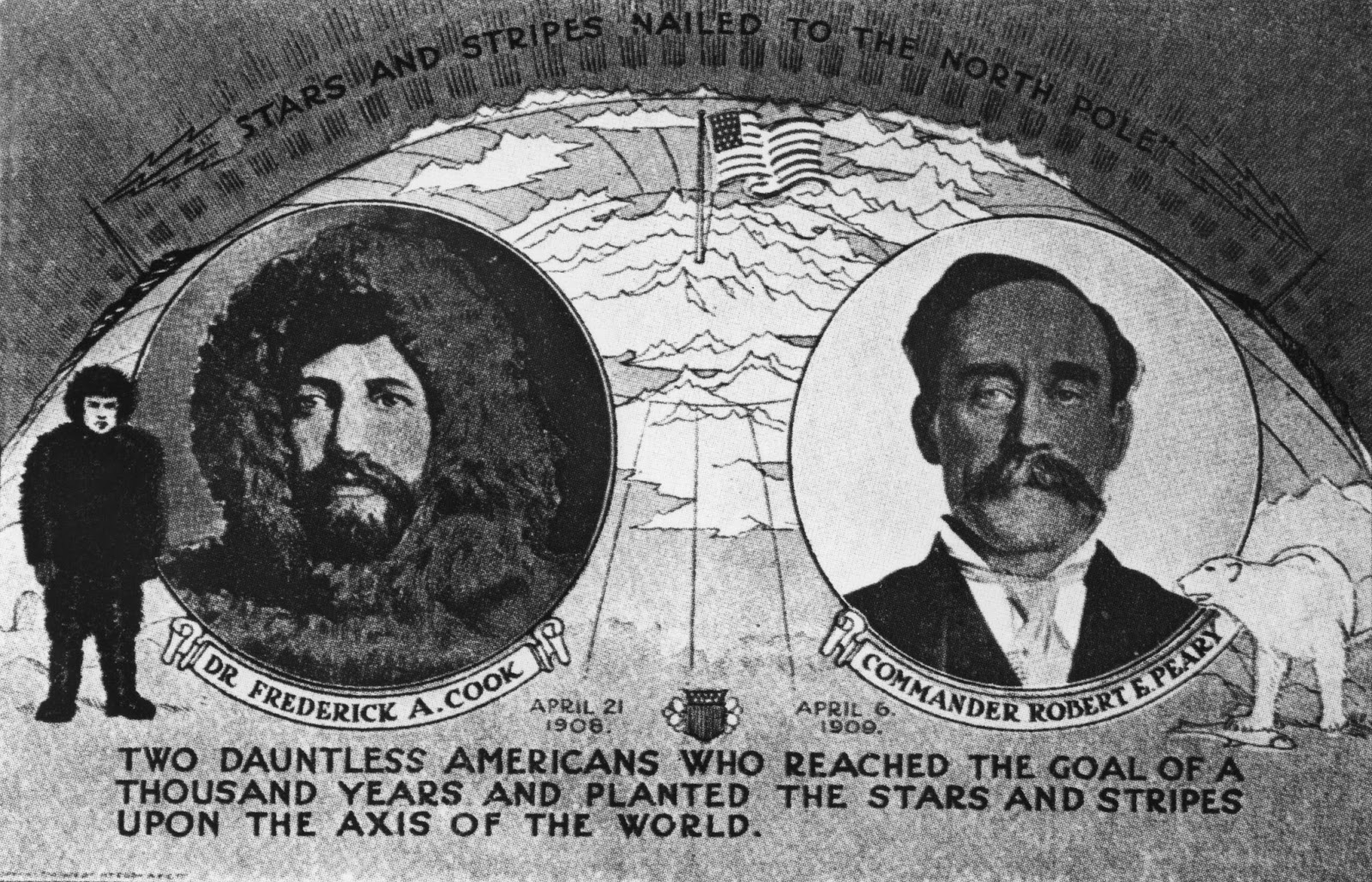
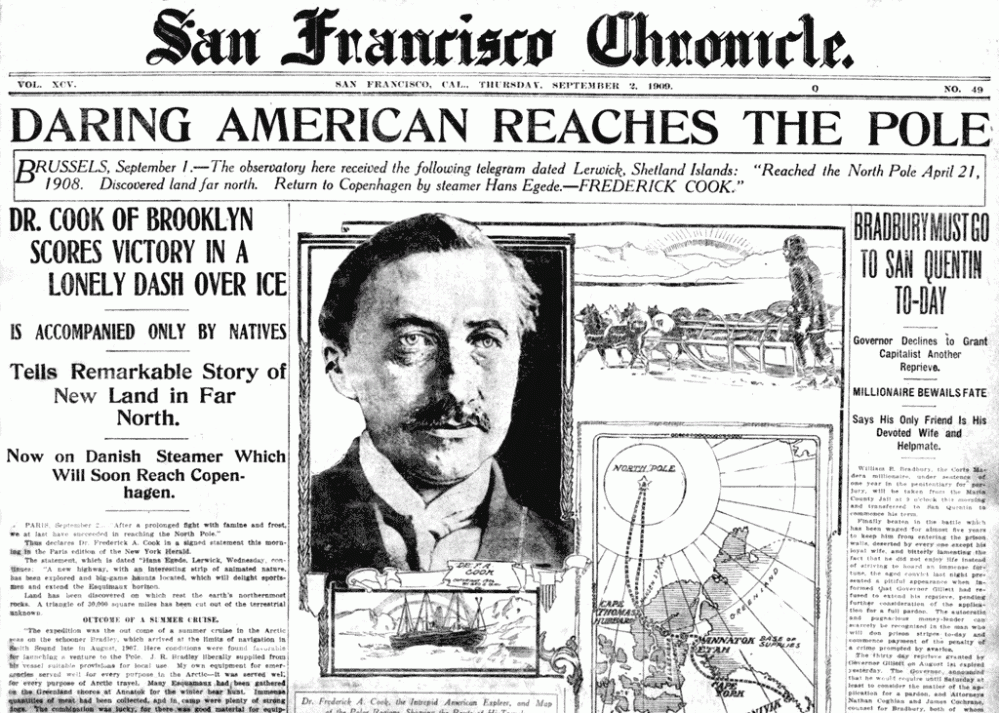
- On April 21, 1908, Frederick Cook along with the 2 Inuit Etukishook and Ahwelah were absolutely at the closest point to the geographic North Pole. They had succeeded in the enterprise of arriving at the "Big Nail". They remained on site for two days during which Cook made several measurements to confirm the latitude. Before returning home he put a note in a brass tube and hid it in a crevice in the ice.
- April 6, 1909 - second expedition to reach the geographic north pole. The enterprise was directed by the American Robert Edwin Peary; other members of the expedition were his assistant Matthew Henson and four Inuit called Ootah, Seegloo, Egingway, and Ooqueah. The analyzes carried out on some of Peary's annotations found in 1996 have led historians to believe that Peary in believing that he reached the geographic North Pole has actually only passed very close to it; to be precise, he would have arrived about 20 nautical miles (about 40 km) from the geographic north pole.

- May 12, 1926 - first overflight of the geographic north pole aboard the Norge airship, piloted and designed by the Italian Umberto Nobile. Among others were: the Norwegian explorer Roald Amundsen and the financier of the venture, the American Lincoln Ellsworth. The flight began from the Norwegian archipelago of Svalbard and after a crossing of over 5300 km of uninterrupted flight ended with a landing in Alaska.
![]()
- May 24, 1928 - Umberto Nobile on board the airship Italia manages to reach and fly over the geographic north pole for the second time. During the return trip, however, Italy crashes on the polar ice pack.
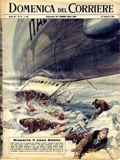
Despite this accident, which had global significance, thanks to the start of the first international relief expedition to be operating in the north pole area, Nobile was saved.

- April 23, 1948 - The Soviet Aleksandr Kuznetsov, together with 23 companions, landed near the pole, and then continued on foot to the geographic north pole, thus becoming the first human being to succeed in the feat.

This version of events is mainly supported by the Scott Polar Research Institute of the University of Cambridge, while the Antarctica.org institute believes that an expedition made up of seven Soviets, in turn landed in the north, was the first to reach the geographic North Pole on foot. vicinity with three Lisunov Li-2. According to other sources, the Soviet Pavel Gordiyenko was the first to reach the geographic north pole on April 23, 1948, along with three or five other men.
- May 3, 1952 - United States Air Force Lieutenant Colonel Joseph O. Fletcher, Lieutenant William P. Benedict and scientist Albert P. Crary, aboard a suitably modified C-47 aircraft, made the first landing on the North Pole geographical. The three members of this enterprise are considered by some sources to be the first humans to have set foot with relative exactness at the geographic North Pole.
- In 1955 Louise Boyd was the first woman to overlook the point.
- August 3, 1958 - The United States Navy's first nuclear-powered submarine USS Nautilus (SSN-571) crosses (submerged) the geographic North Pole for the first time.
- March 17, 1959 - the USS Skate submarine (SSN-578) first emerges on the geographic north pole becoming the first naval vessel to have reached it.
- April 19, 1968 - Ralph Plaisted manages to reach the polo with a snowmobile. This is the first confirmed conquest of the pole with surface vehicles.

- August 17, 1977 - Soviet nuclear icebreaker NS Arktika reaches pole. It is the first vessel traveling above the surface of the water to have reached the North Pole.
Video: North Pole
Map: North Pole
Address: Mar Glaciale Artico
Artide (Acque Internazionali)
Latitude: 84.03
Longitude: 174.51
Site: https://en.wikipedia.org/wiki/...
vCard created by: CHO.earth
Currently owned by: CHO.earth
Type: Zone
Function: Natural good
Creation date: 05-11-2021 04:59
Last update: 09/11/2021

